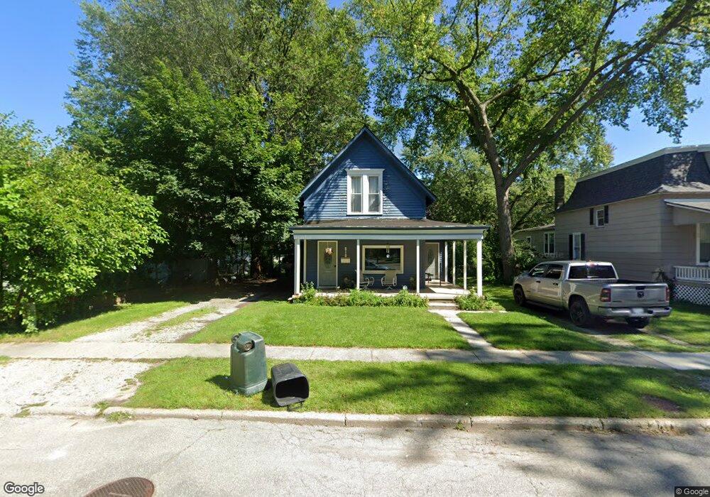
618 N 6th St Unit N Saint Clair, MI 48079
Estimated Value: $164,000 - $262,000
4
Beds
1
Bath
1,469
Sq Ft
$141/Sq Ft
Est. Value
About This Home
This home is located at 618 N 6th St Unit N, Saint Clair, MI 48079 and is currently estimated at $206,713, approximately $140 per square foot. 618 N 6th St Unit N is a home located in St. Clair County with nearby schools including Gearing Elementary School, St. Clair Middle School, and St. Clair High School.
Ownership History
Date
Name
Owned For
Owner Type
Purchase Details
Closed on
Jan 20, 2017
Sold by
Mellado Andrew D and Mellado Jessica
Bought by
Marshall David T
Current Estimated Value
Home Financials for this Owner
Home Financials are based on the most recent Mortgage that was taken out on this home.
Original Mortgage
$117,335
Outstanding Balance
$94,675
Interest Rate
3.75%
Mortgage Type
FHA
Estimated Equity
$112,038
Purchase Details
Closed on
Jun 23, 2015
Sold by
Wheatley Keith A and Wheatley Jeannette L
Bought by
Mellado Andrew D
Home Financials for this Owner
Home Financials are based on the most recent Mortgage that was taken out on this home.
Original Mortgage
$104,500
Interest Rate
3.82%
Mortgage Type
New Conventional
Purchase Details
Closed on
Nov 23, 2011
Sold by
Seaway Community Bank
Bought by
Wheatly Keith A and Wheatly Jeannette L
Create a Home Valuation Report for This Property
The Home Valuation Report is an in-depth analysis detailing your home's value as well as a comparison with similar homes in the area
Home Values in the Area
Average Home Value in this Area
Purchase History
| Date | Buyer | Sale Price | Title Company |
|---|---|---|---|
| Marshall David T | $119,500 | First American Title | |
| Mellado Andrew D | $110,000 | Attorneys Title Agency Llc | |
| Wheatly Keith A | $20,000 | None Available |
Source: Public Records
Mortgage History
| Date | Status | Borrower | Loan Amount |
|---|---|---|---|
| Open | Marshall David T | $117,335 | |
| Previous Owner | Mellado Andrew D | $104,500 |
Source: Public Records
Tax History
| Year | Tax Paid | Tax Assessment Tax Assessment Total Assessment is a certain percentage of the fair market value that is determined by local assessors to be the total taxable value of land and additions on the property. | Land | Improvement |
|---|---|---|---|---|
| 2025 | $2,179 | $88,600 | $0 | $0 |
| 2024 | $2,120 | $81,900 | $0 | $0 |
| 2023 | $1,989 | $86,000 | $0 | $0 |
| 2022 | $2,189 | $76,700 | $0 | $0 |
| 2020 | $2,069 | $64,900 | $64,900 | $0 |
| 2019 | $1,954 | $59,500 | $0 | $0 |
| 2018 | $1,966 | $49,100 | $0 | $0 |
| 2017 | $1,845 | $54,000 | $0 | $0 |
| 2016 | $2,002 | $54,000 | $0 | $0 |
| 2015 | -- | $45,300 | $45,300 | $0 |
| 2014 | -- | $44,000 | $44,000 | $0 |
| 2013 | -- | $41,200 | $0 | $0 |
Source: Public Records
Map
Nearby Homes
- 606 N 6th St
- 521 N 6th St
- 409 N 5th St
- 412 Orchard St
- 715 Thornapple St
- 206 S 4th St
- 592 Snowbird Cir E
- 402 S 5th St
- 920 Clinton Ave
- TBD Range
- 740 Highland Dr
- 1207 Clinton Ave
- 1810 Riley Rd
- 1936 Shelldrake Ln Unit Lot 29
- 1924 Shelldrake Ln Unit 32
- 1932 Sheldrake Ln Unit 30
- 239 Shelldrake Ln Unit 40
- 1826 Riley Rd
- 1007 Henry St
- 1423 S Riverside Ave
Your Personal Tour Guide
Ask me questions while you tour the home.