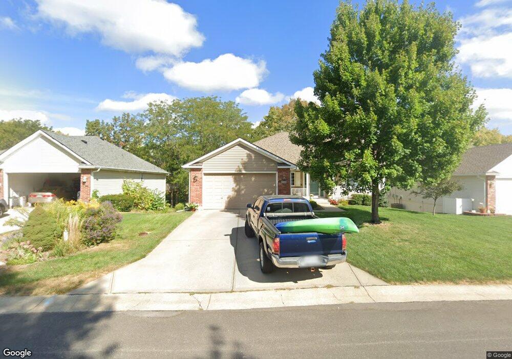
618 NW Cortland Dr Blue Springs, MO 64015
Estimated Value: $301,000 - $360,000
3
Beds
3
Baths
1,336
Sq Ft
$248/Sq Ft
Est. Value
About This Home
This home is located at 618 NW Cortland Dr, Blue Springs, MO 64015 and is currently estimated at $331,987, approximately $248 per square foot. 618 NW Cortland Dr is a home located in Jackson County with nearby schools including John Nowlin Elementary School, Paul Kinder Middle School, and Blue Springs High School.
Ownership History
Date
Name
Owned For
Owner Type
Purchase Details
Closed on
Jun 22, 2009
Sold by
Pierce Christine A
Bought by
Canfield Donald Eugene and Canfield Debra Anne
Current Estimated Value
Purchase Details
Closed on
Apr 7, 2005
Sold by
Harrison Kenny D and Harrison Rhonda G
Bought by
Pierce Christine A
Home Financials for this Owner
Home Financials are based on the most recent Mortgage that was taken out on this home.
Original Mortgage
$153,600
Interest Rate
5.78%
Mortgage Type
Purchase Money Mortgage
Purchase Details
Closed on
Nov 27, 2000
Sold by
T E Woods Construction Inc
Bought by
Harrison Kenny D and Harrison Rhonda G
Create a Home Valuation Report for This Property
The Home Valuation Report is an in-depth analysis detailing your home's value as well as a comparison with similar homes in the area
Home Values in the Area
Average Home Value in this Area
Purchase History
| Date | Buyer | Sale Price | Title Company |
|---|---|---|---|
| Canfield Donald Eugene | -- | Chicago | |
| Pierce Christine A | -- | Cbkc Title & Escrow Llc | |
| Harrison Kenny D | -- | Ati Title Company |
Source: Public Records
Mortgage History
| Date | Status | Borrower | Loan Amount |
|---|---|---|---|
| Previous Owner | Pierce Christine A | $153,600 |
Source: Public Records
Tax History Compared to Growth
Tax History
| Year | Tax Paid | Tax Assessment Tax Assessment Total Assessment is a certain percentage of the fair market value that is determined by local assessors to be the total taxable value of land and additions on the property. | Land | Improvement |
|---|---|---|---|---|
| 2025 | $4,697 | $66,205 | $7,351 | $58,854 |
| 2024 | $4,697 | $57,570 | $8,624 | $48,946 |
| 2023 | $4,607 | $57,570 | $8,624 | $48,946 |
| 2022 | $4,765 | $52,630 | $5,677 | $46,953 |
| 2021 | $4,760 | $52,630 | $5,677 | $46,953 |
| 2020 | $4,247 | $47,757 | $5,677 | $42,080 |
| 2019 | $4,106 | $47,757 | $5,677 | $42,080 |
| 2018 | $3,712 | $41,564 | $4,941 | $36,623 |
| 2017 | $3,668 | $41,564 | $4,941 | $36,623 |
| 2016 | $3,668 | $41,173 | $6,365 | $34,808 |
| 2014 | $3,439 | $38,481 | $5,945 | $32,536 |
Source: Public Records
Map
Nearby Homes
- 4301 NW Briarwood Dr
- 14 Emerald Shore Dr
- 4508 NW Valley View Rd
- 4012 NW Delwood Ct
- 0 No Address Assigned By County N A Unit HMS2492165
- 704 NW 39th St
- 4075 SW M 7 Hwy
- 404 Countryside Rd
- 403 Countryside Rd
- 405 Bellemere Rd
- 1204 NW 55th St
- 1401 NW Birdseye Ct
- 3605 NW Dogwood Dr
- 3616 NW Dogwood Dr
- 5200 NW Primrose Ct
- 5205 NW Primrose Ct
- 1515 NW Primrose Ln
- 27 Beach Dr
- 148 Beach Dr
- 3213 NW Canterbury Place
- 616 NW Cortland Dr
- 620 NW Cortland Dr
- 614 NW Cortland Dr
- 619 NW Cortland Dr
- 622 NW Cortland Dr
- 617 NW Cortland Dr
- 615 NW Cortland Dr
- 612 NW Cortland Dr
- 624 NW Cortland Dr
- 805 NW Blossom Ct
- 808 NW Blossom Ct
- 610 NW Cortland Dr
- 621 NW Cortland Dr
- 626 NW Cortland Dr
- 625 NW Rosaceae Dr
- 610R NW Cortland Dr
- 801 NW Blossom Ct
- 804 NW Blossom Ct
- 629 NW Rosaceae Dr
- 628 NW Cortland Dr