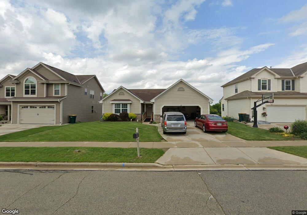
618 Polaris St West Bend, WI 53095
Estimated Value: $427,150 - $477,000
4
Beds
3
Baths
1,862
Sq Ft
$245/Sq Ft
Est. Value
About This Home
This home is located at 618 Polaris St, West Bend, WI 53095 and is currently estimated at $456,788, approximately $245 per square foot. 618 Polaris St is a home located in Washington County with nearby schools including Decorah Elementary School, Badger Middle School, and East High School.
Ownership History
Date
Name
Owned For
Owner Type
Purchase Details
Closed on
Dec 16, 2015
Sold by
Re Fund Ii Llc
Bought by
Capgrow Holdings Jv Sub I Llc
Current Estimated Value
Home Financials for this Owner
Home Financials are based on the most recent Mortgage that was taken out on this home.
Original Mortgage
$16,760,000
Outstanding Balance
$13,280,753
Interest Rate
3.93%
Mortgage Type
Unknown
Estimated Equity
-$12,823,965
Purchase Details
Closed on
Jan 26, 2012
Sold by
Murray Kevin M and Murray Kellie H
Bought by
Re Fund Ii Llc
Purchase Details
Closed on
Jul 30, 2010
Sold by
Mk and Mk Ss
Bought by
Murray Kevin M and Murray Kellie H
Home Financials for this Owner
Home Financials are based on the most recent Mortgage that was taken out on this home.
Original Mortgage
$200,000
Interest Rate
4.63%
Mortgage Type
VA
Create a Home Valuation Report for This Property
The Home Valuation Report is an in-depth analysis detailing your home's value as well as a comparison with similar homes in the area
Home Values in the Area
Average Home Value in this Area
Purchase History
| Date | Buyer | Sale Price | Title Company |
|---|---|---|---|
| Capgrow Holdings Jv Sub I Llc | $205,600 | None Available | |
| Re Fund Ii Llc | $189,000 | None Available | |
| Murray Kevin M | $200,000 | None Available |
Source: Public Records
Mortgage History
| Date | Status | Borrower | Loan Amount |
|---|---|---|---|
| Open | Capgrow Holdings Jv Sub I Llc | $16,760,000 | |
| Previous Owner | Murray Kevin M | $200,000 |
Source: Public Records
Tax History Compared to Growth
Tax History
| Year | Tax Paid | Tax Assessment Tax Assessment Total Assessment is a certain percentage of the fair market value that is determined by local assessors to be the total taxable value of land and additions on the property. | Land | Improvement |
|---|---|---|---|---|
| 2024 | $5,495 | $407,200 | $53,100 | $354,100 |
| 2023 | $4,908 | $255,300 | $51,700 | $203,600 |
| 2022 | $4,662 | $255,300 | $51,700 | $203,600 |
| 2021 | $5,053 | $255,300 | $51,700 | $203,600 |
| 2020 | $4,662 | $255,300 | $51,700 | $203,600 |
| 2019 | $4,535 | $255,300 | $51,700 | $203,600 |
| 2018 | $4,384 | $255,300 | $51,700 | $203,600 |
| 2017 | $3,885 | $204,900 | $51,700 | $153,200 |
| 2016 | $3,920 | $204,900 | $51,700 | $153,200 |
| 2015 | $3,892 | $204,900 | $51,700 | $153,200 |
| 2014 | $3,892 | $204,900 | $51,700 | $153,200 |
| 2013 | $4,207 | $204,900 | $51,700 | $153,200 |
Source: Public Records
Map
Nearby Homes
- 1301 Goldcrest Ct
- 1275 Shadowood Cir Unit 110
- 1130 S River Rd
- 1125 Anchor Ave
- 1117 Anchor Ave
- 1063 Anchor Ave
- 1071 Anchor Ave
- 2040 Paradise Hills Ct
- 787 Sheridan Dr
- 1040 Lincoln Dr W
- 2600 S Main St
- 2490 S River Rd
- 2245 E Decorah Rd
- 638 Vine St
- 518 Woodside Ct
- 478 Woodside Ct
- 511 Woodside Ct
- 1317 S 7th Ave
- 1795 Arbor Vista Place
- 1865 Arbor Vista Place