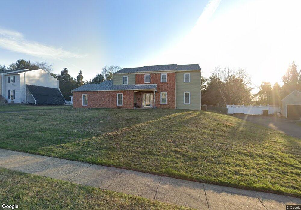
6180 Brockton Rd Unit 5 Hatboro, PA 19040
Upper Moreland NeighborhoodEstimated Value: $628,000 - $697,000
4
Beds
3
Baths
2,778
Sq Ft
$237/Sq Ft
Est. Value
About This Home
This home is located at 6180 Brockton Rd Unit 5, Hatboro, PA 19040 and is currently estimated at $657,824, approximately $236 per square foot. 6180 Brockton Rd Unit 5 is a home located in Montgomery County with nearby schools including Upper Moreland Intermediate School, Upper Moreland Primary School, and Upper Moreland Middle School.
Ownership History
Date
Name
Owned For
Owner Type
Purchase Details
Closed on
Jun 16, 1995
Sold by
Federal Home Loan Mortgage Corporation
Bought by
G E Capital Mtg Services Inc
Current Estimated Value
Purchase Details
Closed on
Jun 2, 1995
Sold by
Ge Capital Mtg Services Inc
Bought by
Carroll Michael R and Carroll Christina M
Purchase Details
Closed on
Feb 7, 1995
Sold by
Lalley Francis P
Bought by
Federal Home Loan Mortgage Corporation
Create a Home Valuation Report for This Property
The Home Valuation Report is an in-depth analysis detailing your home's value as well as a comparison with similar homes in the area
Home Values in the Area
Average Home Value in this Area
Purchase History
| Date | Buyer | Sale Price | Title Company |
|---|---|---|---|
| G E Capital Mtg Services Inc | $170,000 | -- | |
| Carroll Michael R | $170,000 | -- | |
| Federal Home Loan Mortgage Corporation | $167,000 | -- |
Source: Public Records
Tax History Compared to Growth
Tax History
| Year | Tax Paid | Tax Assessment Tax Assessment Total Assessment is a certain percentage of the fair market value that is determined by local assessors to be the total taxable value of land and additions on the property. | Land | Improvement |
|---|---|---|---|---|
| 2025 | $11,228 | $236,220 | $64,430 | $171,790 |
| 2024 | $11,228 | $236,220 | $64,430 | $171,790 |
| 2023 | $10,762 | $236,220 | $64,430 | $171,790 |
| 2022 | $10,121 | $236,220 | $64,430 | $171,790 |
| 2021 | $9,985 | $236,220 | $64,430 | $171,790 |
| 2020 | $9,655 | $236,220 | $64,430 | $171,790 |
| 2019 | $9,444 | $236,220 | $64,430 | $171,790 |
| 2018 | $9,444 | $236,220 | $64,430 | $171,790 |
| 2017 | $9,021 | $236,220 | $64,430 | $171,790 |
| 2016 | $8,929 | $236,220 | $64,430 | $171,790 |
| 2015 | $8,474 | $236,220 | $64,430 | $171,790 |
| 2014 | $8,474 | $236,220 | $64,430 | $171,790 |
Source: Public Records
Map
Nearby Homes
- 2015 Butternut Dr
- 4280 Frontier Rd
- 2325 Pioneer Rd
- 4145 Thistlewood Rd
- 1001 Hemlock Place
- 3541 Reading Way
- 43 Davisville Rd
- 725 E County Line Rd
- 3505 Heaton Rd
- 205 Willard Rd
- 620 Constitutional Dr
- 377 Holly Dr
- 609 Stewart Rd
- 1439 Byberry Rd
- 551 Revolutionary Way
- 1427 Byberry Rd
- 3898 Round Meadow Ln
- 1363 Byberry Rd
- 185 Toll Dr
- 1291 Mettler Rd
- 6160 Brockton Rd
- 6200 Brockton Rd
- 6140 Brockton Rd
- 6220 Brockton Rd
- 6165 Brockton Rd
- 6185 Brockton Rd
- 6120 Brockton Rd
- 2060 Pioneer Rd
- 6240 Brockton Rd
- 6125 Brockton Rd
- 6205 Brockton Rd
- 2050 Pioneer Rd
- 2100 Pioneer Rd
- 5205 Ivystream Rd
- 3100 Milford Cir
- 3120 Milford Cir
- 2110 Pioneer Rd
- 5100 Ivystream Rd
- 4065 Frontier Rd
- 6105 Brockton Rd