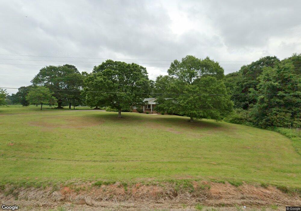
6180 Highway 145 Carnesville, GA 30521
Estimated Value: $247,000 - $316,000
3
Beds
2
Baths
1,760
Sq Ft
$160/Sq Ft
Est. Value
About This Home
This home is located at 6180 Highway 145, Carnesville, GA 30521 and is currently estimated at $281,205, approximately $159 per square foot. 6180 Highway 145 is a home located in Franklin County with nearby schools including Franklin County High School.
Ownership History
Date
Name
Owned For
Owner Type
Purchase Details
Closed on
May 16, 2012
Sold by
Ward Michael
Bought by
Liberty Baptist Church Of Carn
Current Estimated Value
Purchase Details
Closed on
Feb 7, 2012
Sold by
Sadler Kenneth R
Bought by
Ward Michael
Purchase Details
Closed on
Mar 28, 2003
Sold by
Sadler Kenneth R
Bought by
Sadler Kenneth R and Sadler Theresa B
Create a Home Valuation Report for This Property
The Home Valuation Report is an in-depth analysis detailing your home's value as well as a comparison with similar homes in the area
Home Values in the Area
Average Home Value in this Area
Purchase History
| Date | Buyer | Sale Price | Title Company |
|---|---|---|---|
| Liberty Baptist Church Of Carn | $56,451 | -- | |
| Ward Michael | $56,451 | -- | |
| Sadler Kenneth R | -- | -- | |
| Sadler Kenneth R | $130,000 | -- |
Source: Public Records
Tax History Compared to Growth
Tax History
| Year | Tax Paid | Tax Assessment Tax Assessment Total Assessment is a certain percentage of the fair market value that is determined by local assessors to be the total taxable value of land and additions on the property. | Land | Improvement |
|---|---|---|---|---|
| 2024 | -- | $79,022 | $5,369 | $73,653 |
| 2023 | $0 | $71,839 | $4,881 | $66,958 |
| 2022 | $1,669 | $64,690 | $3,804 | $60,886 |
| 2021 | $1,572 | $57,152 | $3,804 | $53,348 |
| 2020 | $1,280 | $47,652 | $3,804 | $43,848 |
| 2019 | $1,331 | $47,652 | $3,804 | $43,848 |
| 2018 | $0 | $41,782 | $4,621 | $37,161 |
| 2017 | -- | $41,782 | $4,621 | $37,161 |
| 2016 | -- | $36,499 | $4,621 | $31,878 |
| 2015 | -- | $36,498 | $4,621 | $31,878 |
| 2014 | -- | $36,499 | $4,621 | $31,878 |
| 2013 | -- | $37,004 | $4,620 | $32,384 |
Source: Public Records
Map
Nearby Homes
- 0 Murphy Rd Unit 10585891
- 456 Aderhold Rd
- 110 Telford Rd
- 2985 Jackson Bridge Rd
- 499 Aderhold Rd
- 340 Telford Rd
- 2556 Turkey Creek Rd
- 7690 Royston Rd
- 0 Turkey Creek Rd Unit 10589237
- 365 Carroll Church Rd
- 0 Manley St Unit 10611784
- 735 Bowersville Rd
- 228 Franklin Hills Dr
- 228 Franklin Hills Dr Unit B14
- 210 Nora Moss Ln
- 10170 Lavonia Rd
- 7 Crest View Cir
- 2695 Brays Lake Rd
- 1320 Burroughs Rd
- 00 Hall Carson Rd
- 6242 Highway 145
- 6070 Highway 145
- 6207 Highway 145
- 6207 Georgia 145
- 5971 Highway 145
- 78 Adaline Ct
- 6281 Georgia 145
- 0 Aderhold Rd
- 0 Aderhold Rd Unit 7420144
- 0 Aderhold Rd Unit 8813020
- 0 Aderhold Rd Unit 7468473
- 0 Aderhold Rd Unit 7151034
- 0 Aderhold Rd Unit 8643243
- 6300 Highway 145
- 6305 Highway 145
- 6281 Highway 145
- 110 Aderhold Rd
- 6373 Highway 145
- 3820 Jackson Bridge Rd
- 3667 Jackson Bridge Rd