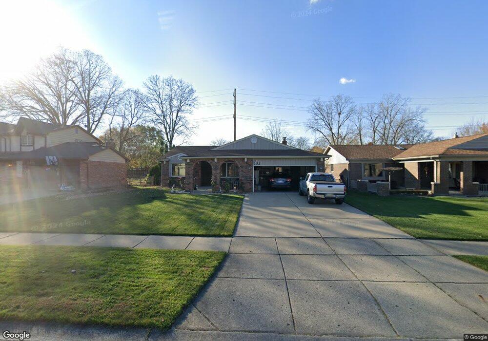
6183 Gloucester Dr Canton, MI 48187
Estimated Value: $326,639 - $375,000
Studio
2
Baths
1,452
Sq Ft
$245/Sq Ft
Est. Value
About This Home
This home is located at 6183 Gloucester Dr, Canton, MI 48187 and is currently estimated at $355,660, approximately $244 per square foot. 6183 Gloucester Dr is a home located in Wayne County with nearby schools including Canton High School, Discovery Middle School, and Salem High School.
Ownership History
Date
Name
Owned For
Owner Type
Purchase Details
Closed on
Oct 8, 2011
Sold by
Chira Aurel and Chira Viorica
Bought by
The Chira Family Trust
Current Estimated Value
Purchase Details
Closed on
Mar 23, 1995
Sold by
Daniel J Delagarza
Bought by
Chira Aurel and Chira Viorica
Home Financials for this Owner
Home Financials are based on the most recent Mortgage that was taken out on this home.
Original Mortgage
$116,900
Interest Rate
8.91%
Mortgage Type
New Conventional
Create a Home Valuation Report for This Property
The Home Valuation Report is an in-depth analysis detailing your home's value as well as a comparison with similar homes in the area
Home Values in the Area
Average Home Value in this Area
Purchase History
| Date | Buyer | Sale Price | Title Company |
|---|---|---|---|
| The Chira Family Trust | -- | None Available | |
| Chira Aurel | $129,900 | -- |
Source: Public Records
Mortgage History
| Date | Status | Borrower | Loan Amount |
|---|---|---|---|
| Closed | Chira Aurel | $116,900 |
Source: Public Records
Tax History
| Year | Tax Paid | Tax Assessment Tax Assessment Total Assessment is a certain percentage of the fair market value that is determined by local assessors to be the total taxable value of land and additions on the property. | Land | Improvement |
|---|---|---|---|---|
| 2025 | $1,881 | $173,100 | $0 | $0 |
| 2024 | $1,828 | $164,800 | $0 | $0 |
| 2023 | $1,743 | $139,800 | $0 | $0 |
| 2022 | $3,925 | $129,000 | $0 | $0 |
| 2021 | $3,804 | $125,000 | $0 | $0 |
| 2020 | $3,745 | $119,000 | $0 | $0 |
| 2019 | $3,679 | $113,100 | $0 | $0 |
| 2018 | $1,481 | $106,260 | $0 | $0 |
| 2017 | $3,880 | $104,300 | $0 | $0 |
| 2016 | $3,375 | $101,000 | $0 | $0 |
| 2015 | $8,138 | $93,730 | $0 | $0 |
| 2013 | $7,884 | $82,660 | $0 | $0 |
| 2010 | -- | $80,690 | $34,695 | $45,995 |
Source: Public Records
Map
Nearby Homes
- 47527 Ellery Ln
- 49772 Shoreline Dr
- 44035 Westminister Way
- 44652 Nantucket Dr
- 835 Coldrose Way
- 6852 New Providence Way Unit 104
- 6907 Harvard Ln
- 1977 Elmhurst St
- 1987 E Franklin Dr Unit 65
- 44447 Savery Dr Unit 126
- 48590 Ford Rd
- 58560 Stuart Dr
- 44528 Whitman Ave
- 1822 N Sheldon Rd
- 44432 Newburyport Dr
- 44418 Newburyport Dr
- 43800 Simsbury St
- 5806 Wedgewood Rd
- 0000 Ford
- 45193 Quaker Hill Dr
- 6195 Gloucester Dr
- 6159 Gloucester Dr
- 6207 Gloucester Dr
- 6147 Gloucester Dr
- 6188 Gloucester Dr
- 6176 Gloucester Dr
- 6202 Gloucester Dr
- 6164 Gloucester Dr
- 6228 New England Ln
- 6240 New England Ln
- 6216 New England Ln
- 6235 Gloucester Dr
- 6252 New England Ln
- 6152 Gloucester Dr
- 6204 New England Ln
- 6135 Gloucester Dr
- 6222 Gloucester Dr
- 6276 New England Ln
- 6264 New England Ln
- 6146 New England Ln
Your Personal Tour Guide
Ask me questions while you tour the home.