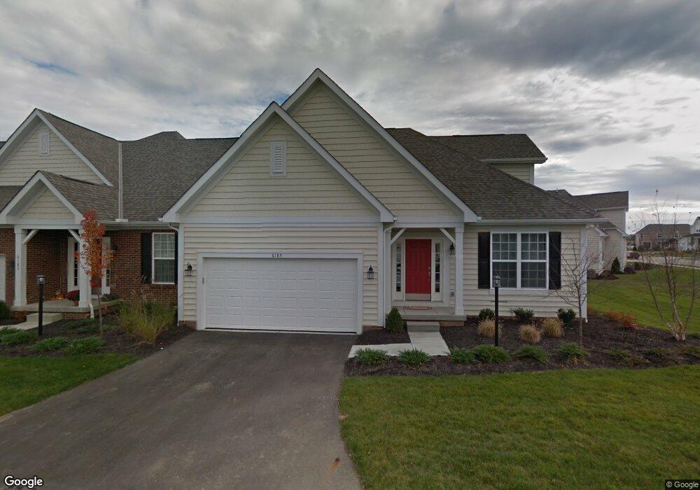
6183 Ray's Way Unit 25 Hilliard, OH 43026
Estimated Value: $403,026 - $463,000
2
Beds
3
Baths
2,110
Sq Ft
$205/Sq Ft
Est. Value
About This Home
This home is located at 6183 Ray's Way Unit 25, Hilliard, OH 43026 and is currently estimated at $432,257, approximately $204 per square foot. 6183 Ray's Way Unit 25 is a home located in Franklin County with nearby schools including Hoffman Trails Elementary School, Hilliard Station Sixth Grade Elementary School, and Hilliard Heritage Middle School.
Ownership History
Date
Name
Owned For
Owner Type
Purchase Details
Closed on
Jul 25, 2020
Sold by
Jirik John A and Jirik Susan M
Bought by
Tierney Jeanne E and Jeanne E Tierney Living Trust
Current Estimated Value
Purchase Details
Closed on
Jun 4, 2015
Sold by
Wood Run Partners
Bought by
Jirik John A and Lewis Susan M
Home Financials for this Owner
Home Financials are based on the most recent Mortgage that was taken out on this home.
Original Mortgage
$229,400
Interest Rate
0.78%
Mortgage Type
New Conventional
Create a Home Valuation Report for This Property
The Home Valuation Report is an in-depth analysis detailing your home's value as well as a comparison with similar homes in the area
Home Values in the Area
Average Home Value in this Area
Purchase History
| Date | Buyer | Sale Price | Title Company |
|---|---|---|---|
| Tierney Jeanne E | $307,000 | Crown Search Services | |
| Jirik John A | $254,900 | Stewart Title |
Source: Public Records
Mortgage History
| Date | Status | Borrower | Loan Amount |
|---|---|---|---|
| Previous Owner | Jirik John A | $229,400 |
Source: Public Records
Tax History Compared to Growth
Tax History
| Year | Tax Paid | Tax Assessment Tax Assessment Total Assessment is a certain percentage of the fair market value that is determined by local assessors to be the total taxable value of land and additions on the property. | Land | Improvement |
|---|---|---|---|---|
| 2024 | $8,754 | $130,690 | $25,900 | $104,790 |
| 2023 | $7,128 | $130,690 | $25,900 | $104,790 |
| 2022 | $6,423 | $93,730 | $19,320 | $74,410 |
| 2021 | $6,419 | $93,730 | $19,320 | $74,410 |
| 2020 | $6,403 | $93,730 | $19,320 | $74,410 |
| 2019 | $6,543 | $81,520 | $16,800 | $64,720 |
| 2018 | $6,520 | $81,520 | $16,800 | $64,720 |
| 2017 | $6,519 | $81,520 | $16,800 | $64,720 |
| 2016 | $6,519 | $73,500 | $13,930 | $59,570 |
| 2015 | -- | $0 | $0 | $0 |
| 2014 | -- | $0 | $0 | $0 |
Source: Public Records
Map
Nearby Homes
- 6172 Ray's Way Unit 19
- 6185 Ray's Way
- 6223 Pollard Place Dr
- 5994 Farmcreek Ct
- 6228 Parkmeadow Ln
- 6110 Parkmeadow Ln
- 5935 Pondview Ct
- 6451 Whitewater Way
- 5806 Barbara Dr
- 6504 Shadewater Dr
- 4206 Coventry Manor Way
- 5633 Maple Dell Ct
- 5628 Weston Trail Dr
- 4093 Greenbelt Dr
- 4180 Elliott Rd
- 4509 Nonius Dr
- 6952 Corsican Loop N
- 6950 Corsican Loop N
- 6954 Corsican Loop N
- 6956 Corsican Loop N
- 6183 Ray's Way
- 6185 Ray's Way Unit 26
- 6181 Ray's Way
- 6185 Rays Way Unit 26
- 6185 Rays Way
- 4506 Daves Ct
- 4502 Daves Ct
- 6184 Ray's Way Unit 22
- 4525 Bens Ct
- 4521 Bens Ct
- 4521 Bens Ct Unit 28
- 6188 Ray's Way
- 6180 Rays Way Unit 21
- 6180 Rays Way
- 6180 Ray's Way
- 4517 Bens Ct
- 4056 Dave's Ct
- 6176 Rays Way
- 6176 Rays Way Unit 20
- 6176 Ray's Way