Estimated Value: $217,000 - $346,000
3
Beds
2
Baths
1,568
Sq Ft
$174/Sq Ft
Est. Value
About This Home
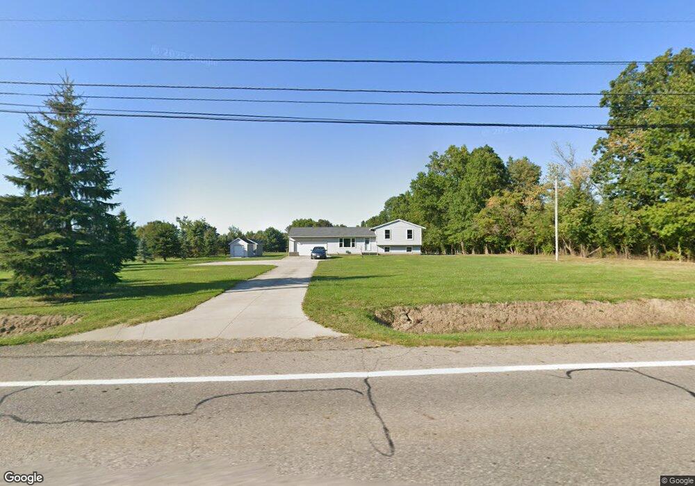
This home is located at 6183 State Route 82, Hiram, OH 44234 and is currently estimated at $272,673, approximately $173 per square foot. 6183 State Route 82 is a home located in Portage County with nearby schools including Crestwood Primary School, Crestwood Intermediate School, and Crestwood Middle School.
Ownership History
Date
Name
Owned For
Owner Type
Purchase Details
Closed on
Jun 3, 2003
Sold by
Collier Raymond J and Collier Trina
Bought by
Lott William J
Current Estimated Value
Home Financials for this Owner
Home Financials are based on the most recent Mortgage that was taken out on this home.
Original Mortgage
$121,000
Outstanding Balance
$49,238
Interest Rate
5.51%
Mortgage Type
Purchase Money Mortgage
Estimated Equity
$223,435
Purchase Details
Closed on
Mar 23, 1999
Sold by
Collier David G
Bought by
Collier Raymond J
Purchase Details
Closed on
Jan 6, 1992
Bought by
Collier David G and Collier Lyn L
Create a Home Valuation Report for This Property
The Home Valuation Report is an in-depth analysis detailing your home's value as well as a comparison with similar homes in the area
Purchase History
| Date | Buyer | Sale Price | Title Company |
|---|---|---|---|
| Lott William J | $121,666 | Advanced Title | |
| Collier Raymond J | -- | -- | |
| Collier David G | -- | -- |
Source: Public Records
Mortgage History
| Date | Status | Borrower | Loan Amount |
|---|---|---|---|
| Open | Lott William J | $121,000 |
Source: Public Records
Tax History
| Year | Tax Paid | Tax Assessment Tax Assessment Total Assessment is a certain percentage of the fair market value that is determined by local assessors to be the total taxable value of land and additions on the property. | Land | Improvement |
|---|---|---|---|---|
| 2025 | $3,997 | $97,100 | $21,810 | $75,290 |
| 2024 | $3,809 | $97,100 | $21,810 | $75,290 |
| 2023 | $3,102 | $71,050 | $17,430 | $53,620 |
| 2022 | $3,132 | $71,050 | $17,430 | $53,620 |
| 2021 | $3,219 | $71,050 | $17,430 | $53,620 |
| 2020 | $2,929 | $61,740 | $17,430 | $44,310 |
| 2019 | $2,898 | $61,740 | $17,430 | $44,310 |
| 2018 | $2,733 | $56,910 | $17,430 | $39,480 |
| 2017 | $2,733 | $56,910 | $17,430 | $39,480 |
| 2016 | $2,725 | $56,910 | $17,430 | $39,480 |
| 2015 | $2,730 | $56,910 | $17,430 | $39,480 |
| 2014 | $2,783 | $56,910 | $17,430 | $39,480 |
| 2013 | $2,684 | $56,910 | $17,430 | $39,480 |
Source: Public Records
Map
Nearby Homes
- 6023 Pioneer Trail
- 11801 Kenyon Dr
- 11743 Peckham Ave
- 11769 Peckham Ave
- 6792 Bancroft St
- 6846 Wakefield Rd
- 11861 Garfield Rd
- 0 Garfield Rd
- 5863 Allyn Rd
- 7000 Village Way Dr
- 12698 Herr Dr
- 7076 Village Way Dr
- 11383 Rolling Meadows Dr
- 10685 Limeridge Rd
- 19109 Tilden Rd
- 4620 Pioneer Trail
- 10200 Stamm Rd
- 0 Ambler Ln Unit 5142203
- 7760 State Route 305
- 11131 State Route 44
- 6143 State Route 82
- 6143 State Route 82 Unit 21,22
- 6198 State Route 82
- 6188 State Route 82
- 6124 State Route 82
- 6178 State Route 82
- 11730 Abbott Rd
- 11748 Abbott Rd
- 11792 Abbott Rd
- 6266 State Route 82
- 11711 Abbott Rd
- 11727 Abbott Rd
- 6290 State Route 82
- 6268 State Route 82
- 6238 State Route 82
- 11777 Abbott Rd
- 6248 State Route 82
- 6068 State Route 82
- 6078 State Route 82
- 11793 Abbott Rd
Your Personal Tour Guide
Ask me questions while you tour the home.