Estimated Value: $291,000 - $327,000
3
Beds
2
Baths
1,540
Sq Ft
$197/Sq Ft
Est. Value
About This Home
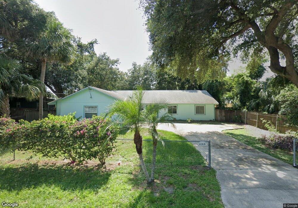
This home is located at 6184 Corning Rd, Cocoa, FL 32927 and is currently estimated at $302,727, approximately $196 per square foot. 6184 Corning Rd is a home located in Brevard County with nearby schools including Enterprise Elementary School, Space Coast Junior/Senior High School, and East Atlantic Prep of Brevard County.
Ownership History
Date
Name
Owned For
Owner Type
Purchase Details
Closed on
Apr 7, 2021
Sold by
Coburn Ann S and Edward H Coburn Revocable Trus
Bought by
Coburn Ann S
Current Estimated Value
Purchase Details
Closed on
Mar 2, 2007
Sold by
Coburn Edward H and Coburn Ann S
Bought by
Coburn Edward H and Coburn Ann S
Purchase Details
Closed on
Feb 6, 2007
Sold by
Coburn Edward H and Coburn Ann S
Bought by
Coburn Edward H and Coburn Ann S
Purchase Details
Closed on
Jan 25, 2006
Sold by
Coburn Edward H and Coburn Ann S
Bought by
Coburn Edward H and Coburn Ann S
Purchase Details
Closed on
Sep 2, 2005
Sold by
Burris Ray D and Burris Beverly A
Bought by
Coburn Edward H and Coburn Ann S
Home Financials for this Owner
Home Financials are based on the most recent Mortgage that was taken out on this home.
Original Mortgage
$100,000
Interest Rate
5.77%
Purchase Details
Closed on
Apr 13, 2001
Sold by
Veterans Affairs
Bought by
Burris Ray D and Burris Beverly A
Home Financials for this Owner
Home Financials are based on the most recent Mortgage that was taken out on this home.
Original Mortgage
$83,200
Interest Rate
7.01%
Purchase Details
Closed on
Apr 2, 2001
Sold by
Veterans Affairs
Bought by
Burris Ray D and Burris Beverly A
Home Financials for this Owner
Home Financials are based on the most recent Mortgage that was taken out on this home.
Original Mortgage
$83,200
Interest Rate
7.01%
Purchase Details
Closed on
Mar 25, 1999
Sold by
Clerk Circuit Court
Bought by
Veterans Affairs
Create a Home Valuation Report for This Property
The Home Valuation Report is an in-depth analysis detailing your home's value as well as a comparison with similar homes in the area
Home Values in the Area
Average Home Value in this Area
Purchase History
| Date | Buyer | Sale Price | Title Company |
|---|---|---|---|
| Coburn Ann S | -- | None Available | |
| Coburn Edward H | -- | None Available | |
| Coburn Edward H | -- | None Available | |
| Coburn Edward H | -- | None Available | |
| Coburn Edward H | $190,000 | Fidelity Natl Title Ins Co | |
| Burris Ray D | -- | -- | |
| Burris Ray D | $84,200 | -- | |
| Veterans Affairs | -- | -- |
Source: Public Records
Mortgage History
| Date | Status | Borrower | Loan Amount |
|---|---|---|---|
| Previous Owner | Coburn Edward H | $100,000 | |
| Previous Owner | Burris Ray D | $83,200 |
Source: Public Records
Tax History
| Year | Tax Paid | Tax Assessment Tax Assessment Total Assessment is a certain percentage of the fair market value that is determined by local assessors to be the total taxable value of land and additions on the property. | Land | Improvement |
|---|---|---|---|---|
| 2025 | $1,107 | $82,860 | -- | -- |
| 2024 | $1,069 | $80,530 | -- | -- |
| 2023 | $1,069 | $78,190 | $0 | $0 |
| 2022 | $1,048 | $75,920 | $0 | $0 |
| 2021 | $1,049 | $73,710 | $0 | $0 |
| 2020 | $991 | $72,700 | $0 | $0 |
| 2019 | $938 | $71,070 | $0 | $0 |
| 2018 | $938 | $69,750 | $0 | $0 |
| 2017 | $938 | $68,320 | $0 | $0 |
| 2016 | $946 | $66,920 | $18,000 | $48,920 |
| 2015 | $955 | $66,460 | $15,000 | $51,460 |
| 2014 | $959 | $65,940 | $11,000 | $54,940 |
Source: Public Records
Map
Nearby Homes
- 6085 Edison St
- 6150 Baltimore Ave
- 00000 Golfview Ave
- 6230 Balsam St
- 6220 Golfview Ave
- 6180 Balboa St
- 6250 Ainsworth Rd
- 6215 Balboa St
- 23-35-21-JX-B-2 Aruin St
- 6460 Homestead Ave
- 5812 Homestead Ave
- 0 Aruin St Unit 1222557
- 6510 Aspen Ln
- 6460 Ainsworth Rd
- 6545 Addie Ave
- 6135 Allmont St
- 6115 Allmont St
- 6490 Addax Ave
- 5721 Beaverbrook St
- 5680 Banos Ave
- 6178 Corning Rd
- 6175 Edison St
- 6181 Dees Rd
- 6172 Corning Rd
- 6187 Corning Rd
- 6185 Edison St
- 6181 Corning Rd
- 6165 Dees Rd
- 6193 Corning Rd
- 6175 Corning Rd
- 6166 Corning Rd
- 6160 Edison St
- 6170 Edison St
- 6169 Corning Rd
- 6150 Euclid Ave
- 6182 Dees Rd
- 6160 Euclid Ave
- 6150 Edison St
- 6180 Edison St
- 6121 Dees Rd
Your Personal Tour Guide
Ask me questions while you tour the home.