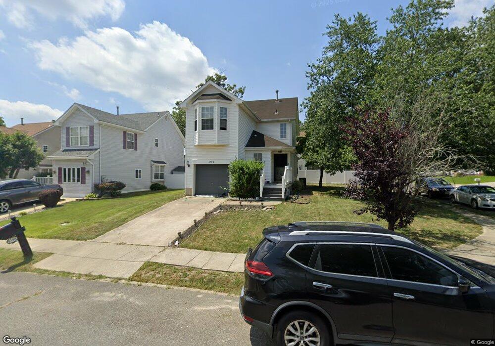
6184 Falcon Run Rd Mays Landing, NJ 08330
Estimated Value: $323,162 - $364,000
--
Bed
--
Bath
1,380
Sq Ft
$251/Sq Ft
Est. Value
About This Home
This home is located at 6184 Falcon Run Rd, Mays Landing, NJ 08330 and is currently estimated at $345,791, approximately $250 per square foot. 6184 Falcon Run Rd is a home located in Atlantic County with nearby schools including Joseph Shaner School, George L. Hess Educational Complex, and William Davies Middle School.
Ownership History
Date
Name
Owned For
Owner Type
Purchase Details
Closed on
Aug 22, 2005
Sold by
Cherry Kenneth
Bought by
Holmes Lance
Current Estimated Value
Home Financials for this Owner
Home Financials are based on the most recent Mortgage that was taken out on this home.
Original Mortgage
$216,000
Outstanding Balance
$115,357
Interest Rate
5.92%
Mortgage Type
Purchase Money Mortgage
Estimated Equity
$230,434
Purchase Details
Closed on
Aug 28, 1995
Sold by
Hamilton Pointe Holding Corp
Bought by
Cherry Kenneth and Cherry Marie
Create a Home Valuation Report for This Property
The Home Valuation Report is an in-depth analysis detailing your home's value as well as a comparison with similar homes in the area
Home Values in the Area
Average Home Value in this Area
Purchase History
| Date | Buyer | Sale Price | Title Company |
|---|---|---|---|
| Holmes Lance | $270,000 | -- | |
| Cherry Kenneth | $97,500 | -- |
Source: Public Records
Mortgage History
| Date | Status | Borrower | Loan Amount |
|---|---|---|---|
| Open | Holmes Lance | $216,000 |
Source: Public Records
Tax History Compared to Growth
Tax History
| Year | Tax Paid | Tax Assessment Tax Assessment Total Assessment is a certain percentage of the fair market value that is determined by local assessors to be the total taxable value of land and additions on the property. | Land | Improvement |
|---|---|---|---|---|
| 2025 | $5,304 | $154,600 | $32,200 | $122,400 |
| 2024 | $5,304 | $154,600 | $32,200 | $122,400 |
| 2023 | $4,987 | $154,600 | $32,200 | $122,400 |
| 2022 | $4,987 | $154,600 | $32,200 | $122,400 |
| 2021 | $4,977 | $154,600 | $32,200 | $122,400 |
| 2020 | $4,977 | $154,600 | $32,200 | $122,400 |
| 2019 | $4,989 | $154,600 | $32,200 | $122,400 |
| 2018 | $4,814 | $154,600 | $32,200 | $122,400 |
| 2017 | $4,738 | $154,600 | $32,200 | $122,400 |
| 2016 | $4,951 | $166,200 | $42,200 | $124,000 |
| 2015 | $4,783 | $166,200 | $42,200 | $124,000 |
| 2014 | $4,763 | $181,300 | $47,200 | $134,100 |
Source: Public Records
Map
Nearby Homes
- 0 Harding Hwy Unit 597638
- 0 Harding Hwy Unit NJAC2019438
- 6140 Robin Dr
- 6302 Palmer Ave
- 6251 Old Harding Hwy
- 6206 Roberts Ave
- 87 Devon Rd
- 6314 Lance Ave
- 6310 Phillips Ave
- 6301 Knight Ave
- 37 Delancy Ct
- 6126 Longwood Ave
- 80 Mill St
- 16 Holly Ct
- 24 Holly Ct
- 13 Hickory Ln
- 14 Hickory Ln
- 1305 Matthews Ave
- 9 Oaks Dr Unit 341
- 10 Locust Ct
- 6182 Falcon Run Rd
- 6185 Towhee Ln
- 6183 Towhee Ln
- 6180 Falcon Run Rd
- 6186 Falcon Run Rd
- 6180 Robin Dr
- 6181 Towhee Ln
- 6179 Robin Dr
- 6188 Falcon Run Rd
- 6181 Eagle Dr
- 6178 Robin Dr
- 6179 Towhee Ln
- 6181 Robin Dr
- 6181 Falcon Run Rd
- 6177 Falcon Run Rd
- 6183 Eagle Dr
- 6183 Robin Dr
- 6183 Falcon Run Rd
- 6177 Towhee Ln
- 6176 Robin Dr