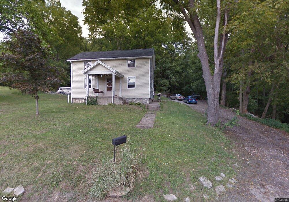
6184 Ottawa St Cincinnati, OH 45233
Sayler Park NeighborhoodEstimated Value: $182,000 - $216,966
3
Beds
1
Bath
1,477
Sq Ft
$135/Sq Ft
Est. Value
About This Home
This home is located at 6184 Ottawa St, Cincinnati, OH 45233 and is currently estimated at $199,742, approximately $135 per square foot. 6184 Ottawa St is a home located in Hamilton County with nearby schools including Sayler Park Elementary School, Gilbert A. Dater High School, and Western Hills High School.
Ownership History
Date
Name
Owned For
Owner Type
Purchase Details
Closed on
Jul 31, 2006
Sold by
Vanhook Gregory S
Bought by
Vanhook Richard W
Current Estimated Value
Home Financials for this Owner
Home Financials are based on the most recent Mortgage that was taken out on this home.
Original Mortgage
$80,750
Interest Rate
6.85%
Mortgage Type
Unknown
Purchase Details
Closed on
Nov 14, 2001
Sold by
Vanhook Elizabeth
Bought by
Vanhook Richard H and Vanhook Elizabeth
Create a Home Valuation Report for This Property
The Home Valuation Report is an in-depth analysis detailing your home's value as well as a comparison with similar homes in the area
Home Values in the Area
Average Home Value in this Area
Purchase History
| Date | Buyer | Sale Price | Title Company |
|---|---|---|---|
| Vanhook Richard W | $85,000 | None Available | |
| Vanhook Richard H | -- | -- |
Source: Public Records
Mortgage History
| Date | Status | Borrower | Loan Amount |
|---|---|---|---|
| Closed | Vanhook Richard W | $80,750 |
Source: Public Records
Tax History
| Year | Tax Paid | Tax Assessment Tax Assessment Total Assessment is a certain percentage of the fair market value that is determined by local assessors to be the total taxable value of land and additions on the property. | Land | Improvement |
|---|---|---|---|---|
| 2025 | $2,464 | $48,889 | $20,045 | $28,844 |
| 2023 | $3,067 | $48,889 | $20,045 | $28,844 |
| 2022 | $2,373 | $33,639 | $16,394 | $17,245 |
| 2021 | $2,266 | $33,639 | $16,394 | $17,245 |
| 2020 | $2,326 | $33,639 | $16,394 | $17,245 |
| 2019 | $2,205 | $29,509 | $14,382 | $15,127 |
| 2018 | $2,208 | $29,509 | $14,382 | $15,127 |
| 2017 | $2,099 | $29,509 | $14,382 | $15,127 |
| 2016 | $2,214 | $30,856 | $14,084 | $16,772 |
| 2015 | $1,998 | $30,856 | $14,084 | $16,772 |
| 2014 | $2,012 | $30,856 | $14,084 | $16,772 |
| 2013 | $2,026 | $30,552 | $13,944 | $16,608 |
Source: Public Records
Map
Nearby Homes
- 133 Meridian St
- 6378 Hillside Ave
- 665 Fox Trails Way
- 6721 Hillside Ave
- 6723 Daniels Walk
- 6713 Daniels Walk
- 524 Trison Dr
- 6855 Sayler Ave
- 1538 Tanner Rd
- 815 Westview Dr
- 6551 Cleves Warsaw Pike
- 7027 Gracely Dr
- 7026 River Rd
- 6278 Gardenlake Ct
- 1779 Tanner Rd
- 7126 River Rd
- 1259 Wexford Ln
- 2141 Ridgeline Dr
- 2145 Ridgeline Dr
- 146 Overcliff Rd
- 6188 Hillside Ave
- 6170 Ottawa St
- 6184 Hillside Ave
- 6182 Hillside Ave
- 6180 Hillside Ave
- 6178 Hillside Ave
- 6164 Ottawa St
- 6206 Hillside Ave
- 6222 Ottawa St
- 6172 Benvue St
- 6164 Benvue St
- 6166 Benvue St
- 6142 Benvue St
- 6140 Benvue St
- 6145 Benvue St
- 6144 Benvue St
- 6133 Benvue St
- 6146 Benvue St
- 6148 Benvue St
- 6150 Benvue St
Your Personal Tour Guide
Ask me questions while you tour the home.