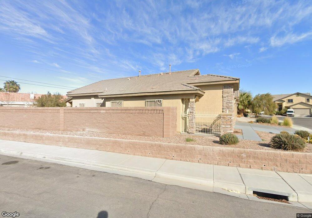
6186 Bunker Commons Ct Las Vegas, NV 89108
Michael Way NeighborhoodEstimated Value: $456,221 - $530,000
3
Beds
2
Baths
1,878
Sq Ft
$265/Sq Ft
Est. Value
About This Home
This home is located at 6186 Bunker Commons Ct, Las Vegas, NV 89108 and is currently estimated at $498,305, approximately $265 per square foot. 6186 Bunker Commons Ct is a home located in Clark County with nearby schools including Berkeley L. Bunker Elementary School, Irwin & Susan Molasky Junior High School, and Cimarron Memorial High School.
Ownership History
Date
Name
Owned For
Owner Type
Purchase Details
Closed on
Jan 22, 2009
Sold by
Callahan William A and Callahan Estrella L
Bought by
Callahan William Arthur and Callahan Estrella Lee
Current Estimated Value
Purchase Details
Closed on
Jul 18, 2008
Sold by
Federal National Mortgage Association
Bought by
Callahan William A and Callahan Estrella L
Purchase Details
Closed on
Nov 23, 2007
Sold by
Ford Thomas L
Bought by
Federal National Mortgage Association
Purchase Details
Closed on
Jan 8, 2007
Sold by
Sf Investments Llc
Bought by
Ford Thomas L
Home Financials for this Owner
Home Financials are based on the most recent Mortgage that was taken out on this home.
Original Mortgage
$306,320
Interest Rate
6.21%
Mortgage Type
Unknown
Create a Home Valuation Report for This Property
The Home Valuation Report is an in-depth analysis detailing your home's value as well as a comparison with similar homes in the area
Home Values in the Area
Average Home Value in this Area
Purchase History
| Date | Buyer | Sale Price | Title Company |
|---|---|---|---|
| Callahan William Arthur | -- | None Available | |
| Callahan William A | $227,000 | Lawyers Title Of Nevada Inc | |
| Federal National Mortgage Association | $326,209 | Fidelity National Title | |
| Ford Thomas L | $382,900 | Nevada Title Company |
Source: Public Records
Mortgage History
| Date | Status | Borrower | Loan Amount |
|---|---|---|---|
| Previous Owner | Ford Thomas L | $306,320 |
Source: Public Records
Tax History Compared to Growth
Tax History
| Year | Tax Paid | Tax Assessment Tax Assessment Total Assessment is a certain percentage of the fair market value that is determined by local assessors to be the total taxable value of land and additions on the property. | Land | Improvement |
|---|---|---|---|---|
| 2025 | $1,905 | $147,907 | $40,250 | $107,657 |
| 2024 | $1,850 | $147,907 | $40,250 | $107,657 |
| 2023 | $1,850 | $138,548 | $37,450 | $101,098 |
| 2022 | $1,796 | $124,859 | $32,550 | $92,309 |
| 2021 | $1,744 | $113,992 | $26,250 | $87,742 |
| 2020 | $1,690 | $110,669 | $23,800 | $86,869 |
| 2019 | $1,641 | $108,051 | $22,750 | $85,301 |
| 2018 | $1,593 | $101,763 | $19,600 | $82,163 |
| 2017 | $2,785 | $84,970 | $18,550 | $66,420 |
| 2016 | $1,509 | $86,573 | $15,050 | $71,523 |
| 2015 | $1,506 | $54,349 | $12,250 | $42,099 |
| 2014 | $1,462 | $47,950 | $5,950 | $42,000 |
Source: Public Records
Map
Nearby Homes
- 2870 Maverick St
- 2879 N Jones Blvd
- 2915 Maverick St
- 6100 W Brooks Ave
- 6316 Portola Rd
- 5905 Paseo Montana
- 3009 Brair Knoll Ct
- 2632 Ironside Dr
- 2912 Drury St
- 2512 Rialto Rd
- 6428 Yarmouth Dr
- 2624 Shakespeare Rd
- 6400 Deadwood Rd
- 6204 Barkstone Ave
- 6204 Robin Hood Cir
- 2536 Charteroak St
- 6428 Deadwood Rd
- 5807 Madre Mesa Dr
- 6436 Deadwood Rd
- 6444 Deadwood Rd
- 6174 Bunker Commons Ct
- 2860 Maverick St
- 6204 Bunker Commons Ct
- 6162 Bunker Commons Ct
- 6187 Bunker Commons Ct
- 6175 Bunker Commons Ct
- 6216 Bunker Commons Ct
- 6203 Bunker Commons Ct
- 2855 Maverick St
- 6215 Bunker Commons Ct
- 6163 Bunker Commons Ct
- 6151 Bunker Commons Ct
- 6228 Bunker Commons Ct
- 2890 Maverick St
- 6227 Bunker Commons Ct
- 2880 Maverick St
- 6240 Bunker Commons Ct
- 2865 N Bronco St
- 2875 Maverick St
- 6239 Bunker Commons Ct