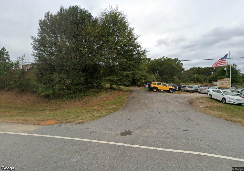
6186 Highway 441 Nicholson, GA 30565
Estimated Value: $266,000 - $293,000
--
Bed
--
Bath
1,628
Sq Ft
$172/Sq Ft
Est. Value
About This Home
This home is located at 6186 Highway 441, Nicholson, GA 30565 and is currently estimated at $279,740, approximately $171 per square foot. 6186 Highway 441 is a home with nearby schools including East Jackson Middle School and East Jackson Comprehensive High School.
Ownership History
Date
Name
Owned For
Owner Type
Purchase Details
Closed on
Mar 3, 2025
Sold by
Crumley Aubrey Chase
Bought by
Abbs Reid Heather
Current Estimated Value
Purchase Details
Closed on
Jun 28, 2013
Sold by
Frm Realty Llc
Bought by
Crumley Aubrey Chase
Purchase Details
Closed on
Oct 22, 2007
Sold by
Not Provided
Bought by
Frm Realty Llc
Purchase Details
Closed on
Dec 6, 2002
Sold by
Lorenz Christy Charles
Bought by
Department Of Transportation
Purchase Details
Closed on
May 27, 1997
Bought by
Lorenz Christy Charl
Create a Home Valuation Report for This Property
The Home Valuation Report is an in-depth analysis detailing your home's value as well as a comparison with similar homes in the area
Home Values in the Area
Average Home Value in this Area
Purchase History
| Date | Buyer | Sale Price | Title Company |
|---|---|---|---|
| Abbs Reid Heather | -- | -- | |
| Crumley Aubrey Chase | $100,000 | -- | |
| Frm Realty Llc | $129,900 | -- | |
| Department Of Transportation | -- | -- | |
| Lorenz Christy Charl | $85,000 | -- |
Source: Public Records
Tax History Compared to Growth
Tax History
| Year | Tax Paid | Tax Assessment Tax Assessment Total Assessment is a certain percentage of the fair market value that is determined by local assessors to be the total taxable value of land and additions on the property. | Land | Improvement |
|---|---|---|---|---|
| 2024 | $1,834 | $68,064 | $29,520 | $38,544 |
| 2023 | $1,834 | $62,984 | $29,520 | $33,464 |
| 2022 | $1,093 | $35,944 | $10,040 | $25,904 |
| 2021 | $1,086 | $35,944 | $10,040 | $25,904 |
| 2020 | $1,030 | $31,184 | $10,040 | $21,144 |
| 2019 | $1,050 | $31,184 | $10,040 | $21,144 |
| 2018 | $1,043 | $30,680 | $10,040 | $20,640 |
| 2017 | $842 | $24,585 | $9,343 | $15,242 |
| 2016 | $847 | $24,585 | $9,343 | $15,242 |
| 2015 | $850 | $24,585 | $9,343 | $15,242 |
| 2014 | $730 | $21,284 | $9,343 | $11,941 |
| 2013 | -- | $25,018 | $9,342 | $15,675 |
Source: Public Records
Map
Nearby Homes
- 520 Old Athens Dr
- 719 Old Athens Dr
- 104 Staplers Bridge Rd
- 1192 Old Kings Bridge Rd
- 0 Birch St Unit 7627498
- 7 Red Rose Rd
- 9 Red Rose Rd
- 0 Jefferson Dr Unit 7635823
- 0 Jefferson Dr Unit 10588928
- 5111 U S 441
- 573 Sanford Dr
- 334 Summit Heights Dr
- 620 Ivy Creek Dr
- 10 Red Rose Rd
- 0 Watkins Trail Unit TRACT 22
- 0 Sanford Oak Ct Unit 7683746
- 0 Sanford Oak Ct Unit TRACT 11
- 0 Sanford Oak Ct Unit TRACT 12
- 0 Sanford Oak Ct Unit 7683743
- 322 Cedar Tree Ln
- 38 Dogwood Trail
- 15 Old Athens Dr
- 211 Old Kings Bridge Rd
- 0 Dogwood Dr Unit 9031011
- 0 Dogwood Dr
- 6075 Highway 441
- 55 Old Athens Dr
- 00 Old Kings Bridge Rd
- Lot 2 Old Kings Bridge Rd
- 164 Old Kings Bridge Rd
- 6021 Highway 441
- 97 Old Athens Dr
- 4562 Georgia 15
- 0 Old Athens Dr Unit 10592005
- 0 Old Athens Dr Unit 7345861
- 0 Old Athens Dr
- 123 Old Athens Dr
- 141 Old Athens Dr
- 332 Old Kings Bridge Rd
- 56 Old Kings Bridge Rd
