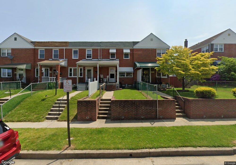
619 Aldworth Rd Dundalk, MD 21222
Estimated Value: $188,315 - $202,000
3
Beds
1
Bath
1,027
Sq Ft
$191/Sq Ft
Est. Value
About This Home
This home is located at 619 Aldworth Rd, Dundalk, MD 21222 and is currently estimated at $196,329, approximately $191 per square foot. 619 Aldworth Rd is a home located in Baltimore County with nearby schools including Berkshire Elementary School, Holabird Middle School, and Dundalk High School.
Ownership History
Date
Name
Owned For
Owner Type
Purchase Details
Closed on
Nov 26, 2007
Sold by
Cate Arthur F
Bought by
Cate Arthur F
Current Estimated Value
Home Financials for this Owner
Home Financials are based on the most recent Mortgage that was taken out on this home.
Original Mortgage
$100,500
Outstanding Balance
$63,908
Interest Rate
6.39%
Mortgage Type
Purchase Money Mortgage
Estimated Equity
$132,421
Purchase Details
Closed on
Oct 10, 2007
Sold by
Cate Arthur F
Bought by
Cate Arthur F
Home Financials for this Owner
Home Financials are based on the most recent Mortgage that was taken out on this home.
Original Mortgage
$100,500
Outstanding Balance
$63,908
Interest Rate
6.39%
Mortgage Type
Purchase Money Mortgage
Estimated Equity
$132,421
Purchase Details
Closed on
Jun 22, 1992
Sold by
Malloy Stephen Ray
Bought by
Cate Arthur F 3Rd
Create a Home Valuation Report for This Property
The Home Valuation Report is an in-depth analysis detailing your home's value as well as a comparison with similar homes in the area
Home Values in the Area
Average Home Value in this Area
Purchase History
| Date | Buyer | Sale Price | Title Company |
|---|---|---|---|
| Cate Arthur F | -- | -- | |
| Cate Arthur F | -- | -- | |
| Cate Arthur F 3Rd | $72,500 | -- |
Source: Public Records
Mortgage History
| Date | Status | Borrower | Loan Amount |
|---|---|---|---|
| Open | Cate Arthur F | $100,500 | |
| Previous Owner | Cate Arthur F | $100,500 |
Source: Public Records
Tax History Compared to Growth
Tax History
| Year | Tax Paid | Tax Assessment Tax Assessment Total Assessment is a certain percentage of the fair market value that is determined by local assessors to be the total taxable value of land and additions on the property. | Land | Improvement |
|---|---|---|---|---|
| 2025 | $2,229 | $137,667 | -- | -- |
| 2024 | $2,229 | $126,833 | $0 | $0 |
| 2023 | $2,537 | $116,000 | $36,000 | $80,000 |
| 2022 | $2,357 | $114,567 | $0 | $0 |
| 2021 | $1,756 | $113,133 | $0 | $0 |
| 2020 | $1,756 | $111,700 | $36,000 | $75,700 |
| 2019 | $1,706 | $109,467 | $0 | $0 |
| 2018 | $0 | $107,233 | $0 | $0 |
| 2017 | $2,037 | $105,000 | $0 | $0 |
| 2016 | -- | $105,000 | $0 | $0 |
| 2015 | $1,894 | $105,000 | $0 | $0 |
| 2014 | $1,894 | $112,600 | $0 | $0 |
Source: Public Records
Map
Nearby Homes
- 7455 Manchester Rd
- 7432 Manchester Rd
- 739 Aldworth Rd
- 7521 Lange St
- 7412 Poplar Ave
- 988 Dalton Ave
- 7525 Lange St
- 7420 Poplar Ave
- 7412 Belmont Ave
- 1237 Willow Rd
- 904 Elton Ave
- 7506 Belmont Ave
- 0 Hillshire Rd
- 2429 Plainfield Rd
- 1260 Willow Rd
- 1205 N Point Rd
- 800 Northpoint Rd
- 1229 N Point Rd
- 7520 Avondale Ave
- 1708 Rita Rd
- 617 Aldworth Rd
- 621 Aldworth Rd
- 623 Aldworth Rd
- 615 Aldworth Rd
- 625 Aldworth Rd
- 7435 Durwood Rd
- 627 Aldworth Rd
- 629 Aldworth Rd
- 7437 Durwood Rd
- 631 Aldworth Rd
- 7439 Durwood Rd
- 7434 Edsworth Rd
- 613 Aldworth Rd
- 7441 Durwood Rd
- 633 Aldworth Rd
- 7436 Edsworth Rd
- 7438 Edsworth Rd
- 630 Aldworth Rd
- 611 Aldworth Rd
- 628 Aldworth Rd