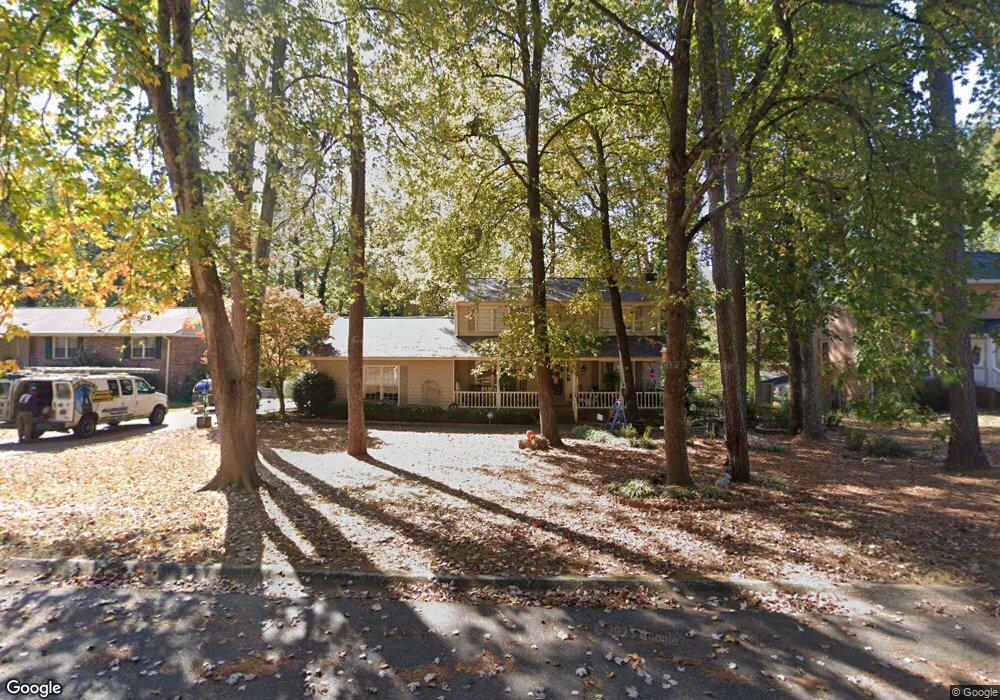
619 Buckeye Cir SE Conyers, GA 30094
Estimated Value: $314,000 - $359,000
4
Beds
4
Baths
2,611
Sq Ft
$126/Sq Ft
Est. Value
About This Home
This home is located at 619 Buckeye Cir SE, Conyers, GA 30094 and is currently estimated at $330,277, approximately $126 per square foot. 619 Buckeye Cir SE is a home located in Rockdale County with nearby schools including Barksdale Elementary School, Gen. Ray Davis Middle School, and Salem High School.
Ownership History
Date
Name
Owned For
Owner Type
Purchase Details
Closed on
Apr 17, 2019
Sold by
Williams-Fleisc Cynthia
Bought by
Williams-Fleisc Cynthia and Fleischmann Raymond Allen
Current Estimated Value
Home Financials for this Owner
Home Financials are based on the most recent Mortgage that was taken out on this home.
Original Mortgage
$194,000
Outstanding Balance
$170,214
Interest Rate
4.2%
Mortgage Type
New Conventional
Estimated Equity
$160,063
Purchase Details
Closed on
Feb 26, 2014
Sold by
Nationstar Mtg Llc
Bought by
Crosby Laura
Purchase Details
Closed on
Dec 3, 2013
Sold by
Pine Robert S
Bought by
Nationstar Mtg Llc
Purchase Details
Closed on
Feb 28, 2012
Sold by
Pine Mary Ann
Bought by
Pine Robert Steven
Purchase Details
Closed on
Oct 26, 2003
Sold by
Hooks Richard W and Hooks Kathy L
Bought by
Pine Robert S and Pine Mary
Create a Home Valuation Report for This Property
The Home Valuation Report is an in-depth analysis detailing your home's value as well as a comparison with similar homes in the area
Home Values in the Area
Average Home Value in this Area
Purchase History
| Date | Buyer | Sale Price | Title Company |
|---|---|---|---|
| Williams-Fleisc Cynthia | -- | -- | |
| Williams-Fleisc Cynthia | $200,000 | -- | |
| Crosby Laura | $67,200 | -- | |
| Nationstar Mtg Llc | $114,757 | -- | |
| Pine Robert Steven | -- | -- | |
| Pine Robert S | $25,000 | -- |
Source: Public Records
Mortgage History
| Date | Status | Borrower | Loan Amount |
|---|---|---|---|
| Open | Williams-Fleisc Cynthia | $194,000 | |
| Closed | Williams-Fleisc Cynthia | $194,000 |
Source: Public Records
Tax History Compared to Growth
Tax History
| Year | Tax Paid | Tax Assessment Tax Assessment Total Assessment is a certain percentage of the fair market value that is determined by local assessors to be the total taxable value of land and additions on the property. | Land | Improvement |
|---|---|---|---|---|
| 2024 | $3,203 | $130,560 | $25,360 | $105,200 |
| 2023 | $3,157 | $132,840 | $26,400 | $106,440 |
| 2022 | $2,636 | $112,560 | $22,640 | $89,920 |
| 2021 | $2,425 | $98,160 | $17,040 | $81,120 |
| 2020 | $1,968 | $80,000 | $12,333 | $67,667 |
| 2019 | $2,416 | $53,440 | $10,840 | $42,600 |
| 2018 | $2,295 | $50,520 | $9,680 | $40,840 |
| 2017 | $1,819 | $39,600 | $8,680 | $30,920 |
| 2016 | $1,819 | $39,600 | $8,680 | $30,920 |
| 2015 | $1,242 | $26,880 | $5,606 | $21,274 |
| 2014 | $1,783 | $38,360 | $8,000 | $30,360 |
| 2013 | -- | $50,088 | $12,000 | $38,088 |
Source: Public Records
Map
Nearby Homes
- 634 Knollwood Cir SE
- 2178 NE Hillwood Dr
- 4938 Lake Forest Dr SE
- 4931 W Lake Dr SE
- 5312 Ashley Dr SE
- 801 Greenwood Trail SE
- 4811 W Lake Dr SE
- 4731 Shadybrook Way SE Unit 2
- 4980 W Lake Dr SE
- 821 Greenwood Trail SE
- 824 Cedar Lake Dr SE
- 4710 Cedar Brook Dr SE
- 4797 Hemlock Dr SE
- 1459 Highway 212 SW
- 4670 Cedar Brook Dr SE
- 4822 Navajo Trail SE
- 4773 Bell Cir SE
- 570 Bell Rd SE
- 609 Buckeye Cir SE
- 629 Buckeye Cir SE
- 599 Buckeye Cir SE
- 620 Glenridge Ct SE
- 0 Buckeye Cir SE Unit 8892263
- 0 Buckeye Cir SE Unit 8836143
- 0 Buckeye Cir SE Unit 8811986
- 0 Buckeye Cir SE Unit 8430272
- 0 Buckeye Cir SE Unit 7132274
- 0 Buckeye Cir SE Unit 8808010
- 0 Buckeye Cir SE Unit 8026019
- 0 Buckeye Cir SE
- 630 Glenridge Ct SE
- 610 Glenridge Ct SE
- 631 Buckeye Cir SE
- 620 Buckeye Cir SE
- 600 Glenridge Ct SE Unit 3
- 612 Buckeye Cir SE
- 600 Buckeye Cir SE
- 632 Buckeye Cir SE