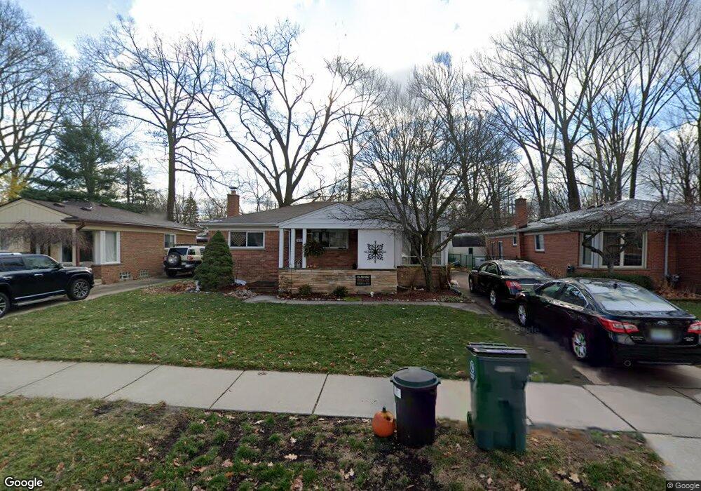
619 Butternut Ave Royal Oak, MI 48073
Estimated Value: $320,281 - $369,000
3
Beds
2
Baths
1,094
Sq Ft
$323/Sq Ft
Est. Value
About This Home
This home is located at 619 Butternut Ave, Royal Oak, MI 48073 and is currently estimated at $353,570, approximately $323 per square foot. 619 Butternut Ave is a home located in Oakland County with nearby schools including Addams Elementary, Royal Oak Middle School, and Royal Oak High School.
Ownership History
Date
Name
Owned For
Owner Type
Purchase Details
Closed on
Nov 5, 2009
Sold by
Blasky John and Blasky Karen
Bought by
Bush David and Sylvester Ruth Ann
Current Estimated Value
Purchase Details
Closed on
Sep 15, 2005
Sold by
Christiansen Lance M and Pierson Bridgett
Bought by
Blasky John
Purchase Details
Closed on
Mar 18, 2002
Sold by
Prudential Residential S
Bought by
Christiansen Lance M
Purchase Details
Closed on
Dec 12, 1997
Sold by
Kay Michael J
Bought by
Hoff Allison L
Home Financials for this Owner
Home Financials are based on the most recent Mortgage that was taken out on this home.
Original Mortgage
$99,650
Interest Rate
7.28%
Create a Home Valuation Report for This Property
The Home Valuation Report is an in-depth analysis detailing your home's value as well as a comparison with similar homes in the area
Home Values in the Area
Average Home Value in this Area
Purchase History
| Date | Buyer | Sale Price | Title Company |
|---|---|---|---|
| Bush David | $130,000 | Greater Macomb Title Agency | |
| Blasky John | $216,000 | Parks Title | |
| Christiansen Lance M | $182,500 | -- | |
| Hoff Allison L | $136,500 | -- |
Source: Public Records
Mortgage History
| Date | Status | Borrower | Loan Amount |
|---|---|---|---|
| Previous Owner | Hoff Allison L | $99,650 |
Source: Public Records
Tax History Compared to Growth
Tax History
| Year | Tax Paid | Tax Assessment Tax Assessment Total Assessment is a certain percentage of the fair market value that is determined by local assessors to be the total taxable value of land and additions on the property. | Land | Improvement |
|---|---|---|---|---|
| 2024 | $2,644 | $130,610 | $0 | $0 |
| 2022 | $3,124 | $113,600 | $0 | $0 |
| 2020 | $2,569 | $102,360 | $0 | $0 |
| 2018 | $3,124 | $95,350 | $0 | $0 |
| 2017 | $3,003 | $95,350 | $0 | $0 |
| 2015 | -- | $87,350 | $0 | $0 |
| 2014 | -- | $80,330 | $0 | $0 |
| 2011 | -- | $69,950 | $0 | $0 |
Source: Public Records
Map
Nearby Homes
- 816 Royal Ave
- 922 Butternut Ave
- 1123 Royal Ave
- 2931 N Main St
- 1012 W Windemere Ave
- 306 W 13 Mile Rd
- 3303 Vinsetta Blvd
- 817 Magnolia Ave
- 3553 Marais Ave
- 1304 W Windemere Ave
- 3316 Vinsetta Blvd
- 140 E Lawrence Ave
- 1433 Royal Ave
- 2814 Crooks Rd
- 1211 Smith Ave
- 206 E Windemere Ave
- 2115 Marywood Dr
- 508 W Houstonia Ave
- 142 Midland Blvd
- 2438 Evergreen Dr
- 623 Butternut Ave
- 627 Butternut Ave
- 615 Butternut Ave
- 631 Butternut Ave
- 609 Butternut Ave
- 3002 Sylvan Dr
- 622 Royal Ave
- 616 Royal Ave
- 701 Butternut Ave
- 3003 Sylvan Dr
- 626 Royal Ave
- 612 Royal Ave
- 610 Butternut Ave
- 632 Royal Ave
- 3006 Sylvan Dr
- 634 Royal Ave
- 3007 Sylvan Dr
- 606 Royal Ave
- 601 Butternut Ave
- 702 Butternut Ave