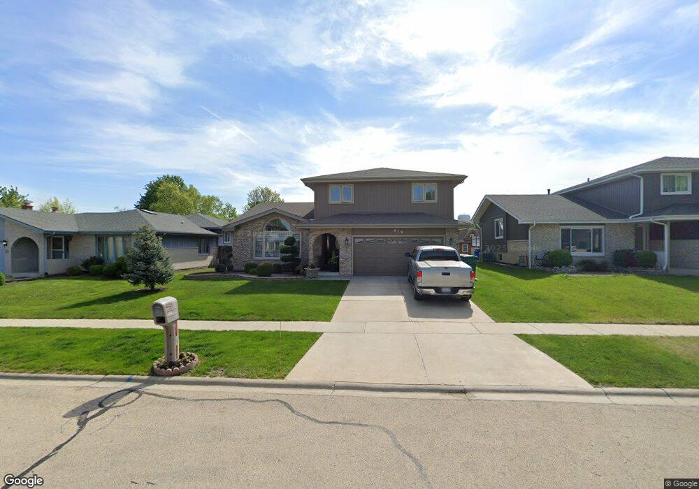
619 Driftwood Ave Romeoville, IL 60446
Estimated Value: $261,987 - $407,000
--
Bed
1
Bath
2,255
Sq Ft
$137/Sq Ft
Est. Value
About This Home
This home is located at 619 Driftwood Ave, Romeoville, IL 60446 and is currently estimated at $308,497, approximately $136 per square foot. 619 Driftwood Ave is a home located in Will County with nearby schools including Irene King Elementary School, A. Vito Martinez Middle School, and Romeoville High School.
Ownership History
Date
Name
Owned For
Owner Type
Purchase Details
Closed on
Nov 30, 1998
Sold by
Standard Bank & Trust Company
Bought by
Metelski Waldemar and Metelski Elizabeth
Current Estimated Value
Home Financials for this Owner
Home Financials are based on the most recent Mortgage that was taken out on this home.
Original Mortgage
$110,000
Interest Rate
6.96%
Create a Home Valuation Report for This Property
The Home Valuation Report is an in-depth analysis detailing your home's value as well as a comparison with similar homes in the area
Home Values in the Area
Average Home Value in this Area
Purchase History
| Date | Buyer | Sale Price | Title Company |
|---|---|---|---|
| Metelski Waldemar | $160,000 | -- |
Source: Public Records
Mortgage History
| Date | Status | Borrower | Loan Amount |
|---|---|---|---|
| Closed | Metelski Waldemar | $110,000 |
Source: Public Records
Tax History Compared to Growth
Tax History
| Year | Tax Paid | Tax Assessment Tax Assessment Total Assessment is a certain percentage of the fair market value that is determined by local assessors to be the total taxable value of land and additions on the property. | Land | Improvement |
|---|---|---|---|---|
| 2024 | $1,863 | $28,006 | $26,892 | $1,114 |
| 2023 | $1,863 | $106,789 | $24,142 | $82,647 |
| 2022 | $9,121 | $97,451 | $22,520 | $74,931 |
| 2021 | $8,709 | $91,580 | $21,163 | $70,417 |
| 2020 | $8,471 | $88,569 | $20,467 | $68,102 |
| 2019 | $8,112 | $83,952 | $19,400 | $64,552 |
| 2018 | $7,896 | $80,723 | $18,654 | $62,069 |
| 2017 | $7,429 | $76,204 | $17,610 | $58,594 |
| 2016 | $7,022 | $71,419 | $16,504 | $54,915 |
| 2015 | $6,281 | $65,974 | $15,246 | $50,728 |
| 2014 | $6,281 | $64,052 | $14,802 | $49,250 |
| 2013 | $6,281 | $64,052 | $14,802 | $49,250 |
Source: Public Records
Map
Nearby Homes
- 255 W Romeo Rd
- 312 Fremont Ave
- 346 Wild Rose Ln
- 322 Kent Ave
- 923 E Savannah Dr Unit 2
- 939 E Savannah Dr
- Lot 2 Governors Hwy
- 0 N Weber Rd Unit MRD12364369
- 1086 Princeton Dr
- 1282 W Normantown Rd
- Lot 5 Weber Rd
- 1033 Key Largo Dr Unit M702
- 487 N Anna Ln
- 343 Hale Ave
- 408 Haller Ave
- 440 N Kelly Ct
- 915 Brassfield Ave
- 497 N Frieh Dr
- 947 Brassfield Ave
- 611 Flambeau Ct
- 617 Driftwood Ave
- 621 Driftwood Ave
- 615 Driftwood Ave
- 623 Driftwood Ave
- 618 Briarwood Ave
- 620 Briarwood Ave
- 616 Briarwood Ave
- 614 Briarwood Ave
- 622 Briarwood Ave
- 613 Driftwood Ave
- 625 Driftwood Ave
- 614 Driftwood Ave
- 612 Driftwood Ave
- 616 Driftwood Ave
- 610 Driftwood Ave Unit 1
- 612 Briarwood Ave
- 624 Briarwood Ave
- 618 Driftwood Ave
- 611 Driftwood Ave
- 608 Driftwood Ave