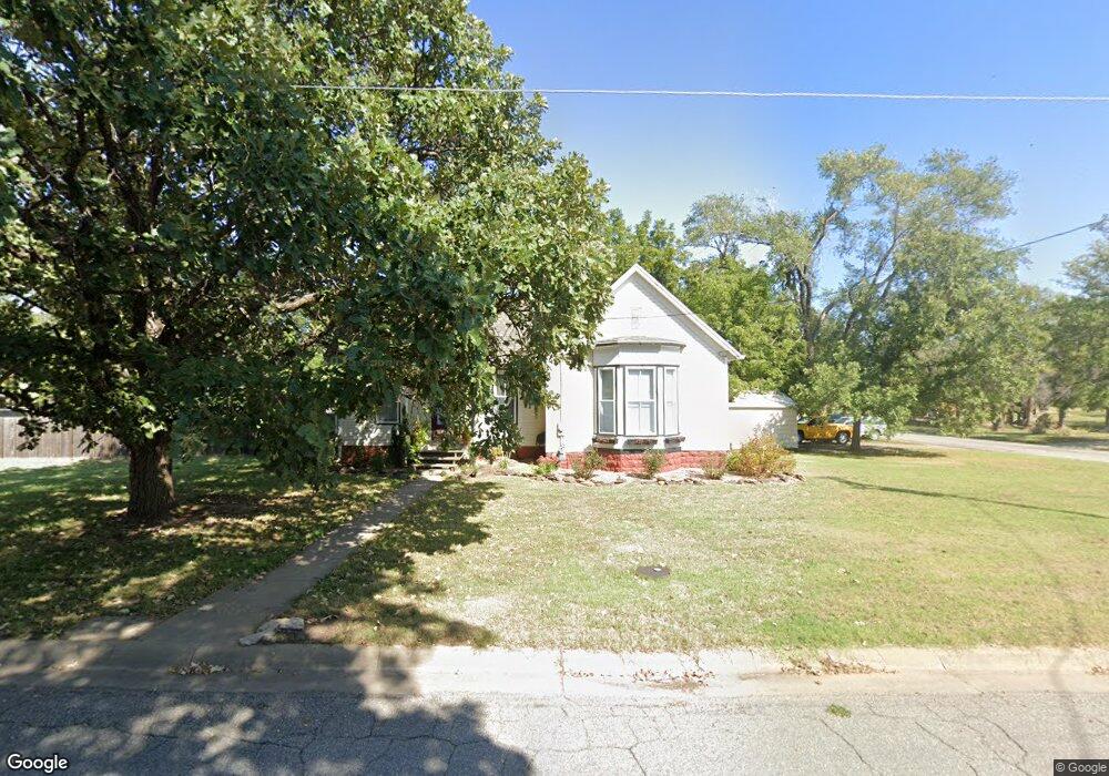
619 E 1st St Minneapolis, KS 67467
Estimated Value: $103,000 - $137,000
About This Home
This home is located at 619 E 1st St, Minneapolis, KS 67467 and is currently estimated at $118,449, approximately $105 per square foot. 619 E 1st St is a home located in Ottawa County with nearby schools including Minneapolis Elementary School and Minneapolis High School.
Ownership History
We collect this data history from publicly available records. To have your information removed, we recommend requesting removal directly through your county’s website.
Purchase Details
Home Financials for this Owner
Home Financials are based on the most recent Mortgage that was taken out on this home.Purchase History
We collect this data history from publicly available records. To have your information removed, we recommend requesting removal directly through your county’s website.
| Date | Buyer | Sale Price | Title Company |
|---|---|---|---|
| -- | -- |
Mortgage History
We collect this data history from publicly available records. To have your information removed, we recommend requesting removal directly through your county’s website.
| Date | Status | Borrower | Loan Amount |
|---|---|---|---|
| Open | $47,900 |
Tax History
We collect this data history from publicly available records. To have your information removed, we recommend requesting removal directly through your county’s website.
| Year | Tax Paid | Tax Assessment Tax Assessment Total Assessment is a certain percentage of the fair market value that is determined by local assessors to be the total taxable value of land and additions on the property. | Land | Improvement |
|---|---|---|---|---|
| 2025 | $2,025 | $11,240 | $530 | $10,710 |
| 2024 | $18 | $10,407 | $530 | $9,877 |
| 2023 | $1,651 | $9,330 | $530 | $8,800 |
| 2022 | $1,607 | $8,648 | $530 | $8,118 |
| 2021 | $1,451 | $7,406 | $530 | $6,876 |
| 2020 | $1,451 | $7,279 | $530 | $6,749 |
| 2019 | $1,455 | $7,176 | $530 | $6,646 |
| 2018 | $1,393 | $6,863 | $530 | $6,333 |
| 2017 | $1,392 | $6,795 | $530 | $6,265 |
| 2016 | $1,353 | $6,515 | $530 | $5,985 |
| 2015 | -- | $6,233 | $530 | $5,703 |
| 2014 | -- | $5,953 | $530 | $5,423 |
Map
- 211 S First
- 204 S Rothsay Ave
- 131 Spruce Ave
- 132 E 2nd St
- 222 Mackenzie St
- 319 N Sheridan St
- 725 Argyle Ave
- 212 W 4th St
- 313 W 2nd St
- 702 N Rock St
- 711 Battle Creek Ln
- 723 Battle Creek Ln
- 805 Battle Creek Ln
- 809 Battle Creek Ln
- 301 N Mill St
- 1943 Frontier Rd
- 1335 Quartz Rd
- 751 N 170th Rd
- 522 N 150th Rd
- 424 N Nelson St
Ask me questions while you tour the home.