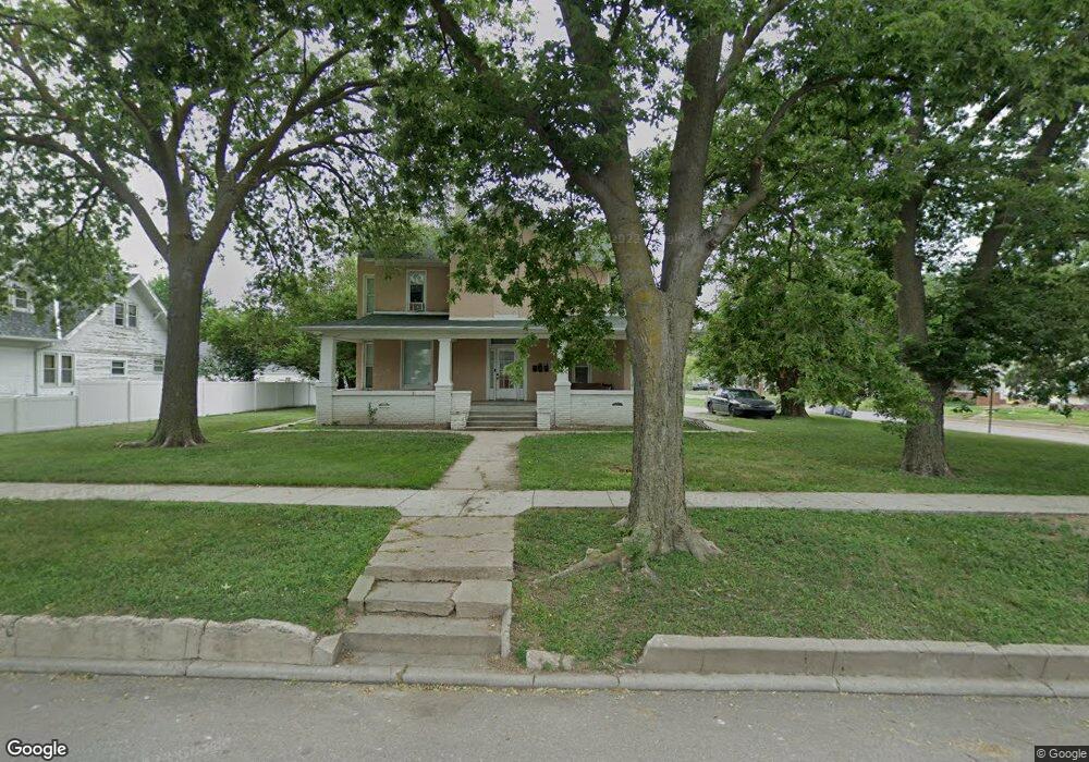
619 N Saunders Ave Hastings, NE 68901
Estimated Value: $164,000 - $239,173
4
Beds
3
Baths
2,894
Sq Ft
$73/Sq Ft
Est. Value
About This Home
This home is located at 619 N Saunders Ave, Hastings, NE 68901 and is currently estimated at $210,793, approximately $72 per square foot. 619 N Saunders Ave is a home located in Adams County with nearby schools including Hastings Senior High School, St. Michael's Preschool & Elementary School, and St. Cecilia High School.
Ownership History
Date
Name
Owned For
Owner Type
Purchase Details
Closed on
Mar 21, 2014
Sold by
Hinrichs Brent B and Hinrichs Rogene L
Bought by
Demuth Martin M and Demuth Janie
Current Estimated Value
Home Financials for this Owner
Home Financials are based on the most recent Mortgage that was taken out on this home.
Original Mortgage
$96,925
Outstanding Balance
$73,270
Interest Rate
4.27%
Mortgage Type
Future Advance Clause Open End Mortgage
Estimated Equity
$137,523
Create a Home Valuation Report for This Property
The Home Valuation Report is an in-depth analysis detailing your home's value as well as a comparison with similar homes in the area
Home Values in the Area
Average Home Value in this Area
Purchase History
| Date | Buyer | Sale Price | Title Company |
|---|---|---|---|
| Demuth Martin M | $35,000 | Elizabeth Prairie Title |
Source: Public Records
Mortgage History
| Date | Status | Borrower | Loan Amount |
|---|---|---|---|
| Open | Demuth Martin M | $96,925 |
Source: Public Records
Tax History Compared to Growth
Tax History
| Year | Tax Paid | Tax Assessment Tax Assessment Total Assessment is a certain percentage of the fair market value that is determined by local assessors to be the total taxable value of land and additions on the property. | Land | Improvement |
|---|---|---|---|---|
| 2024 | $2,715 | $158,029 | $24,500 | $133,529 |
| 2023 | $1,758 | $85,215 | $24,500 | $60,715 |
| 2022 | $1,252 | $55,597 | $24,500 | $31,097 |
| 2021 | $1,082 | $49,319 | $19,982 | $29,337 |
| 2020 | $1,033 | $47,922 | $19,982 | $27,940 |
| 2019 | $978 | $45,852 | $19,982 | $25,870 |
| 2018 | $822 | $38,345 | $12,475 | $25,870 |
| 2017 | $800 | $37,350 | $0 | $0 |
| 2016 | $801 | $37,350 | $12,475 | $24,875 |
| 2011 | -- | $0 | $0 | $0 |
Source: Public Records
Map
Nearby Homes
- 618 N Saunders Ave
- 1114-1116 W 6th St
- 727 N Williams Ave
- 619 N Briggs Ave
- 310 N Saunders Ave
- 1011 W 4th St
- 714 N Baltimore Ave
- 850 N Burlington Ave
- 814 N Lincoln Ave
- 1001 N Webster Ave
- 1615 W 7th St
- 1011 N Bellevue Ave
- 904 N Washington Ave
- 1619 Boyce St
- 313 Jefferson Ave
- 919 N Hastings Ave
- 1123-1125 N Bellevue Ave
- 514 Oswego Ave
- 1108 N Baltimore Ave
- 1127 N Bellevue Ave
- 609 N Saunders Ave
- 1211 W 7th St
- 1215 W 7th St
- 614 N Saunders Ave
- 1204 W 6th St
- 1208 W 6th St
- 1214 W 6th St
- 1202 W 7th St
- 610 N Briggs Ave
- 1138 W 6th St
- 1219 W 7th St
- 1135 W 7th St
- 711 N Saunders Ave
- 1212 W 7th St
- 1220 W 6th St
- 1134 W 6th St
- 1224 W 7th St
- 1138 W 7th St
- 1130 W 6th St
- 713 N Saunders Ave