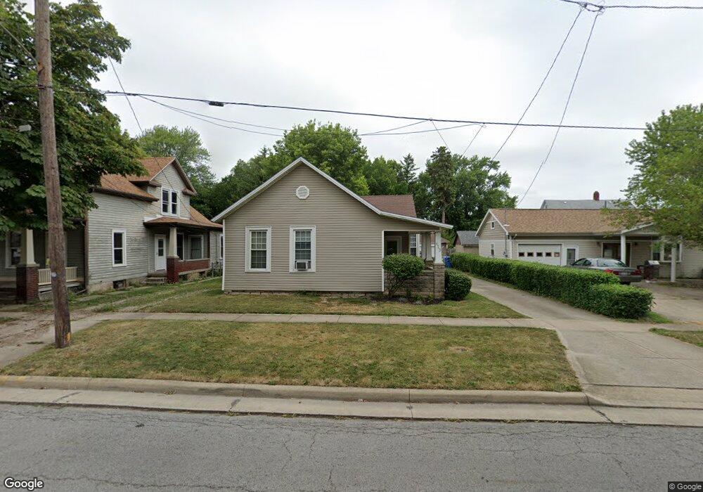
619 Neil St Sandusky, OH 44870
Estimated Value: $92,000 - $141,000
3
Beds
1
Bath
1,758
Sq Ft
$70/Sq Ft
Est. Value
About This Home
This home is located at 619 Neil St, Sandusky, OH 44870 and is currently estimated at $123,056, approximately $69 per square foot. 619 Neil St is a home located in Erie County with nearby schools including Sandusky High School, Monroe Preparatory Academy, and Sandusky Central Catholic School.
Ownership History
Date
Name
Owned For
Owner Type
Purchase Details
Closed on
Jul 27, 2018
Sold by
Silverwood Ronald D
Bought by
Vanscoy Fredrick W
Current Estimated Value
Home Financials for this Owner
Home Financials are based on the most recent Mortgage that was taken out on this home.
Original Mortgage
$44,184
Outstanding Balance
$39,171
Interest Rate
5.5%
Mortgage Type
FHA
Estimated Equity
$83,885
Purchase Details
Closed on
Nov 23, 1992
Bought by
Silverwood Ronald D
Create a Home Valuation Report for This Property
The Home Valuation Report is an in-depth analysis detailing your home's value as well as a comparison with similar homes in the area
Home Values in the Area
Average Home Value in this Area
Purchase History
| Date | Buyer | Sale Price | Title Company |
|---|---|---|---|
| Vanscoy Fredrick W | $45,000 | None Available | |
| Silverwood Ronald D | $44,000 | -- |
Source: Public Records
Mortgage History
| Date | Status | Borrower | Loan Amount |
|---|---|---|---|
| Open | Vanscoy Fredrick W | $44,184 |
Source: Public Records
Tax History
| Year | Tax Paid | Tax Assessment Tax Assessment Total Assessment is a certain percentage of the fair market value that is determined by local assessors to be the total taxable value of land and additions on the property. | Land | Improvement |
|---|---|---|---|---|
| 2024 | $1,140 | $30,569 | $4,536 | $26,033 |
| 2023 | $1,178 | $22,868 | $3,545 | $19,323 |
| 2022 | $1,133 | $22,872 | $3,545 | $19,327 |
| 2021 | $1,144 | $22,880 | $3,550 | $19,330 |
| 2020 | $1,213 | $22,320 | $3,550 | $18,770 |
| 2019 | $1,248 | $22,320 | $3,550 | $18,770 |
| 2018 | $1,250 | $22,320 | $3,550 | $18,770 |
| 2017 | $1,635 | $29,120 | $3,690 | $25,430 |
| 2016 | $1,634 | $29,120 | $3,690 | $25,430 |
| 2015 | $1,475 | $29,120 | $3,690 | $25,430 |
| 2014 | $1,609 | $31,950 | $3,690 | $28,260 |
| 2013 | $1,592 | $31,950 | $3,690 | $28,260 |
Source: Public Records
Map
Nearby Homes
- 1002 Sycamore Line
- 621 Reese St
- 1003 5th St
- 1034 Warren St
- 421 Scott St
- 1035 1st St
- 1117 Ogontz St
- 1130 4th St
- 1131 5th St
- 444 Hasting Dr
- 0 Milan Rd Unit 3997231
- 0 Milan Rd Unit 3805445
- 0 Milan Rd Unit 20182198
- 919 Hancock St
- 1019 Hancock St
- 628 Hancock St
- 3 Curran St
- 4 Curran St
- 526 Hancock St
- 522 Hancock St
- 615 Neil St
- 907 Sycamore Line
- 611 Neil St
- 901 Sycamore Line
- 821 Sycamore Line
- 607 Neil St
- 904 Perry St
- 620 Neil St
- 817 Sycamore Line
- 820 Perry St
- 616 Neil St
- 912 Perry St
- 813 Meigs St
- 612 Neil St
- 1011 Sycamore Line
- 608 Neil St
- 824 Sycamore Line
- 912 Sycamore Line Unit AA
- 912 Sycamore Line
- 912 Sycamore Line
Your Personal Tour Guide
Ask me questions while you tour the home.