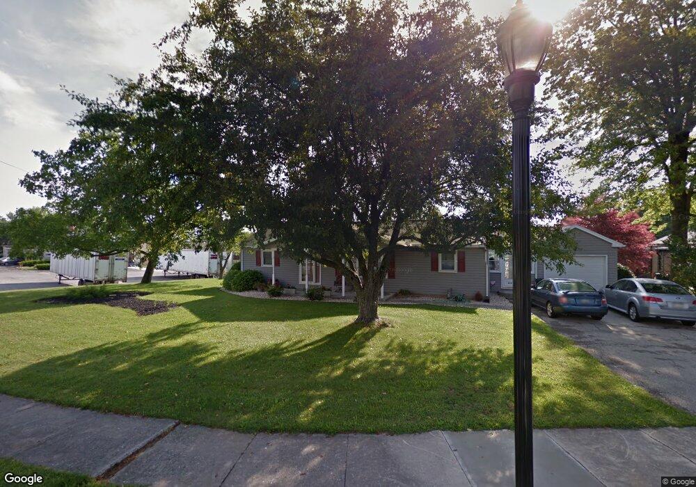
619 Prince St Unit 51 Littlestown, PA 17340
Estimated Value: $220,000 - $279,088
2
Beds
1
Bath
1,152
Sq Ft
$219/Sq Ft
Est. Value
About This Home
This home is located at 619 Prince St Unit 51, Littlestown, PA 17340 and is currently estimated at $252,022, approximately $218 per square foot. 619 Prince St Unit 51 is a home located in Adams County with nearby schools including Rolling Acres El School, Maple Avenue Middle School, and Littlestown Senior High School.
Ownership History
Date
Name
Owned For
Owner Type
Purchase Details
Closed on
Aug 31, 2020
Sold by
Reed Jan
Bought by
Barnes Eric R and Reed Jan
Current Estimated Value
Purchase Details
Closed on
Feb 27, 2009
Sold by
Barnes Eric R and Barnes Michelle D
Bought by
Reed Jan
Home Financials for this Owner
Home Financials are based on the most recent Mortgage that was taken out on this home.
Original Mortgage
$142,500
Interest Rate
5.14%
Mortgage Type
New Conventional
Create a Home Valuation Report for This Property
The Home Valuation Report is an in-depth analysis detailing your home's value as well as a comparison with similar homes in the area
Home Values in the Area
Average Home Value in this Area
Purchase History
| Date | Buyer | Sale Price | Title Company |
|---|---|---|---|
| Barnes Eric R | -- | None Available | |
| Reed Jan | $150,000 | -- |
Source: Public Records
Mortgage History
| Date | Status | Borrower | Loan Amount |
|---|---|---|---|
| Closed | Reed Jan | $142,500 |
Source: Public Records
Tax History Compared to Growth
Tax History
| Year | Tax Paid | Tax Assessment Tax Assessment Total Assessment is a certain percentage of the fair market value that is determined by local assessors to be the total taxable value of land and additions on the property. | Land | Improvement |
|---|---|---|---|---|
| 2025 | $4,200 | $182,700 | $39,200 | $143,500 |
| 2024 | $4,047 | $182,700 | $39,200 | $143,500 |
| 2023 | $3,890 | $182,700 | $39,200 | $143,500 |
| 2022 | $3,867 | $182,700 | $39,200 | $143,500 |
| 2021 | $3,752 | $182,700 | $39,200 | $143,500 |
| 2020 | $3,712 | $182,900 | $39,400 | $143,500 |
| 2019 | $3,600 | $182,900 | $39,400 | $143,500 |
| 2018 | $3,535 | $182,900 | $39,400 | $143,500 |
| 2017 | $3,444 | $182,900 | $39,400 | $143,500 |
| 2016 | -- | $182,900 | $39,400 | $143,500 |
| 2015 | -- | $182,900 | $39,400 | $143,500 |
| 2014 | -- | $182,900 | $39,400 | $143,500 |
Source: Public Records
Map
Nearby Homes
- 0 Locust Dr Unit PAAD2015910
- 20c Locust Dr
- 20 Locust Dr
- 440 N Queen St
- 58 Windsor Ct
- 48 Windsor Ct
- 162 Newark St
- 135 Apple Grove Ln Unit 438
- 140 Apple Grove Ln Unit 425
- 52 Stayman Way Unit 81
- 161 Stoners Cir
- 22 Rita Marie Ave
- 61 E King St
- 41 Smith Cir
- 129 W King St
- 115 Charles St
- 117 Charles St
- 211 E King St
- 449 Glenwyn Dr
- 349 Basehoar School Rd Unit 5
- 613 Prince St Unit 50
- 609 Prince St
- 605 Prince St
- 610 Prince St
- 2225 White Hall Rd
- 602 Prince St Unit 59
- 2190 White Hall Rd
- 532 Prince St Unit 61
- 529 Prince St Unit 74
- 528 Prince St Unit 62
- 523 Prince St
- 524 Prince St Unit 63
- 5356 Baltimore Pike
- 2178 White Hall Rd
- 519 Prince St
- 520 Prince St Unit 64
- 2171 White Hall Rd
- 5304 Baltimore Pike
- 513 Prince St Unit 44
- 516 Prince St