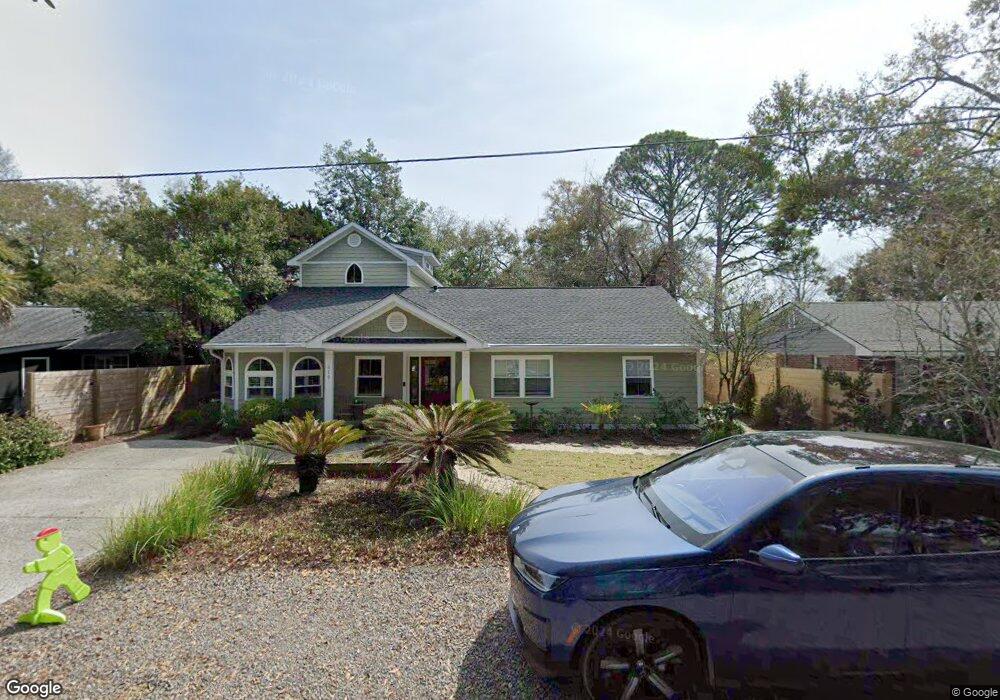
619 Ruby Dr Mount Pleasant, SC 29464
Old Village NeighborhoodEstimated Value: $927,000 - $2,563,000
4
Beds
3
Baths
2,213
Sq Ft
$681/Sq Ft
Est. Value
About This Home
This home is located at 619 Ruby Dr, Mount Pleasant, SC 29464 and is currently estimated at $1,506,985, approximately $680 per square foot. 619 Ruby Dr is a home located in Charleston County with nearby schools including Mt. Pleasant Academy, Moultrie Middle School, and Lucy Garrett Beckham High School.
Ownership History
Date
Name
Owned For
Owner Type
Purchase Details
Closed on
Jun 10, 2013
Sold by
Frost Michael A and Frost Susan
Bought by
Firth Alan S and Firth Missi J
Current Estimated Value
Home Financials for this Owner
Home Financials are based on the most recent Mortgage that was taken out on this home.
Original Mortgage
$364,400
Outstanding Balance
$258,403
Interest Rate
3.42%
Mortgage Type
New Conventional
Estimated Equity
$1,248,582
Purchase Details
Closed on
Oct 31, 2005
Sold by
Burrows Robert W and Donovan Susan
Bought by
Frost Michael A and Frost Susan
Purchase Details
Closed on
Jun 9, 2004
Sold by
Graves Stephen P
Bought by
Burrows Robert W and Donovan Susan
Create a Home Valuation Report for This Property
The Home Valuation Report is an in-depth analysis detailing your home's value as well as a comparison with similar homes in the area
Home Values in the Area
Average Home Value in this Area
Purchase History
| Date | Buyer | Sale Price | Title Company |
|---|---|---|---|
| Firth Alan S | $455,500 | -- | |
| Frost Michael A | $274,900 | None Available | |
| Burrows Robert W | $140,008 | -- |
Source: Public Records
Mortgage History
| Date | Status | Borrower | Loan Amount |
|---|---|---|---|
| Open | Firth Alan S | $364,400 |
Source: Public Records
Tax History
| Year | Tax Paid | Tax Assessment Tax Assessment Total Assessment is a certain percentage of the fair market value that is determined by local assessors to be the total taxable value of land and additions on the property. | Land | Improvement |
|---|---|---|---|---|
| 2024 | $2,795 | $22,310 | $0 | $0 |
| 2023 | $2,220 | $22,310 | $0 | $0 |
| 2022 | $2,044 | $22,310 | $0 | $0 |
| 2021 | $2,249 | $22,310 | $0 | $0 |
| 2020 | $2,326 | $22,310 | $0 | $0 |
| 2019 | $2,027 | $19,400 | $0 | $0 |
| 2017 | $1,998 | $19,400 | $0 | $0 |
| 2016 | $1,901 | $19,400 | $0 | $0 |
| 2015 | $1,988 | $19,400 | $0 | $0 |
| 2014 | $1,908 | $0 | $0 | $0 |
| 2011 | -- | $0 | $0 | $0 |
Source: Public Records
Map
Nearby Homes
- 651 McCants Dr
- 605 Ann St
- 948 McCants Dr
- 206 Freeman St
- 119 Freeman St
- 680 Atlantic St
- 546 Center St
- 558 Center St
- 727 McCants Dr
- 721 Royall Ave
- 733 Atlantic St
- 105 Friend St
- 1504 Old Village Dr
- 712 Harbor Ln
- 710 Simmons St
- 1331 Pherigo St
- 740 Atlantic St
- 1463 Seminole St
- 1527 Barquentine Dr
- 208 Mccormick St
Your Personal Tour Guide
Ask me questions while you tour the home.