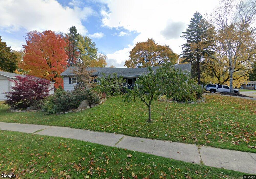
619 S Locust St Wayland, MI 49348
Estimated Value: $357,000 - $382,000
3
Beds
3
Baths
1
Sq Ft
$368,084/Sq Ft
Est. Value
About This Home
This home is located at 619 S Locust St, Wayland, MI 49348 and is currently estimated at $368,084, approximately $368,084 per square foot. 619 S Locust St is a home located in Allegan County with nearby schools including Wayland High School and St. Therese Catholic School.
Ownership History
Date
Name
Owned For
Owner Type
Purchase Details
Closed on
May 10, 1995
Sold by
Deboer Stephen H and Deboer Julie
Bought by
Bolton Scott and Bolton Vickie
Current Estimated Value
Purchase Details
Closed on
Aug 8, 1989
Sold by
Hekker Kimberly and Wright Pamel
Bought by
Goosen Todd G and Goosen Lisa C
Purchase Details
Closed on
Mar 2, 1989
Sold by
Dewitt Donald and Dewitt Barbara
Bought by
Hekker Kimberly and Wright Pamel
Purchase Details
Closed on
May 13, 1986
Sold by
Finkbeiner Richard L and Finkbeiner Ruth E
Bought by
Dewitt Donald and Dewitt Barbara
Create a Home Valuation Report for This Property
The Home Valuation Report is an in-depth analysis detailing your home's value as well as a comparison with similar homes in the area
Home Values in the Area
Average Home Value in this Area
Purchase History
| Date | Buyer | Sale Price | Title Company |
|---|---|---|---|
| Bolton Scott | $115,500 | -- | |
| Goosen Todd G | $96,500 | -- | |
| Hekker Kimberly | $94,000 | -- | |
| Dewitt Donald | $8,000 | -- |
Source: Public Records
Tax History Compared to Growth
Tax History
| Year | Tax Paid | Tax Assessment Tax Assessment Total Assessment is a certain percentage of the fair market value that is determined by local assessors to be the total taxable value of land and additions on the property. | Land | Improvement |
|---|---|---|---|---|
| 2025 | $4,501 | $171,900 | $23,300 | $148,600 |
| 2024 | $4,087 | $153,300 | $18,600 | $134,700 |
| 2023 | $4,087 | $157,200 | $17,400 | $139,800 |
| 2022 | $4,087 | $140,300 | $16,100 | $124,200 |
| 2021 | $3,845 | $129,500 | $16,100 | $113,400 |
| 2020 | $3,845 | $125,900 | $16,100 | $109,800 |
| 2019 | $0 | $112,800 | $14,300 | $98,500 |
| 2018 | $0 | $103,600 | $14,300 | $89,300 |
| 2017 | $0 | $101,800 | $14,300 | $87,500 |
| 2016 | $0 | $88,200 | $11,700 | $76,500 |
| 2015 | -- | $88,200 | $11,700 | $76,500 |
| 2014 | -- | $81,100 | $11,700 | $69,400 |
| 2013 | -- | $70,500 | $11,700 | $58,800 |
Source: Public Records
Map
Nearby Homes
- 621 S Main St
- 110 E Sycamore St
- 146 Hanlon Ct
- 212 E Superior St
- 330 Lotz Ct
- 835 Wild Flower Ct
- 319 Alpine St
- 219 Alpine St
- 3282 Stonehill Ct
- 545 N Main St
- 3296 Stonehill Ct
- 3610 Garden St
- 1143 Regina Trail
- 3570 Windsor Woods Dr
- 4674 12th St
- 3770 Division Ave S
- 3685 Calkins Ct
- 3214 7th St
- 3897 Division St
- 986 129th Ave