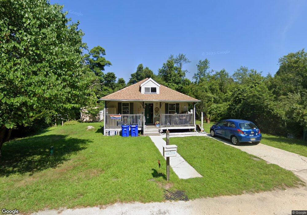
619 S Simms Ave Egg Harbor City, NJ 08215
Estimated Value: $164,112 - $220,000
--
Bed
--
Bath
650
Sq Ft
$312/Sq Ft
Est. Value
About This Home
This home is located at 619 S Simms Ave, Egg Harbor City, NJ 08215 and is currently estimated at $202,778, approximately $311 per square foot. 619 S Simms Ave is a home located in Atlantic County with nearby schools including Cedar Creek High School, Oakcrest High School, and Absegami High School.
Ownership History
Date
Name
Owned For
Owner Type
Purchase Details
Closed on
Aug 16, 2002
Sold by
Boddy Daniel and Boddy Michele
Bought by
Tippins Colby
Current Estimated Value
Home Financials for this Owner
Home Financials are based on the most recent Mortgage that was taken out on this home.
Original Mortgage
$50,000
Outstanding Balance
$21,188
Interest Rate
6.57%
Estimated Equity
$181,590
Purchase Details
Closed on
Jun 27, 2002
Sold by
J & M Land Co
Bought by
All Star Builders Inc
Home Financials for this Owner
Home Financials are based on the most recent Mortgage that was taken out on this home.
Original Mortgage
$50,000
Outstanding Balance
$21,188
Interest Rate
6.57%
Estimated Equity
$181,590
Purchase Details
Closed on
Aug 9, 2000
Sold by
Brooks Sharren
Bought by
Boddy Daniel W and Boddy Michele
Create a Home Valuation Report for This Property
The Home Valuation Report is an in-depth analysis detailing your home's value as well as a comparison with similar homes in the area
Home Values in the Area
Average Home Value in this Area
Purchase History
| Date | Buyer | Sale Price | Title Company |
|---|---|---|---|
| Tippins Colby | $78,400 | Fidelity National Title | |
| All Star Builders Inc | $25,000 | Liberty Title Agency | |
| Boddy Daniel W | $20,000 | -- |
Source: Public Records
Mortgage History
| Date | Status | Borrower | Loan Amount |
|---|---|---|---|
| Open | Tippins Colby | $50,000 |
Source: Public Records
Tax History Compared to Growth
Tax History
| Year | Tax Paid | Tax Assessment Tax Assessment Total Assessment is a certain percentage of the fair market value that is determined by local assessors to be the total taxable value of land and additions on the property. | Land | Improvement |
|---|---|---|---|---|
| 2025 | $1,967 | $73,900 | $44,300 | $29,600 |
| 2024 | $1,967 | $73,900 | $44,300 | $29,600 |
| 2023 | $1,873 | $73,900 | $44,300 | $29,600 |
| 2022 | $1,873 | $73,900 | $44,300 | $29,600 |
| 2021 | $1,826 | $73,900 | $44,300 | $29,600 |
| 2020 | $2,289 | $73,900 | $44,300 | $29,600 |
| 2019 | $2,247 | $73,900 | $44,300 | $29,600 |
| 2018 | $2,278 | $73,900 | $44,300 | $29,600 |
| 2017 | $2,278 | $73,900 | $44,300 | $29,600 |
| 2016 | $2,258 | $73,900 | $44,300 | $29,600 |
| 2015 | $2,248 | $73,900 | $44,300 | $29,600 |
| 2014 | $2,173 | $73,900 | $44,300 | $29,600 |
Source: Public Records
Map
Nearby Homes
- 1525 W Aloe St
- 617 S County Blvd
- 1409 Fairmont St
- 1409 W Fairmont Ave
- 1412 W Cleveland Ave
- 5837 White Horse Pike
- 31 London Ave
- 136 New York Ave
- 547 S Cincinnati Ave
- 29 Liverpool Ave
- 145 Washington Ave
- 213 Washington Ave
- 1321 W North St
- 0 Dahlia St
- 115 Buffalo Ave
- 119 Buffalo Ave
- 5013 White Horse Pike
- 134 Buffalo Ave
- 3058 Chicago Ave
- 214 Buffalo Ave
- 621 S Simms Ave
- 620 S Simms Ave
- 633 S Simms Ave
- 616 S Roosevelt Ave
- 0 Shaffer Ave
- 576 S Roosevelt Ave
- 1548 Detroit Ave
- 649 S Roosevelt Ave
- 1550 Detroit Ave
- 577 S Roosevelt Ave
- 508 S Roosevelt Ave
- 646 S Pershing Ave
- 1516 W Shaffer Ave
- 1519 W Lincoln Ave
- 1511 W Shaffer Ave
- 1516 W Cleveland Ave
- 1513 W Lincoln Ave
- 1517 W Cleveland Ave
- 1506 W Shaffer Ave
- 533 S Wilson Ave