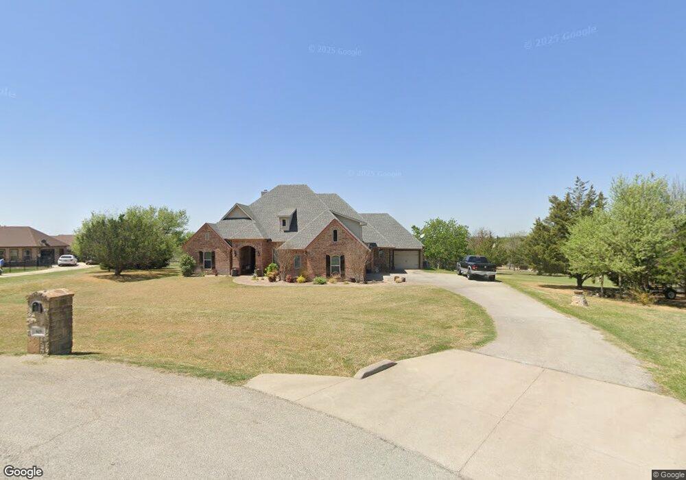
619 Sandwood Ct Weatherford, TX 76085
Estimated Value: $595,628 - $706,000
4
Beds
3
Baths
3,045
Sq Ft
$215/Sq Ft
Est. Value
About This Home
This home is located at 619 Sandwood Ct, Weatherford, TX 76085 and is currently estimated at $653,407, approximately $214 per square foot. 619 Sandwood Ct is a home located in Parker County with nearby schools including Martin Elementary School, Tison Middle School, and Weatherford High School.
Ownership History
Date
Name
Owned For
Owner Type
Purchase Details
Closed on
Nov 6, 2020
Sold by
Russell David C and Russell Patricia M
Bought by
Rhodes Chad Dewitt and Perry Shelly Elizabeth
Current Estimated Value
Home Financials for this Owner
Home Financials are based on the most recent Mortgage that was taken out on this home.
Original Mortgage
$439,375
Outstanding Balance
$389,916
Interest Rate
2.9%
Mortgage Type
New Conventional
Estimated Equity
$263,491
Purchase Details
Closed on
Jun 22, 2011
Sold by
Federal Home Loan Mortgage Corporation
Bought by
Russell David C and Russell Patricia M
Home Financials for this Owner
Home Financials are based on the most recent Mortgage that was taken out on this home.
Original Mortgage
$184,000
Interest Rate
4.55%
Mortgage Type
New Conventional
Purchase Details
Closed on
Dec 7, 2010
Sold by
Potts Jeffrey T
Bought by
Russell David C and Russell Patricia M
Purchase Details
Closed on
Oct 4, 2007
Sold by
Cayenne Development Llc
Bought by
Russell David C and Russell Patricia M
Home Financials for this Owner
Home Financials are based on the most recent Mortgage that was taken out on this home.
Original Mortgage
$49,927
Interest Rate
6.18%
Mortgage Type
Stand Alone Second
Purchase Details
Closed on
Sep 25, 2006
Sold by
Ray French Land Company Ltd
Bought by
Russell David C and Russell Patricia M
Home Financials for this Owner
Home Financials are based on the most recent Mortgage that was taken out on this home.
Original Mortgage
$248,590
Interest Rate
6.77%
Mortgage Type
Purchase Money Mortgage
Purchase Details
Closed on
Aug 1, 2006
Sold by
Ray French Land Co Ltd
Bought by
Cayenne Development Llc
Home Financials for this Owner
Home Financials are based on the most recent Mortgage that was taken out on this home.
Original Mortgage
$248,590
Interest Rate
6.77%
Mortgage Type
Purchase Money Mortgage
Purchase Details
Closed on
May 17, 2006
Sold by
Avanti Landscape Magment Inc
Bought by
Russell David C and Russell Patricia M
Create a Home Valuation Report for This Property
The Home Valuation Report is an in-depth analysis detailing your home's value as well as a comparison with similar homes in the area
Home Values in the Area
Average Home Value in this Area
Purchase History
| Date | Buyer | Sale Price | Title Company |
|---|---|---|---|
| Rhodes Chad Dewitt | -- | Providence Title Company | |
| Russell David C | -- | Chicago Title Servicelink Br | |
| Russell David C | -- | -- | |
| Federal Home Loan Mortgage Corp | $215,913 | None Available | |
| Russell David C | -- | -- | |
| Potts Jeffrey T | -- | Fnt | |
| Russell David C | -- | -- | |
| Cayenne Development Llc | -- | Stnt | |
| Russell David C | -- | -- |
Source: Public Records
Mortgage History
| Date | Status | Borrower | Loan Amount |
|---|---|---|---|
| Open | Rhodes Chad Dewitt | $439,375 | |
| Previous Owner | Russell David C | $184,000 | |
| Previous Owner | Potts Jeffrey T | $49,927 | |
| Previous Owner | Potts Jeffrey T | $266,280 | |
| Previous Owner | Russell David C | $49,927 | |
| Previous Owner | Cayenne Development Llc | $248,590 |
Source: Public Records
Tax History Compared to Growth
Tax History
| Year | Tax Paid | Tax Assessment Tax Assessment Total Assessment is a certain percentage of the fair market value that is determined by local assessors to be the total taxable value of land and additions on the property. | Land | Improvement |
|---|---|---|---|---|
| 2025 | $7,580 | $581,780 | -- | -- |
| 2024 | $7,580 | $528,891 | -- | -- |
| 2023 | $7,580 | $480,810 | $0 | $0 |
| 2022 | $8,138 | $437,100 | $50,000 | $387,100 |
| 2021 | $8,823 | $437,100 | $50,000 | $387,100 |
| 2020 | $8,387 | $418,490 | $30,000 | $388,490 |
| 2019 | $8,133 | $418,490 | $30,000 | $388,490 |
| 2018 | $7,433 | $370,670 | $30,000 | $340,670 |
| 2017 | $6,895 | $370,670 | $30,000 | $340,670 |
| 2016 | $6,268 | $282,410 | $30,000 | $252,410 |
| 2015 | $5,816 | $282,410 | $30,000 | $252,410 |
| 2014 | $5,277 | $270,980 | $30,000 | $240,980 |
Source: Public Records
Map
Nearby Homes
- 777 Trailwood Dr
- 1301 Eagle Dr
- 1337 Eagle Dr
- 1305 Green Ridge Rd
- 408 Sandridge Dr
- Haven Plan at Wossum Ranch
- 1300 Green Ridge Rd
- Vista Plan at Wossum Ranch
- 116 Sandstone Ln
- 2526 Hayley Dr
- 2517 Hayley Dr
- 1860 Trailwood Dr
- 1201 Azle Hwy
- 1541 Stanchion Way
- 1605 Stanchion Way
- 106 Rambling Trail
- 1624 Sandle Wood Dr
- 707 Gail Dr
- 719 Gail Dr
- 1629 Silverstone Dr
- 613 Sandwood Ct
- 849 Trailwood Dr
- 835 Trailwood Dr
- 625 Sandwood Ct
- 857 Trailwood Dr
- 607 Sandwood Ct
- 823 Trailwood Dr
- 254 Sandstone Ln
- 865 Trailwood Dr
- 606 Sandwood Ct
- 631 Sandwood Ct
- 811 Trailwood Dr
- 601 Sandwood Ct
- 600 Sandwood Ct
- 791 Trailwood Dr
- 637 Sandwood Ct
- 877 Trailwood Dr
- 259 Sandstone Ln
- 212 Sandstone Ln
- 253 Sandstone Ln