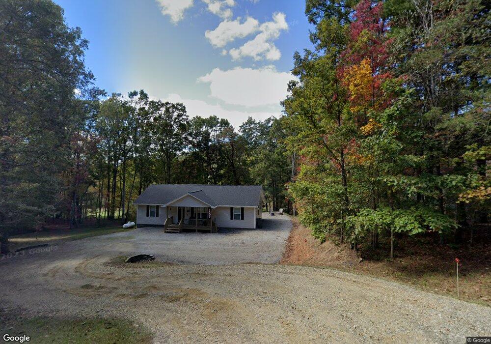
619 Summit Way Blairsville, GA 30512
Estimated Value: $295,346 - $362,000
2
Beds
2
Baths
1,300
Sq Ft
$264/Sq Ft
Est. Value
About This Home
This home is located at 619 Summit Way, Blairsville, GA 30512 and is currently estimated at $342,587, approximately $263 per square foot. 619 Summit Way is a home located in Union County with nearby schools including Union County Primary School, Union County Elementary School, and Union County Middle School.
Ownership History
Date
Name
Owned For
Owner Type
Purchase Details
Closed on
Jun 10, 2022
Sold by
Hughes Margaret Michelle
Bought by
Matheson Joseph T and Matheson Jeannie M
Current Estimated Value
Home Financials for this Owner
Home Financials are based on the most recent Mortgage that was taken out on this home.
Original Mortgage
$303,030
Outstanding Balance
$288,409
Interest Rate
5.3%
Mortgage Type
New Conventional
Estimated Equity
$54,178
Purchase Details
Closed on
Jun 12, 2006
Sold by
Cheek Allison Carlton
Bought by
Hughes Margaret Michelle
Home Financials for this Owner
Home Financials are based on the most recent Mortgage that was taken out on this home.
Original Mortgage
$132,000
Interest Rate
6.75%
Mortgage Type
New Conventional
Purchase Details
Closed on
Jun 21, 2004
Sold by
Carroll Martin
Bought by
Carlton Allison Paige
Purchase Details
Closed on
Jun 1, 1995
Bought by
Carroll Martin
Create a Home Valuation Report for This Property
The Home Valuation Report is an in-depth analysis detailing your home's value as well as a comparison with similar homes in the area
Home Values in the Area
Average Home Value in this Area
Purchase History
| Date | Buyer | Sale Price | Title Company |
|---|---|---|---|
| Matheson Joseph T | $300,000 | -- | |
| Hughes Margaret Michelle | $165,000 | -- | |
| Carlton Allison Paige | $13,000 | -- | |
| Carroll Martin | $9,900 | -- |
Source: Public Records
Mortgage History
| Date | Status | Borrower | Loan Amount |
|---|---|---|---|
| Open | Matheson Joseph T | $303,030 | |
| Previous Owner | Hughes Margaret Michelle | $132,000 |
Source: Public Records
Tax History Compared to Growth
Tax History
| Year | Tax Paid | Tax Assessment Tax Assessment Total Assessment is a certain percentage of the fair market value that is determined by local assessors to be the total taxable value of land and additions on the property. | Land | Improvement |
|---|---|---|---|---|
| 2024 | $1,316 | $111,400 | $10,040 | $101,360 |
| 2023 | $1,438 | $108,000 | $10,040 | $97,960 |
| 2022 | $1,171 | $87,960 | $9,360 | $78,600 |
| 2021 | $1,082 | $68,640 | $7,480 | $61,160 |
| 2020 | $933 | $49,298 | $11,900 | $37,398 |
| 2019 | $882 | $49,298 | $11,900 | $37,398 |
| 2018 | $866 | $49,298 | $11,900 | $37,398 |
| 2017 | $866 | $49,298 | $11,900 | $37,398 |
| 2016 | $866 | $49,298 | $11,900 | $37,398 |
| 2015 | $874 | $49,298 | $11,900 | $37,398 |
| 2013 | -- | $49,298 | $11,900 | $37,398 |
Source: Public Records
Map
Nearby Homes
- 54 Four Seasons Landing
- LOT37 Mountain Valley Ln
- 34 Mountain Valley Ln
- 399 Pinebrook Dr
- Lot 149 Summit Way
- LOT 112 Natalie Ln
- LOT 54 Sunny View Dr
- 1063 Summit Way
- L 10&16 Josie Dr
- na Aj's Holler
- 102 Summit Way
- 517 Mountain Top Rd
- 43 Little Beasley
- Lot 47 Mountain Top Rd
- 78 Reed White Dr
- Lot 35 Middle Creek Rd
- 171 Mountain Top Rd
- 288 Kimsey St
- n/a Wildwood Ln
- 9 Pruitt Cir
- 614 Summit Way
- 676 Summit Way
- 649 Summit Way
- 649 Summit Way
- 567 Summit Way
- 112 Foxwood Dr
- 29 Fields Branch Ln
- 704 Summit Way
- 0 Lt 13 Fields Branch Rd
- 675 Summit Way
- 675 Summit Way
- 434 Stroud Rd
- 65 Fields Branch Ln
- 681 Summit Way
- 109 Summit Way
- 261 Stroud Rd
- 53 Foxwood Dr
- 526 Summit Way
- 491 Summit Way
- LT 20 Fields Branch Ln