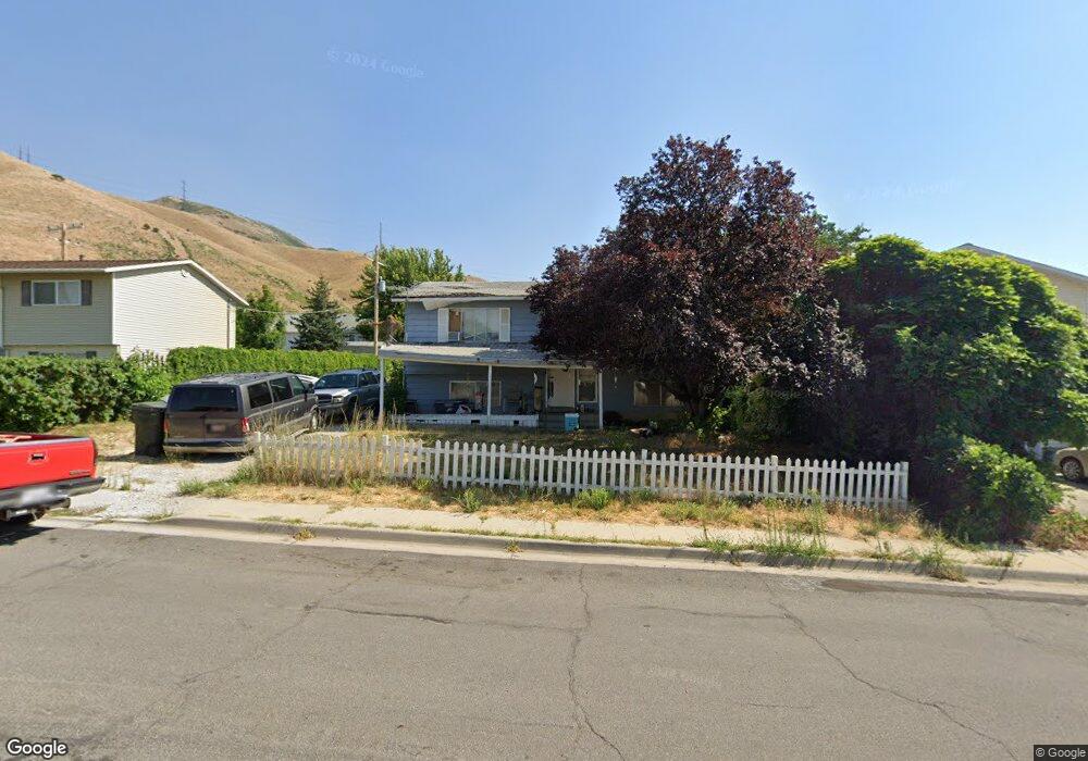
619 W 1000 S Tooele, UT 84074
Estimated Value: $344,000 - $377,000
4
Beds
2
Baths
1,750
Sq Ft
$206/Sq Ft
Est. Value
About This Home
This home is located at 619 W 1000 S, Tooele, UT 84074 and is currently estimated at $359,634, approximately $205 per square foot. 619 W 1000 S is a home located in Tooele County with nearby schools including Settlement Canyon Elementary School, Tooele Junior High School, and Tooele High School.
Ownership History
Date
Name
Owned For
Owner Type
Purchase Details
Closed on
Jun 5, 2024
Sold by
Gem 2005 Lp
Bought by
Mcquiston George E
Current Estimated Value
Purchase Details
Closed on
Dec 27, 2013
Sold by
Mcquiston George E
Bought by
Gem 2005 Lp
Home Financials for this Owner
Home Financials are based on the most recent Mortgage that was taken out on this home.
Original Mortgage
$75,930
Interest Rate
4.17%
Mortgage Type
New Conventional
Purchase Details
Closed on
Oct 27, 2005
Sold by
Mcquiston George E
Bought by
Gem 2005 Lp
Create a Home Valuation Report for This Property
The Home Valuation Report is an in-depth analysis detailing your home's value as well as a comparison with similar homes in the area
Home Values in the Area
Average Home Value in this Area
Purchase History
| Date | Buyer | Sale Price | Title Company |
|---|---|---|---|
| Mcquiston George E | -- | First American Title Insurance | |
| Gem 2005 Lp | -- | First American Title Co Llc | |
| Mcquiston George E | -- | First American Title Co Llc | |
| Gem 2005 Lp | -- | None Available |
Source: Public Records
Mortgage History
| Date | Status | Borrower | Loan Amount |
|---|---|---|---|
| Previous Owner | Mcquiston George E | $75,930 |
Source: Public Records
Tax History Compared to Growth
Tax History
| Year | Tax Paid | Tax Assessment Tax Assessment Total Assessment is a certain percentage of the fair market value that is determined by local assessors to be the total taxable value of land and additions on the property. | Land | Improvement |
|---|---|---|---|---|
| 2025 | $2,024 | $168,848 | $56,375 | $112,473 |
| 2024 | $2,216 | $169,123 | $56,375 | $112,748 |
| 2023 | $2,216 | $172,658 | $53,689 | $118,969 |
| 2022 | $1,966 | $169,145 | $67,155 | $101,990 |
| 2021 | $1,511 | $108,707 | $21,381 | $87,326 |
| 2020 | $1,437 | $179,383 | $38,875 | $140,508 |
| 2019 | $1,338 | $164,329 | $38,875 | $125,454 |
| 2018 | $1,241 | $144,545 | $40,000 | $104,545 |
| 2017 | $1,012 | $139,886 | $35,000 | $104,886 |
| 2016 | $771 | $62,824 | $15,125 | $47,699 |
| 2015 | $771 | $56,041 | $0 | $0 |
| 2014 | -- | $56,041 | $0 | $0 |
Source: Public Records
Map
Nearby Homes
- 893 S Coleman St
- 879 Sundown Ln
- 970 W Shallow Dr Unit 131
- 954 S 1050 W
- 883 W 660 S
- 825 W 620 S
- 844 S Newmark Dr
- 302 W 730 S
- 726 Pioneer Ave
- 374 Melba Dr
- 862 W 580 S
- 726 S 1050 W
- 744 Van Dyke Way
- 498 W 500 S
- 353 Millcreek Way
- 429 S Coleman St
- 209 Millcreek Way
- 169 Millcreek Way
- 420 S 380 W
- 468 Pioneer Ave
- 611 W 1000 S
- 631 W 1000 S
- 624 W 1080 S
- 634 W 1080 S
- 1011 Southland Dr
- 614 W 1000 S
- 614 W 1080 S
- 1054 Southland Dr
- 998 Southland Dr
- 997 Southland Dr
- 1026 Southland Dr
- 992 Southland Dr
- 1000 S Coleman St
- 625 W 1080 S
- 984 Southland Dr
- 635 W 1080 S
- 990 S Coleman St
- 987 Southland Dr
- 647 W 1080 S
- 974 Southland Dr