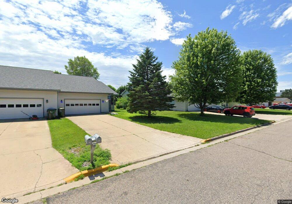
619 Westwynd Ct Mazomanie, WI 53560
Estimated Value: $186,000 - $401,000
--
Bed
--
Bath
--
Sq Ft
6,098
Sq Ft Lot
About This Home
This home is located at 619 Westwynd Ct, Mazomanie, WI 53560 and is currently estimated at $316,917. 619 Westwynd Ct is a home located in Dane County with nearby schools including Wisconsin Heights Elementary School, Mazomanie Elementary School, and Wisconsin Heights Middle School.
Ownership History
Date
Name
Owned For
Owner Type
Purchase Details
Closed on
May 15, 2018
Sold by
Schoenemann Jesse R
Bought by
Schoenemann Jesse R and Jesse Schoenemann Living Trt
Current Estimated Value
Purchase Details
Closed on
Feb 1, 2018
Sold by
Schoenemann Jesse and Schoenemann Melanie
Bought by
Schoenemann Jesse
Purchase Details
Closed on
May 3, 2013
Sold by
Schoenemann Jesse and Schoenemann Melanie
Bought by
Schoenemann Jesse and Schoenemann Melanie
Purchase Details
Closed on
Jun 25, 2012
Sold by
Schoenemann Randy J and Schoenemann Sara J
Bought by
Schoenemann Jesse and Schoenemann Melanie
Home Financials for this Owner
Home Financials are based on the most recent Mortgage that was taken out on this home.
Original Mortgage
$175,000
Outstanding Balance
$121,711
Interest Rate
3.83%
Mortgage Type
Purchase Money Mortgage
Estimated Equity
$195,206
Create a Home Valuation Report for This Property
The Home Valuation Report is an in-depth analysis detailing your home's value as well as a comparison with similar homes in the area
Home Values in the Area
Average Home Value in this Area
Purchase History
| Date | Buyer | Sale Price | Title Company |
|---|---|---|---|
| Schoenemann Jesse R | -- | None Available | |
| Schoenemann Jesse | -- | None Available | |
| Schoenemann Jesse | -- | Wisconsin Title & Escrow Llc | |
| Schoenemann Jesse | $175,000 | Wisconsin Title & Escrow Llc |
Source: Public Records
Mortgage History
| Date | Status | Borrower | Loan Amount |
|---|---|---|---|
| Open | Schoenemann Jesse | $175,000 |
Source: Public Records
Tax History Compared to Growth
Tax History
| Year | Tax Paid | Tax Assessment Tax Assessment Total Assessment is a certain percentage of the fair market value that is determined by local assessors to be the total taxable value of land and additions on the property. | Land | Improvement |
|---|---|---|---|---|
| 2024 | $5,166 | $267,200 | $28,000 | $239,200 |
| 2023 | $4,948 | $267,200 | $28,000 | $239,200 |
| 2021 | $4,493 | $187,000 | $36,500 | $150,500 |
| 2020 | $4,167 | $187,000 | $36,500 | $150,500 |
| 2019 | $4,039 | $187,000 | $36,500 | $150,500 |
| 2018 | $3,896 | $187,000 | $36,500 | $150,500 |
| 2017 | $3,856 | $187,000 | $36,500 | $150,500 |
| 2016 | $3,971 | $187,000 | $36,500 | $150,500 |
| 2015 | $3,940 | $187,000 | $36,500 | $150,500 |
| 2014 | $3,809 | $187,000 | $36,500 | $150,500 |
| 2013 | $3,682 | $187,000 | $36,500 | $150,500 |
Source: Public Records
Map
Nearby Homes
- 621 Westwynd Ct
- 623 Westwynd Ct
- 615 Westwynd Ct
- 628 Westwynd Ct
- 613 Westwynd Ct
- 632 Westwynd Ct Unit 1
- 632 Westwynd Ct
- 626 Westwynd Ct
- 611 Westwynd Ct
- 608 Westwynd Ct
- 406 Walter Rd
- 609 Westwynd Ct
- 612 Westwynd Ct
- 111 Walter Rd
- 606 Westwynd Ct
- 604 Westwynd Ct
- 607 Westwynd Ct
- 629 W Hudson St
- 625 W Hudson St
- 621 W Hudson St