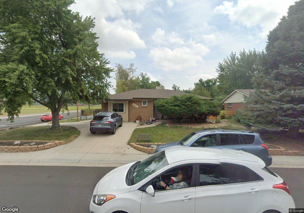
6190 Independence St Arvada, CO 80004
Alta Vista NeighborhoodEstimated Value: $609,474 - $665,000
5
Beds
3
Baths
2,641
Sq Ft
$239/Sq Ft
Est. Value
About This Home
This home is located at 6190 Independence St, Arvada, CO 80004 and is currently estimated at $630,119, approximately $238 per square foot. 6190 Independence St is a home located in Jefferson County with nearby schools including Lawrence Elementary School, North Arvada Middle School, and Arvada High School.
Ownership History
Date
Name
Owned For
Owner Type
Purchase Details
Closed on
Dec 7, 2017
Sold by
Alberti Terd Lynne
Bought by
Conklin Andrew Wayne and Conklin Tonya Luann
Current Estimated Value
Home Financials for this Owner
Home Financials are based on the most recent Mortgage that was taken out on this home.
Original Mortgage
$308,000
Outstanding Balance
$259,309
Interest Rate
3.94%
Mortgage Type
New Conventional
Estimated Equity
$370,810
Purchase Details
Closed on
Apr 18, 2011
Sold by
Alberti Mark Anthony and Alberti Terri Lynne
Bought by
Alberti Terri Lynne
Home Financials for this Owner
Home Financials are based on the most recent Mortgage that was taken out on this home.
Original Mortgage
$172,500
Interest Rate
4.91%
Mortgage Type
New Conventional
Purchase Details
Closed on
Jan 28, 2010
Sold by
Alberti Mark Anthony and Alberti Terri Lynne
Bought by
Alberti Terri Lynne
Create a Home Valuation Report for This Property
The Home Valuation Report is an in-depth analysis detailing your home's value as well as a comparison with similar homes in the area
Home Values in the Area
Average Home Value in this Area
Purchase History
| Date | Buyer | Sale Price | Title Company |
|---|---|---|---|
| Conklin Andrew Wayne | $385,000 | Stewart Title | |
| Alberti Terri Lynne | -- | Chicago Title Co | |
| Alberti Terri Lynne | -- | None Available |
Source: Public Records
Mortgage History
| Date | Status | Borrower | Loan Amount |
|---|---|---|---|
| Open | Conklin Andrew Wayne | $308,000 | |
| Previous Owner | Alberti Terri Lynne | $172,500 |
Source: Public Records
Tax History
| Year | Tax Paid | Tax Assessment Tax Assessment Total Assessment is a certain percentage of the fair market value that is determined by local assessors to be the total taxable value of land and additions on the property. | Land | Improvement |
|---|---|---|---|---|
| 2024 | $3,938 | $40,595 | $17,355 | $23,240 |
| 2023 | $3,938 | $40,595 | $17,355 | $23,240 |
| 2022 | $3,154 | $32,210 | $12,616 | $19,594 |
| 2021 | $3,207 | $33,137 | $12,979 | $20,158 |
| 2020 | $2,951 | $30,584 | $11,358 | $19,226 |
| 2019 | $2,912 | $30,584 | $11,358 | $19,226 |
| 2018 | $2,241 | $22,888 | $6,406 | $16,482 |
| 2017 | $2,052 | $22,888 | $6,406 | $16,482 |
| 2016 | $1,809 | $18,792 | $5,539 | $13,253 |
| 2015 | $1,546 | $18,792 | $5,539 | $13,253 |
| 2014 | $1,546 | $15,268 | $4,872 | $10,396 |
Source: Public Records
Map
Nearby Homes
- 6209 Brooks Dr
- 6141 Hoyt St
- 6025 Brooks Dr
- 9656 Rensselaer Dr
- 6075 Garrison St
- 6077 Flower St
- 9487 W 58th Ave Unit B
- 9487 W 58th Ave Unit A
- 9142 Oberon Rd
- 9457 W 58th Ave Unit B
- 5890 Holland Ct Unit B
- 6371 Brooks Dr
- 6069 Lee St
- 9546 W 58th Ave Unit B
- 6376 Brooks Dr
- 8940 Cole Dr
- 9015 W 63rd Ave
- 10322 W 59th Ave Unit 1
- 6240 Everett Ct Unit B
- 9609 W 57th Ave
- 6180 Independence St
- 6197 Hoyt Ct
- 6183 Hoyt Ct
- 6174 Independence St
- 6147 Independence St
- 6157 Independence St
- 6177 Hoyt Ct
- 6137 Independence St
- 6170 Independence St
- 6167 Independence St
- 6173 Hoyt Ct
- 6127 Independence St
- 6148 Iris Way
- 6158 Iris Way
- 9540 W 62nd Ave
- 6186 Hoyt Ct
- 6160 Independence St
- 6177 Independence St
- 6163 Hoyt Ct
- 6178 Hoyt Ct
Your Personal Tour Guide
Ask me questions while you tour the home.