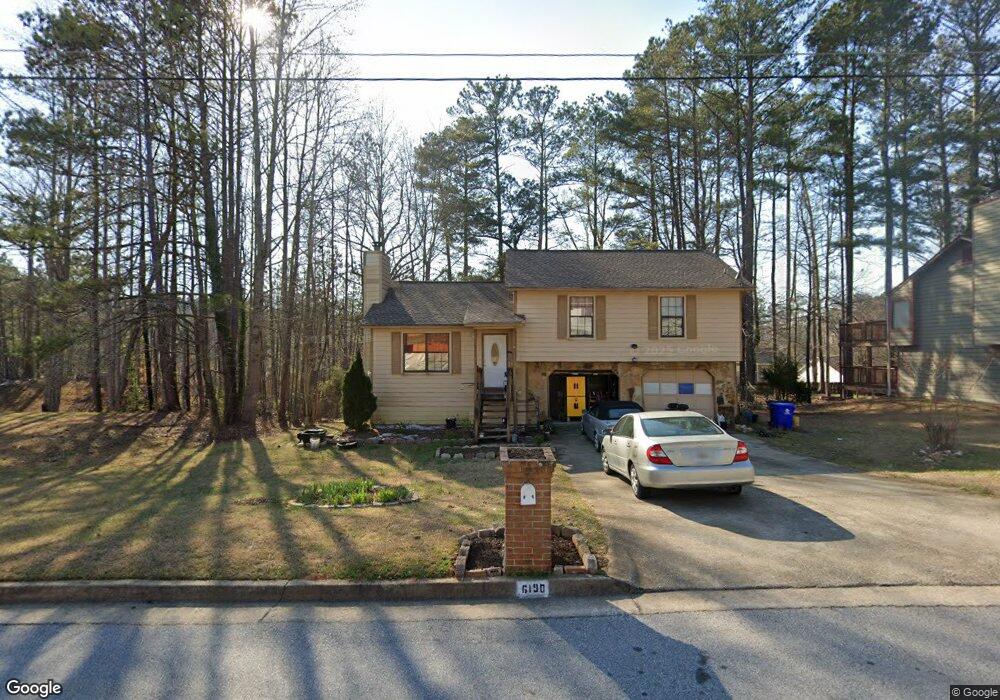
6190 Littleton Dr Union City, GA 30291
Estimated Value: $198,000 - $211,608
3
Beds
2
Baths
1,250
Sq Ft
$166/Sq Ft
Est. Value
About This Home
This home is located at 6190 Littleton Dr, Union City, GA 30291 and is currently estimated at $206,902, approximately $165 per square foot. 6190 Littleton Dr is a home located in Fulton County with nearby schools including Liberty Point Elementary School, Camp Creek Middle School, and Langston Hughes High School.
Ownership History
Date
Name
Owned For
Owner Type
Purchase Details
Closed on
Feb 13, 2024
Sold by
Gordon Nigel
Bought by
Gordon Samantha Hutchinson and Hutchinson Gordon Samantha
Current Estimated Value
Purchase Details
Closed on
Aug 20, 2022
Sold by
Hutchinson Gordon Samantha
Bought by
Gordon Alexander and Gordon Matthieu
Purchase Details
Closed on
Aug 5, 2008
Sold by
Pace Michael A
Bought by
Bank Of New York Mellon Trust
Purchase Details
Closed on
Mar 4, 2002
Sold by
Kingston Neil E and Kingston Latonia S
Bought by
Pace Michael A
Home Financials for this Owner
Home Financials are based on the most recent Mortgage that was taken out on this home.
Original Mortgage
$106,215
Interest Rate
6.95%
Mortgage Type
New Conventional
Purchase Details
Closed on
Mar 24, 2000
Sold by
Martin Gonzalow
Bought by
Kingston Neil E and Kingston Latonia S
Home Financials for this Owner
Home Financials are based on the most recent Mortgage that was taken out on this home.
Original Mortgage
$88,519
Interest Rate
8.38%
Mortgage Type
FHA
Create a Home Valuation Report for This Property
The Home Valuation Report is an in-depth analysis detailing your home's value as well as a comparison with similar homes in the area
Home Values in the Area
Average Home Value in this Area
Purchase History
| Date | Buyer | Sale Price | Title Company |
|---|---|---|---|
| Gordon Samantha Hutchinson | -- | -- | |
| Gordon Alexander | -- | -- | |
| Bank Of New York Mellon Trust | $102,850 | -- | |
| Pace Michael A | $109,500 | -- | |
| Kingston Neil E | $89,000 | -- |
Source: Public Records
Mortgage History
| Date | Status | Borrower | Loan Amount |
|---|---|---|---|
| Previous Owner | Pace Michael A | $106,215 | |
| Previous Owner | Kingston Neil E | $88,519 |
Source: Public Records
Tax History Compared to Growth
Tax History
| Year | Tax Paid | Tax Assessment Tax Assessment Total Assessment is a certain percentage of the fair market value that is determined by local assessors to be the total taxable value of land and additions on the property. | Land | Improvement |
|---|---|---|---|---|
| 2025 | $1,024 | $85,240 | $20,200 | $65,040 |
| 2023 | $1,631 | $57,800 | $11,360 | $46,440 |
| 2022 | $1,521 | $57,800 | $11,360 | $46,440 |
| 2021 | $1,045 | $38,520 | $7,880 | $30,640 |
| 2020 | $1,058 | $38,080 | $7,800 | $30,280 |
| 2019 | $1,218 | $28,840 | $5,920 | $22,920 |
| 2018 | $647 | $22,920 | $3,200 | $19,720 |
| 2017 | $669 | $22,920 | $3,200 | $19,720 |
| 2016 | $775 | $26,560 | $5,160 | $21,400 |
| 2015 | $1,195 | $26,560 | $5,160 | $21,400 |
| 2014 | $492 | $16,040 | $2,080 | $13,960 |
Source: Public Records
Map
Nearby Homes
- 6320 Littleton Dr
- 0 Highpoint Rd Unit 10553938
- 000 Highpoint Rd
- 99 Highpoint Rd
- 3227 Diamond Bluff
- 5135 Hilltop Dr
- 6030 Stonewall Dr
- 0 Lakeside Dr Unit 22475152
- 0 Lakeside Dr Unit 7515650
- 3426 Newgold Trace
- 5947 Rock Rd
- 6000 Diamond Ln
- 6024 Diamond Ln
- 4812 Station Dr Unit 2
- 4811 Station Dr Unit 35
- 9515 Lakeview Rd
- 5910 Rock Rd
- 5856 Rock Rd
- 4818 Sandstone Ln Unit 5
- 4817 Station Ln Unit 32
- 6200 Littleton Dr
- 8226 Eastshore Dr
- 8228 Eastshore Dr
- 6170 Littleton Dr
- 6210 Littleton Dr
- 8226 Eastshore Dr
- 8224 Eastshore Dr
- 8230 Eastshore Dr Unit 1
- 8222 Eastshore Dr
- 6195 Littleton Dr Unit 2
- 6185 Littleton Dr
- 6205 Littleton Dr
- 4800 Cochran Dr
- 8232 Eastshore Dr
- 6160 Littleton Dr
- 6220 Littleton Dr
- 5000 Cochran Dr
- 8220 Eastshore Dr Unit 1
- 6215 Littleton Dr
- 8234 Eastshore Dr Unit 1