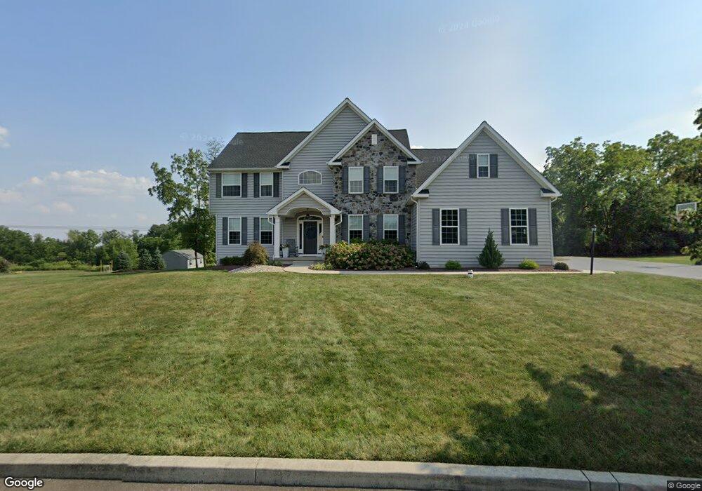
6190 Patrick Ln Unit Lot 17 Coopersburg, PA 18036
Upper Saucon Township NeighborhoodEstimated Value: $776,000 - $913,712
4
Beds
3
Baths
3,400
Sq Ft
$245/Sq Ft
Est. Value
About This Home
This home is located at 6190 Patrick Ln Unit Lot 17, Coopersburg, PA 18036 and is currently estimated at $833,904, approximately $245 per square foot. 6190 Patrick Ln Unit Lot 17 is a home located in Lehigh County with nearby schools including Southern Lehigh High School, St. Michael the Archangel School, and Faith Christian Academy 7-12th.
Ownership History
Date
Name
Owned For
Owner Type
Purchase Details
Closed on
Jul 22, 2020
Sold by
Entena Melanie A
Bought by
Entena Melanie A and Entena Joe Ryan
Current Estimated Value
Home Financials for this Owner
Home Financials are based on the most recent Mortgage that was taken out on this home.
Original Mortgage
$423,000
Outstanding Balance
$298,185
Interest Rate
3%
Mortgage Type
New Conventional
Estimated Equity
$535,719
Purchase Details
Closed on
Apr 3, 2015
Sold by
R B Locust Valley Estates Llc
Bought by
Entena Melanie A
Home Financials for this Owner
Home Financials are based on the most recent Mortgage that was taken out on this home.
Original Mortgage
$417,000
Interest Rate
3.77%
Mortgage Type
New Conventional
Create a Home Valuation Report for This Property
The Home Valuation Report is an in-depth analysis detailing your home's value as well as a comparison with similar homes in the area
Home Values in the Area
Average Home Value in this Area
Purchase History
| Date | Buyer | Sale Price | Title Company |
|---|---|---|---|
| Entena Melanie A | -- | First American Title Ins Co | |
| Entena Melanie A | $540,811 | None Available |
Source: Public Records
Mortgage History
| Date | Status | Borrower | Loan Amount |
|---|---|---|---|
| Open | Entena Melanie A | $423,000 | |
| Closed | Entena Melanie A | $417,000 |
Source: Public Records
Tax History Compared to Growth
Tax History
| Year | Tax Paid | Tax Assessment Tax Assessment Total Assessment is a certain percentage of the fair market value that is determined by local assessors to be the total taxable value of land and additions on the property. | Land | Improvement |
|---|---|---|---|---|
| 2025 | $10,939 | $482,200 | $95,000 | $387,200 |
| 2024 | $10,939 | $482,200 | $95,000 | $387,200 |
| 2023 | $10,805 | $482,200 | $95,000 | $387,200 |
| 2022 | $10,646 | $482,200 | $387,200 | $95,000 |
| 2021 | $10,409 | $482,200 | $95,000 | $387,200 |
| 2020 | $10,208 | $482,200 | $95,000 | $387,200 |
| 2019 | $10,044 | $482,200 | $95,000 | $387,200 |
| 2018 | $10,044 | $482,200 | $95,000 | $387,200 |
| 2017 | $9,947 | $482,200 | $95,000 | $387,200 |
| 2016 | -- | $482,200 | $95,000 | $387,200 |
| 2015 | -- | $89,700 | $89,700 | $0 |
| 2014 | -- | $89,700 | $89,700 | $0 |
Source: Public Records
Map
Nearby Homes
- 7338 Grant Rd
- 0 Trolley Bridge Rd
- 6551 Blue Church Rd S
- 6667 Blue Church Rd S
- 1483 Gable Dr
- 7512 S Main St
- 1500 Gable Dr
- 0 Glen Rd Unit 755784
- 5895 Glen Rd
- 5840 Blue Church Rd
- 173 Ashford Dr
- 167 Ashford Dr
- 7555 Clayton Ave
- 119 Ashford Dr
- Helena Plan at Ashford Preserve
- Meadowood Plan at Ashford Preserve
- Anderson Plan at Ashford Preserve
- The Bennett Plan at Ashford Preserve
- Wells Plan at Ashford Preserve
- 818 W Station Ave
- 6190 Patrick Ln Unit Lot 20
- 6190 Patrick Ln
- 6200 Patrick Ln
- 6180 Patrick Ln
- 6180 Patrick Ln Unit Lot 18
- 6180 Patrick Cir Unit 18
- 6170 Patrick Cir Unit 19
- 6170 Patrick Ln
- 6170 Patrick Ln Unit Lot 19
- 6170 Patrick Ln Unit Lot 18
- 689 Dylan Dr
- 6167 Locust Valley Rd
- 713 Dylan Dr
- 7300 Mary Dr
- 6185 Patrick Ln
- 6185 Patrick Ln Unit Lot 12
- 6210 Patrick Ln Unit 15
- 6210 Patrick Ln
- 6175 Patrick Ln
- 6175 Patrick Ln Unit Lot 11