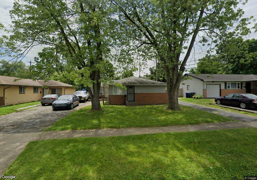
6191-6193 Ambleside Dr Columbus, OH 43229
Devonshire NeighborhoodEstimated Value: $273,000 - $345,000
5
Beds
2
Baths
1,536
Sq Ft
$192/Sq Ft
Est. Value
About This Home
This home is located at 6191-6193 Ambleside Dr, Columbus, OH 43229 and is currently estimated at $294,333, approximately $191 per square foot. 6191-6193 Ambleside Dr is a home located in Franklin County with nearby schools including Devonshire Alternative Elementary School, Woodward Park Middle School, and Beechcroft High School.
Ownership History
Date
Name
Owned For
Owner Type
Purchase Details
Closed on
Jan 4, 2021
Sold by
Deep Blue Investment Llc
Bought by
Paradis Matthew
Current Estimated Value
Home Financials for this Owner
Home Financials are based on the most recent Mortgage that was taken out on this home.
Original Mortgage
$191,468
Outstanding Balance
$170,856
Interest Rate
2.7%
Mortgage Type
FHA
Estimated Equity
$123,477
Purchase Details
Closed on
Nov 29, 2017
Sold by
Fernandes Felix P and Fernandes Juliana G
Bought by
Deep Blue Investments Llc
Purchase Details
Closed on
Jan 16, 2006
Sold by
Alfred M Shannon Family Trust
Bought by
Fernandes Felix P and Fernandes Juliana G
Home Financials for this Owner
Home Financials are based on the most recent Mortgage that was taken out on this home.
Original Mortgage
$131,535
Interest Rate
6.46%
Mortgage Type
Fannie Mae Freddie Mac
Create a Home Valuation Report for This Property
The Home Valuation Report is an in-depth analysis detailing your home's value as well as a comparison with similar homes in the area
Home Values in the Area
Average Home Value in this Area
Purchase History
| Date | Buyer | Sale Price | Title Company |
|---|---|---|---|
| Paradis Matthew | $195,000 | Title First Agency Inc | |
| Deep Blue Investments Llc | $145,000 | None Available | |
| Fernandes Felix P | $146,200 | None Available |
Source: Public Records
Mortgage History
| Date | Status | Borrower | Loan Amount |
|---|---|---|---|
| Open | Paradis Matthew | $191,468 | |
| Previous Owner | Fernandes Felix P | $131,535 |
Source: Public Records
Tax History Compared to Growth
Tax History
| Year | Tax Paid | Tax Assessment Tax Assessment Total Assessment is a certain percentage of the fair market value that is determined by local assessors to be the total taxable value of land and additions on the property. | Land | Improvement |
|---|---|---|---|---|
| 2024 | $3,670 | $80,920 | $17,500 | $63,420 |
| 2023 | $3,774 | $80,920 | $17,500 | $63,420 |
| 2022 | $2,660 | $47,810 | $12,600 | $35,210 |
| 2021 | $2,545 | $47,810 | $12,600 | $35,210 |
| 2020 | $2,549 | $47,810 | $12,600 | $35,210 |
| 2019 | $2,379 | $38,260 | $10,080 | $28,180 |
| 2018 | $2,216 | $38,260 | $10,080 | $28,180 |
| 2017 | $2,215 | $34,900 | $10,080 | $24,820 |
| 2016 | $2,260 | $33,260 | $8,510 | $24,750 |
| 2015 | $2,057 | $33,260 | $8,510 | $24,750 |
| 2014 | $2,062 | $33,260 | $8,510 | $24,750 |
| 2013 | $1,017 | $33,250 | $8,505 | $24,745 |
Source: Public Records
Map
Nearby Homes
- 1288 Oakfield Dr N
- 6189 Northgap Dr
- 5990 Ambleside Dr
- 6211 Parkdale Dr
- 1171 Newbury Dr
- 1549 Alpine Dr
- 6035 Karl Rd
- 1390 E Dublin Granville Rd
- 1268 Kildale Ct
- 6407 Faircrest Rd
- 6342 Bellmeadow Dr
- 1409 Bosworth Place
- 1421 Bosworth Place
- 6458 Faircrest Rd
- 1294 Clydesdale Ct
- 1322 Bolenhill Ct
- 1492 Cottonwood Dr
- 1752 Pine Tree St S Unit H
- 1743 Pine Tree St N Unit A
- 6407 Skywae Dr
- 6191 Ambleside Dr Unit 193
- 6187 Ambleside Dr Unit 189
- 6199 Ambleside Dr
- 1352 Whitby Square N
- 6207 Ambleside Dr
- 6183 Ambleside Dr Unit 185
- 6183-6185 Ambleside Dr
- 1360 Whitby Square N
- 1344 Whitby Square N
- 1366 Whitby Square N
- 1336 Whitby Square N
- 6209 Ambleside Dr
- 6177 Ambleside Dr Unit 179
- 1328 Whitby Square N
- 6167 Ambleside Dr
- 1341 Whitby Square N
- 1380 Whitby Square N
- 6165 Whitby Square W
- 1349 Whitby Square N
- 1357 Whitby Square N