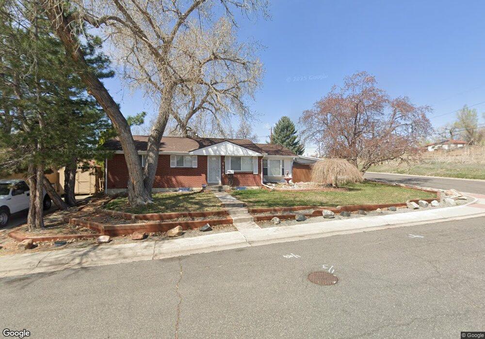
6191 Ammons St Arvada, CO 80004
Alta Vista NeighborhoodEstimated Value: $598,818 - $689,000
5
Beds
5
Baths
1,351
Sq Ft
$468/Sq Ft
Est. Value
About This Home
This home is located at 6191 Ammons St, Arvada, CO 80004 and is currently estimated at $631,955, approximately $467 per square foot. 6191 Ammons St is a home located in Jefferson County with nearby schools including Lawrence Elementary School, Arvada K-8, and North Arvada Middle School.
Ownership History
Date
Name
Owned For
Owner Type
Purchase Details
Closed on
Jun 26, 1996
Sold by
Stutz Maria
Bought by
Schell Dale A and Schell Debra A
Current Estimated Value
Home Financials for this Owner
Home Financials are based on the most recent Mortgage that was taken out on this home.
Original Mortgage
$124,100
Outstanding Balance
$9,181
Interest Rate
8.5%
Mortgage Type
VA
Estimated Equity
$622,774
Create a Home Valuation Report for This Property
The Home Valuation Report is an in-depth analysis detailing your home's value as well as a comparison with similar homes in the area
Home Values in the Area
Average Home Value in this Area
Purchase History
| Date | Buyer | Sale Price | Title Company |
|---|---|---|---|
| Schell Dale A | $120,500 | -- |
Source: Public Records
Mortgage History
| Date | Status | Borrower | Loan Amount |
|---|---|---|---|
| Open | Schell Dale A | $124,100 |
Source: Public Records
Tax History Compared to Growth
Tax History
| Year | Tax Paid | Tax Assessment Tax Assessment Total Assessment is a certain percentage of the fair market value that is determined by local assessors to be the total taxable value of land and additions on the property. | Land | Improvement |
|---|---|---|---|---|
| 2024 | $2,923 | $36,835 | $16,650 | $20,185 |
| 2023 | $2,923 | $36,835 | $16,650 | $20,185 |
| 2022 | $2,171 | $29,120 | $11,926 | $17,194 |
| 2021 | $2,899 | $29,959 | $12,270 | $17,689 |
| 2020 | $2,567 | $26,605 | $9,821 | $16,784 |
| 2019 | $2,533 | $26,605 | $9,821 | $16,784 |
| 2018 | $2,480 | $25,325 | $7,223 | $18,102 |
| 2017 | $2,270 | $25,325 | $7,223 | $18,102 |
| 2016 | $1,942 | $20,410 | $6,265 | $14,145 |
| 2015 | $1,657 | $20,410 | $6,265 | $14,145 |
| 2014 | $1,657 | $16,366 | $5,445 | $10,921 |
Source: Public Records
Map
Nearby Homes
- 6164 Brentwood St
- 6150 Carr St
- 8233 W 62nd Place
- 6009 Yarrow St Unit K
- 6055 Cody St
- 7705 W 61st Ave
- 8548 W 62nd Place
- 7605 W 62nd Ave
- 8537 W 62nd Place
- 6409 Brentwood St
- 6355 Carr St
- 8940 Cole Dr
- 6250 Everett Ct Unit E
- 6135 Everett St
- 7365 W 61st Ave
- 6204 Vance St
- 7235 W 61st Ave
- 6455 Orn Ville Aly
- 7303 W 59th Ave
- 0000S Balsam St Unit 1
- 6181 Ammons St
- 6182 Balsam St
- 6198 Balsam St
- 6178 Balsam St
- 6171 Ammons St
- 6196 Ammons St
- 6186 Ammons St
- 6162 Balsam St
- 6161 Ammons St
- 6176 Ammons St
- 6189 Balsam St
- 6187 Balsam St
- 6173 Allison St
- 6158 Balsam St
- 6185 Balsam St
- 6195 Balsam St
- 6151 Ammons St
- 6156 Ammons St
- 6173 Balsam St
- 6163 Allison St