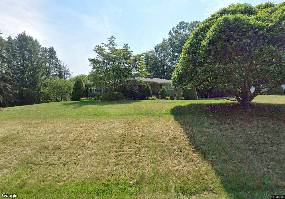
6191 Grove Rd Clinton, OH 44216
Estimated Value: $233,821 - $270,000
2
Beds
2
Baths
1,395
Sq Ft
$182/Sq Ft
Est. Value
About This Home
This home is located at 6191 Grove Rd, Clinton, OH 44216 and is currently estimated at $254,205, approximately $182 per square foot. 6191 Grove Rd is a home located in Summit County with nearby schools including St. Francis de Sales School.
Ownership History
Date
Name
Owned For
Owner Type
Purchase Details
Closed on
Jun 7, 2000
Sold by
Kushnir Robert G and Kushnir Clelia R
Bought by
Shaffer Jeffrey L and Shaffer Ellen M
Current Estimated Value
Home Financials for this Owner
Home Financials are based on the most recent Mortgage that was taken out on this home.
Original Mortgage
$134,900
Interest Rate
8%
Create a Home Valuation Report for This Property
The Home Valuation Report is an in-depth analysis detailing your home's value as well as a comparison with similar homes in the area
Home Values in the Area
Average Home Value in this Area
Purchase History
| Date | Buyer | Sale Price | Title Company |
|---|---|---|---|
| Shaffer Jeffrey L | $142,000 | Bond & Associates Title Agen |
Source: Public Records
Mortgage History
| Date | Status | Borrower | Loan Amount |
|---|---|---|---|
| Closed | Shaffer Jeffrey L | $134,900 |
Source: Public Records
Tax History Compared to Growth
Tax History
| Year | Tax Paid | Tax Assessment Tax Assessment Total Assessment is a certain percentage of the fair market value that is determined by local assessors to be the total taxable value of land and additions on the property. | Land | Improvement |
|---|---|---|---|---|
| 2025 | $2,940 | $68,019 | $12,859 | $55,160 |
| 2024 | $2,940 | $68,019 | $12,859 | $55,160 |
| 2023 | $2,940 | $68,019 | $12,859 | $55,160 |
| 2022 | $2,734 | $51,363 | $9,597 | $41,766 |
| 2021 | $2,744 | $51,363 | $9,597 | $41,766 |
| 2020 | $2,632 | $50,340 | $9,600 | $40,740 |
| 2019 | $2,696 | $46,940 | $10,600 | $36,340 |
| 2018 | $2,327 | $46,940 | $10,600 | $36,340 |
| 2017 | $2,260 | $46,940 | $10,600 | $36,340 |
| 2016 | $2,234 | $42,360 | $10,600 | $31,760 |
| 2015 | $2,260 | $42,360 | $10,600 | $31,760 |
| 2014 | $2,243 | $42,360 | $10,600 | $31,760 |
| 2013 | $2,260 | $42,790 | $10,600 | $32,190 |
Source: Public Records
Map
Nearby Homes
- 1062 Stump Rd
- 6387 Hampsher Rd
- 6090 Manchester Rd Unit 6096
- 5776 Harter Home Dr
- 781 Leeman Dr
- 715 Highland Park Dr
- 2200 W Comet Rd
- 2536 Emmons Dr
- 7452 S Cleveland Massillon Rd
- 4851 Manchester Rd
- 427 Center Rd
- 8177 S Cleveland Massillon Rd Unit 16
- 8177 S Cleveland Massillon Rd Unit 42
- 5983 Weaver Rd
- 6407 Southview Dr
- 4698 Manchester Rd
- 451 Yager Rd
- 6270 Pinto Dr
- 0 Grill Rd
- 7060 Manchester Rd