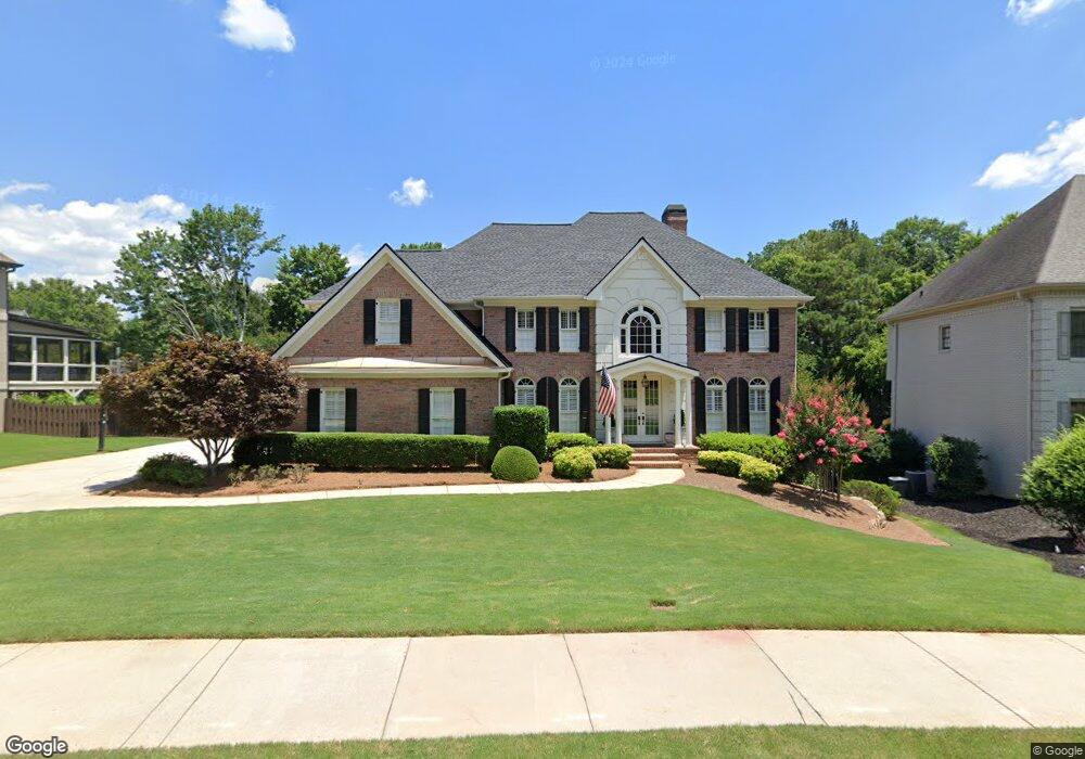
6191 Neely Farm Dr Unit 5 Norcross, GA 30092
Estimated Value: $884,904 - $1,222,000
4
Beds
4
Baths
3,586
Sq Ft
$292/Sq Ft
Est. Value
About This Home
This home is located at 6191 Neely Farm Dr Unit 5, Norcross, GA 30092 and is currently estimated at $1,046,976, approximately $291 per square foot. 6191 Neely Farm Dr Unit 5 is a home located in Gwinnett County with nearby schools including Simpson Elementary School, Pinckneyville Middle School, and Norcross High School.
Ownership History
Date
Name
Owned For
Owner Type
Purchase Details
Closed on
Jan 25, 2002
Sold by
Antin Julie C
Bought by
Binion Robert E and Binion Catherine M
Current Estimated Value
Home Financials for this Owner
Home Financials are based on the most recent Mortgage that was taken out on this home.
Original Mortgage
$352,400
Outstanding Balance
$133,200
Interest Rate
6.13%
Mortgage Type
New Conventional
Estimated Equity
$913,776
Purchase Details
Closed on
Jan 28, 2000
Sold by
Antin Todd M
Bought by
Antin Julie C
Purchase Details
Closed on
Aug 26, 1994
Sold by
Thomas Stanton B
Bought by
Antin Todd M Julie C
Home Financials for this Owner
Home Financials are based on the most recent Mortgage that was taken out on this home.
Original Mortgage
$224,000
Interest Rate
7.5%
Create a Home Valuation Report for This Property
The Home Valuation Report is an in-depth analysis detailing your home's value as well as a comparison with similar homes in the area
Home Values in the Area
Average Home Value in this Area
Purchase History
| Date | Buyer | Sale Price | Title Company |
|---|---|---|---|
| Binion Robert E | $440,500 | -- | |
| Antin Julie C | -- | -- | |
| Antin Todd M Julie C | $280,000 | -- |
Source: Public Records
Mortgage History
| Date | Status | Borrower | Loan Amount |
|---|---|---|---|
| Open | Binion Robert E | $352,400 | |
| Previous Owner | Antin Todd M Julie C | $224,000 |
Source: Public Records
Tax History Compared to Growth
Tax History
| Year | Tax Paid | Tax Assessment Tax Assessment Total Assessment is a certain percentage of the fair market value that is determined by local assessors to be the total taxable value of land and additions on the property. | Land | Improvement |
|---|---|---|---|---|
| 2025 | $7,987 | $285,600 | $64,000 | $221,600 |
| 2024 | $8,184 | $285,600 | $64,000 | $221,600 |
| 2023 | $8,184 | $317,960 | $64,000 | $253,960 |
| 2022 | $8,058 | $278,760 | $52,000 | $226,760 |
| 2021 | $7,812 | $258,440 | $49,840 | $208,600 |
| 2020 | $7,871 | $258,440 | $49,840 | $208,600 |
| 2019 | $7,248 | $239,000 | $44,000 | $195,000 |
| 2018 | $6,774 | $215,840 | $36,000 | $179,840 |
| 2016 | $6,456 | $203,200 | $36,000 | $167,200 |
| 2015 | $6,523 | $203,200 | $36,000 | $167,200 |
| 2014 | $6,420 | $203,200 | $36,000 | $167,200 |
Source: Public Records
Map
Nearby Homes
- 0 Hawk Run Unit 7571401
- 0 Hawk Run
- 4575 Dairy Way
- 4410 River Trail Dr Unit 383
- 4405 River Trail Dr
- 6040 Neely Farm Dr Unit 3
- 4291 River Bottom Dr
- 5970 Rachel Ridge Unit 2
- 5961 Ranger Ct
- 6169 Poplar Bluff Cir
- 225 Brassy Ct
- 5885 Match Point
- 0 Niblick Dr Unit 7655286
- 5863 Revington Dr
- 102 Hawkstone Way
- 4053 Spalding Hollow NW
- 420 Sandwedge Ln
- 98 Holly Isles-Harvel Pond Rd
- 0 Spyglass Bluff Unit 7666454
- 6181 Neely Farm Dr
- 6171 Neely Farm Dr
- 6190 Neely Farm Dr Unit 5
- 4501 River Bottom Dr
- 4515 Hawk Run Unit 5
- 4471 River Bottom Dr
- 6180 Neely Farm Dr
- 6161 Neely Farm Dr
- 4500 River Bottom Dr
- 4525 Hawk Run
- 4430 Quail Ridge Way
- 4480 River Bottom Dr Unit 5
- 6170 Neely Farm Dr Unit 5
- 4461 River Bottom Dr
- 4545 Hawk Run
- 4510 River Bottom Dr Unit 5
- 4470 River Bottom Dr
- 4440 Quail Ridge Way Unit 1
- 4504 Hawk Run
- 4451 River Bottom Dr