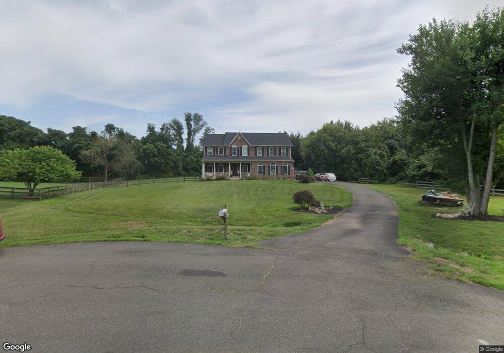
6191 W Pointe Ln Warrenton, VA 20187
Estimated Value: $808,063 - $959,000
4
Beds
4
Baths
3,304
Sq Ft
$260/Sq Ft
Est. Value
About This Home
This home is located at 6191 W Pointe Ln, Warrenton, VA 20187 and is currently estimated at $860,016, approximately $260 per square foot. 6191 W Pointe Ln is a home located in Fauquier County with nearby schools including P.B. Smith Elementary School, Kettle Run High School, and St John Evangelist Elementary School.
Ownership History
Date
Name
Owned For
Owner Type
Purchase Details
Closed on
Jun 25, 2024
Sold by
Johnson Keith M and Johnson Anita F
Bought by
Keith & Anita Johnson Family Joint Trust and Johnson
Current Estimated Value
Purchase Details
Closed on
Nov 18, 2005
Sold by
Dale Mark P
Bought by
Johnson Keith M
Home Financials for this Owner
Home Financials are based on the most recent Mortgage that was taken out on this home.
Original Mortgage
$665,000
Interest Rate
6.07%
Mortgage Type
New Conventional
Create a Home Valuation Report for This Property
The Home Valuation Report is an in-depth analysis detailing your home's value as well as a comparison with similar homes in the area
Home Values in the Area
Average Home Value in this Area
Purchase History
| Date | Buyer | Sale Price | Title Company |
|---|---|---|---|
| Keith & Anita Johnson Family Joint Trust | -- | None Listed On Document | |
| Johnson Keith M | $665,000 | -- |
Source: Public Records
Mortgage History
| Date | Status | Borrower | Loan Amount |
|---|---|---|---|
| Previous Owner | Johnson Keith M | $665,000 |
Source: Public Records
Tax History Compared to Growth
Tax History
| Year | Tax Paid | Tax Assessment Tax Assessment Total Assessment is a certain percentage of the fair market value that is determined by local assessors to be the total taxable value of land and additions on the property. | Land | Improvement |
|---|---|---|---|---|
| 2025 | $6,165 | $637,500 | $122,000 | $515,500 |
| 2024 | $6,025 | $637,500 | $122,000 | $515,500 |
| 2023 | $5,743 | $637,500 | $122,000 | $515,500 |
| 2022 | $5,743 | $637,500 | $122,000 | $515,500 |
| 2021 | $5,266 | $528,400 | $122,000 | $406,400 |
| 2020 | $5,266 | $528,400 | $122,000 | $406,400 |
| 2019 | $5,234 | $528,400 | $122,000 | $406,400 |
| 2018 | $4,944 | $528,400 | $122,000 | $406,400 |
| 2016 | -- | $449,700 | $122,000 | $327,700 |
| 2015 | -- | $449,700 | $122,000 | $327,700 |
| 2014 | -- | $449,700 | $122,000 | $327,700 |
Source: Public Records
Map
Nearby Homes
- 0 Airlie Road Lee Hwy Unit VAFQ2018058
- 0 Hwy Unit VAFQ2018052
- 7323 Bayfield Ln
- 5985 Whippoorwill Dr
- 7333 Hazelwood Ct
- 6416 Airlie Rd
- 7213 Princess Anne Ct
- 7131 Northampton St
- 6397 Tazewell St
- 7040 Hi Rock Ridge Rd
- 7038 Beaconsfield Ln
- 7057 Blackwell Rd
- 6696 Club House Ln Unit 104
- 7241 Blackwell Rd
- 6704 Holly Farm Ln Unit 204
- 6704 Holly Farm Ln Unit 109
- 7245 Blackwell Rd
- 7253 Blackwell Rd
- 5601 Lee Hwy
- 6288 Redwinged Blackbird Dr
- 6181 W Pointe Ln
- 6175 W Pointe Ln
- 6182 W Pointe Ln
- 6194 Dumfries Rd
- 6165 W Pointe Ln
- 6176 W Pointe Ln
- 6332 Dumfries Rd
- 6168 W Pointe Ln
- 6176 Dumfries Rd
- 6162 W Pointe Ln
- 0 Airlie Rd
- 0 Airlie Rd Unit VAFQ2000274
- 0 Airlie Rd Unit VAFQ168442
- 0 Airlie Rd Unit VAFQ164604
- 0 Airlie Rd Unit VAFQ164082
- 0 Airlie Rd Unit 1008349944
- 0 Airlie Rd Unit 1004528156
- 6256 Mint Springs Dr
- 7184 N Crest Ct
- 6260 Lee Hwy