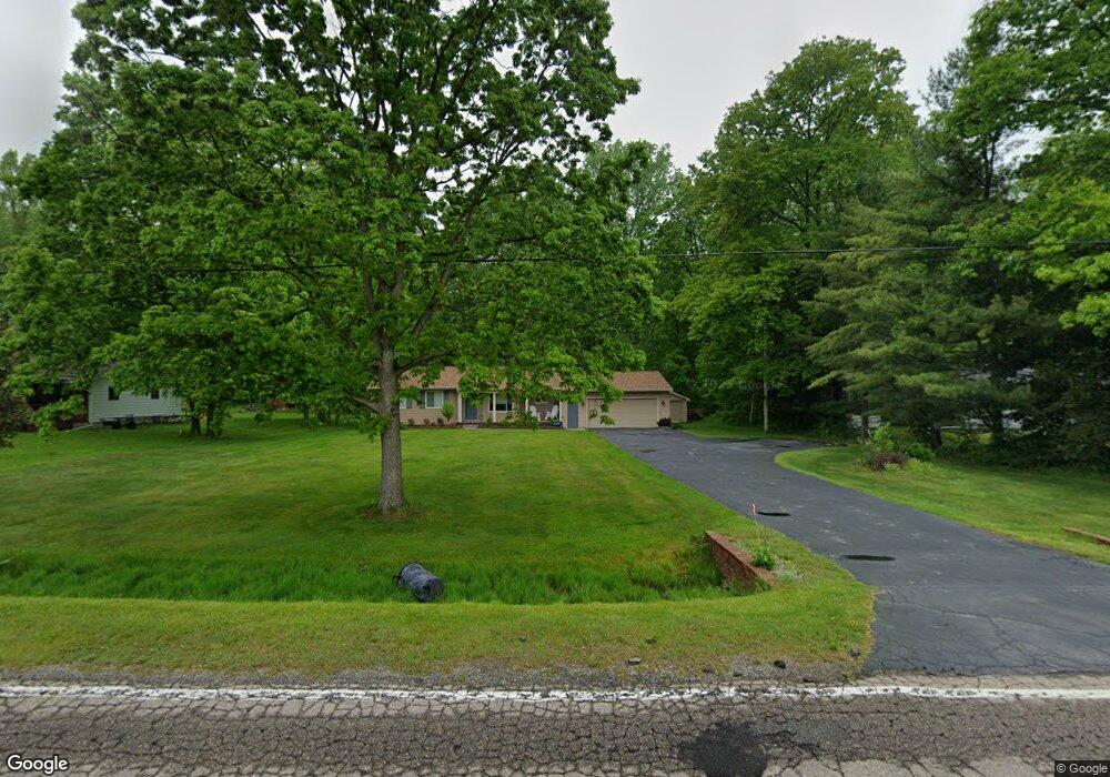
6195 Deland Rd Flushing, MI 48433
Estimated Value: $200,000 - $235,000
--
Bed
1
Bath
1,114
Sq Ft
$195/Sq Ft
Est. Value
About This Home
This home is located at 6195 Deland Rd, Flushing, MI 48433 and is currently estimated at $217,162, approximately $194 per square foot. 6195 Deland Rd is a home located in Genesee County with nearby schools including Elms Elementary School, Flushing Middle School, and Flushing High School.
Ownership History
Date
Name
Owned For
Owner Type
Purchase Details
Closed on
Jul 14, 2010
Sold by
Charles Denise R and Sands Denise
Bought by
Charles Denise R
Current Estimated Value
Purchase Details
Closed on
Oct 26, 2005
Sold by
Sands Denise
Bought by
Revocable Self Trusteed Trust Of Denise
Purchase Details
Closed on
Jun 22, 2005
Sold by
Borowy Bernard and Borowy Debony A
Bought by
Charles Daniel and Sands Denise
Create a Home Valuation Report for This Property
The Home Valuation Report is an in-depth analysis detailing your home's value as well as a comparison with similar homes in the area
Home Values in the Area
Average Home Value in this Area
Purchase History
| Date | Buyer | Sale Price | Title Company |
|---|---|---|---|
| Charles Denise R | -- | None Available | |
| Charles Denise R | -- | None Available | |
| Revocable Self Trusteed Trust Of Denise | -- | None Available | |
| Charles Daniel | $139,000 | First American Title |
Source: Public Records
Tax History Compared to Growth
Tax History
| Year | Tax Paid | Tax Assessment Tax Assessment Total Assessment is a certain percentage of the fair market value that is determined by local assessors to be the total taxable value of land and additions on the property. | Land | Improvement |
|---|---|---|---|---|
| 2025 | $2,283 | $94,200 | $0 | $0 |
| 2024 | $1,206 | $91,300 | $0 | $0 |
| 2023 | $1,151 | $84,700 | $0 | $0 |
| 2022 | $2,031 | $74,800 | $0 | $0 |
| 2021 | $2,009 | $70,500 | $0 | $0 |
| 2020 | $1,070 | $66,700 | $0 | $0 |
| 2019 | $1,059 | $60,900 | $0 | $0 |
| 2018 | $1,880 | $55,700 | $0 | $0 |
| 2017 | $938 | $55,700 | $0 | $0 |
| 2016 | $1,723 | $53,700 | $0 | $0 |
| 2015 | $1,579 | $52,900 | $0 | $0 |
| 2014 | $923 | $50,400 | $0 | $0 |
| 2012 | -- | $48,900 | $48,900 | $0 |
Source: Public Records
Map
Nearby Homes
- 9031 N Island Dr Unit 29
- 6355 N Mckinley Rd
- 0 N Island Dr Unit 20230029447
- 7491 Coldwater Rd
- 8474 Wesley Dr
- 5281 Deland Rd
- 9207 N Island Ct Unit 12
- 8520 Apple Blossom Ln
- 9175 Saddle Horn Dr
- 5082 Prestonwood Ln
- 180 Apollo Cir Unit 180
- 5315 Chickasaw Trail
- 5284 Chickasaw Trail
- 142 Apollo Ave Unit 142
- 196 Apollo Ave
- 10008 Coldwater Rd
- 7025 Coldwater Rd
- 104 Sheppard Ave Unit 104
- 0 Double Tree Estates
- 7451 Johnson Rd