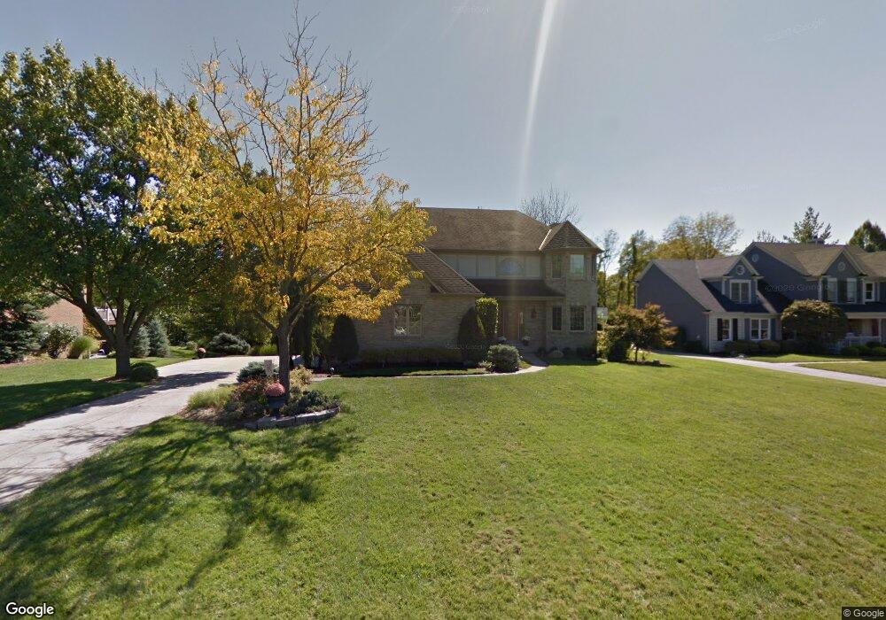
6197 Highcedar Ct Cincinnati, OH 45233
Cotillion Village NeighborhoodEstimated Value: $508,855 - $713,000
4
Beds
4
Baths
3,875
Sq Ft
$157/Sq Ft
Est. Value
About This Home
This home is located at 6197 Highcedar Ct, Cincinnati, OH 45233 and is currently estimated at $606,464, approximately $156 per square foot. 6197 Highcedar Ct is a home located in Hamilton County with nearby schools including John Foster Dulles Elementary School, Rapid Run Middle School, and Oak Hills High School.
Ownership History
Date
Name
Owned For
Owner Type
Purchase Details
Closed on
Oct 15, 2013
Sold by
Bianco Jeanne M and Bianco Joseph A
Bought by
Kammer Jason C and Kammer Heather A
Current Estimated Value
Home Financials for this Owner
Home Financials are based on the most recent Mortgage that was taken out on this home.
Original Mortgage
$284,000
Outstanding Balance
$214,066
Interest Rate
4.58%
Mortgage Type
New Conventional
Estimated Equity
$392,399
Create a Home Valuation Report for This Property
The Home Valuation Report is an in-depth analysis detailing your home's value as well as a comparison with similar homes in the area
Home Values in the Area
Average Home Value in this Area
Purchase History
| Date | Buyer | Sale Price | Title Company |
|---|---|---|---|
| Kammer Jason C | $355,000 | Attorney |
Source: Public Records
Mortgage History
| Date | Status | Borrower | Loan Amount |
|---|---|---|---|
| Open | Kammer Jason C | $284,000 |
Source: Public Records
Tax History Compared to Growth
Tax History
| Year | Tax Paid | Tax Assessment Tax Assessment Total Assessment is a certain percentage of the fair market value that is determined by local assessors to be the total taxable value of land and additions on the property. | Land | Improvement |
|---|---|---|---|---|
| 2024 | $8,698 | $147,620 | $21,000 | $126,620 |
| 2023 | $8,249 | $139,836 | $21,000 | $118,836 |
| 2022 | $8,339 | $125,794 | $21,193 | $104,601 |
| 2021 | $8,166 | $125,794 | $21,193 | $104,601 |
| 2020 | $8,280 | $125,794 | $21,193 | $104,601 |
| 2019 | $7,946 | $108,444 | $18,270 | $90,174 |
| 2018 | $7,948 | $108,444 | $18,270 | $90,174 |
| 2017 | $7,185 | $108,444 | $18,270 | $90,174 |
| 2016 | $8,199 | $124,250 | $16,632 | $107,618 |
| 2015 | $8,191 | $124,250 | $16,632 | $107,618 |
| 2014 | $8,200 | $124,250 | $16,632 | $107,618 |
| 2013 | $7,370 | $118,496 | $18,900 | $99,596 |
Source: Public Records
Map
Nearby Homes
- 6226 Rapid Run Rd
- 6278 Gardenlake Ct
- 760 Stonebridge Dr
- 6474 Simon Dr
- 1259 Wexford Ln
- 5861 Chapelhill Dr
- 1118 Timbervalley Ct
- 5819 Faysel Dr
- 665 Fox Trails Way
- 5789 Juvene Way
- 1366 Devils Backbone Rd
- 5320 Hillside Ave
- 5318 Hillside Ave
- 837 Martini Rd
- 1713 Ebenezer Rd
- 1676 Devils Backbone Rd
- 1706 Beech Grove Dr
- 6164 Hillside Ave
- 2000 Beech Grove Dr
- 2220 Ebenezer Rd
- 6207 Highcedar Ct
- 6189 Highcedar Ct
- 6185 Highcedar Ct
- 6219 Highcedar Ct
- 6173 Highcedar Ct
- 6192 Highcedar Ct
- 821 Cedarpark Dr
- 6183 Highcedar Ct
- 6216 Highcedar Ct
- 6184 Highcedar Ct
- 6227 Highcedar Ct
- 6165 Highcedar Ct
- 6224 Highcedar Ct
- 6176 Highcedar Ct
- 6230 Highcedar Ct
- 6181 Highcedar Ct
- 6168 Highcedar Ct
- 6209 Cedarbluff Ct
- 6159 Highcedar Ct
- 850 Cedarpark Dr