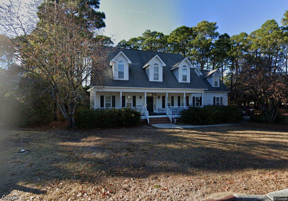
6199 Navigator Way Southport, NC 28461
Estimated Value: $739,743 - $860,000
4
Beds
4
Baths
2,678
Sq Ft
$309/Sq Ft
Est. Value
About This Home
This home is located at 6199 Navigator Way, Southport, NC 28461 and is currently estimated at $827,686, approximately $309 per square foot. 6199 Navigator Way is a home located in Brunswick County with nearby schools including Southport Elementary School, South Brunswick Middle School, and South Brunswick High School.
Ownership History
Date
Name
Owned For
Owner Type
Purchase Details
Closed on
Sep 17, 2007
Sold by
Page Charles and Page Cora Mae
Bought by
Leach John and Leach Sherry
Current Estimated Value
Home Financials for this Owner
Home Financials are based on the most recent Mortgage that was taken out on this home.
Original Mortgage
$330,000
Outstanding Balance
$208,719
Interest Rate
6.55%
Mortgage Type
New Conventional
Estimated Equity
$618,967
Create a Home Valuation Report for This Property
The Home Valuation Report is an in-depth analysis detailing your home's value as well as a comparison with similar homes in the area
Home Values in the Area
Average Home Value in this Area
Purchase History
| Date | Buyer | Sale Price | Title Company |
|---|---|---|---|
| Leach John | $412,500 | None Available |
Source: Public Records
Mortgage History
| Date | Status | Borrower | Loan Amount |
|---|---|---|---|
| Open | Leach John | $330,000 |
Source: Public Records
Tax History Compared to Growth
Tax History
| Year | Tax Paid | Tax Assessment Tax Assessment Total Assessment is a certain percentage of the fair market value that is determined by local assessors to be the total taxable value of land and additions on the property. | Land | Improvement |
|---|---|---|---|---|
| 2025 | $4,028 | $524,330 | $114,750 | $409,580 |
| 2024 | $4,028 | $524,330 | $114,750 | $409,580 |
| 2023 | $4,281 | $524,330 | $114,750 | $409,580 |
| 2022 | $4,281 | $421,570 | $59,500 | $362,070 |
| 2021 | $3,734 | $421,570 | $59,500 | $362,070 |
| 2020 | $3,734 | $421,570 | $59,500 | $362,070 |
| 2019 | $3,734 | $60,870 | $59,500 | $1,370 |
| 2018 | $3,393 | $59,560 | $57,800 | $1,760 |
| 2017 | $3,368 | $59,560 | $57,800 | $1,760 |
| 2016 | $3,128 | $59,560 | $57,800 | $1,760 |
| 2015 | $3,128 | $380,010 | $57,800 | $322,210 |
| 2014 | $2,672 | $339,468 | $76,500 | $262,968 |
Source: Public Records
Map
Nearby Homes
- 5147 Fernwood Dr
- 1015 E Moore St
- 1014 Softwind Way
- 1010 Softwind Way
- 1012 E Moore St
- 1003 Softwind Way
- 5138 Fernwood Dr
- 5122 Fernwood Dr
- 282 Sand Dollar Ln
- 282 Sand Dollar Ln Unit 38
- 2035 Oakton Dr Unit 9
- 131 Stuart Ave Unit 42
- The Thorpe Plan at Waters at Southport
- The Brandt Plan at Waters at Southport
- The Salters Plan at Waters at Southport
- 131 Stuart Ave
- The Summit Plan at Waters at Southport
- 2071 Rosin Dr Unit 19
- 306 N Fodale Ave
- 2079 Rosin Dr
- 6201 Navigator Way
- 101 Park
- 6202 Pebble Shore Ln
- 1107 E Moore St
- 103 Park
- 6189 River Sound Cir
- 1105 E Moore St
- 6205 Pebble Shore Ln
- 102 Park Ave
- 6206 Navigator Way
- 6205 Navigator Way
- 6204 Pebble Shore Ln
- 1103 E Moore St
- 104 Park
- 6117 River Sound
- 6187 River Sound Cir
- 6207 Navigator Way
- 1205 E Moore St
- 105 Park Ave
- 6119 River Sound Cir