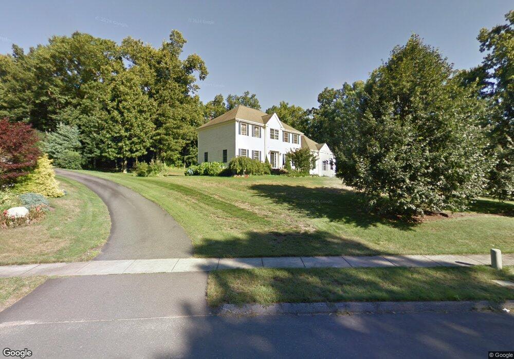
62 Backland Rd South Glastonbury, CT 06073
South Glastonbury NeighborhoodEstimated Value: $880,000 - $1,079,000
5
Beds
3
Baths
3,515
Sq Ft
$282/Sq Ft
Est. Value
About This Home
This home is located at 62 Backland Rd, South Glastonbury, CT 06073 and is currently estimated at $990,149, approximately $281 per square foot. 62 Backland Rd is a home located in Hartford County with nearby schools including Nayaug Elementary School, Gideon Welles School, and Smith Middle School.
Ownership History
Date
Name
Owned For
Owner Type
Purchase Details
Closed on
Nov 30, 2001
Sold by
Lacava Const Co
Bought by
Kimball Gregory B and Kimball Patricia A
Current Estimated Value
Home Financials for this Owner
Home Financials are based on the most recent Mortgage that was taken out on this home.
Original Mortgage
$335,000
Interest Rate
5.05%
Create a Home Valuation Report for This Property
The Home Valuation Report is an in-depth analysis detailing your home's value as well as a comparison with similar homes in the area
Home Values in the Area
Average Home Value in this Area
Purchase History
| Date | Buyer | Sale Price | Title Company |
|---|---|---|---|
| Kimball Gregory B | $516,500 | -- |
Source: Public Records
Mortgage History
| Date | Status | Borrower | Loan Amount |
|---|---|---|---|
| Open | Kimball Gregory B | $284,041 | |
| Closed | Kimball Gregory B | $50,000 | |
| Closed | Kimball Gregory B | $333,700 | |
| Closed | Kimball Gregory B | $335,000 |
Source: Public Records
Tax History Compared to Growth
Tax History
| Year | Tax Paid | Tax Assessment Tax Assessment Total Assessment is a certain percentage of the fair market value that is determined by local assessors to be the total taxable value of land and additions on the property. | Land | Improvement |
|---|---|---|---|---|
| 2025 | $15,998 | $487,300 | $165,600 | $321,700 |
| 2024 | $15,559 | $487,300 | $165,600 | $321,700 |
| 2023 | $15,111 | $487,300 | $165,600 | $321,700 |
| 2022 | $13,730 | $368,100 | $110,700 | $257,400 |
| 2021 | $13,737 | $368,100 | $110,700 | $257,400 |
| 2020 | $13,583 | $368,100 | $110,700 | $257,400 |
| 2019 | $13,384 | $368,100 | $110,700 | $257,400 |
| 2018 | $13,252 | $368,100 | $110,700 | $257,400 |
| 2017 | $14,673 | $391,800 | $110,700 | $281,100 |
| 2016 | $14,262 | $391,800 | $110,700 | $281,100 |
| 2015 | $14,144 | $391,800 | $110,700 | $281,100 |
| 2014 | $13,968 | $391,800 | $110,700 | $281,100 |
Source: Public Records
Map
Nearby Homes
- 130 Main St
- 185 Foote Rd
- 36 S Mill Dr Unit 36
- 438 Foote Rd
- 20 Nessa Way
- 32 Jennifers Way
- 994 Main St
- 30 Southgate Dr Unit 30
- 33 Brookwood Dr Unit D
- 19 Brookwood Dr Unit C
- 58 Cedar Terrace
- 102 Belltown Rd
- 579 Matson Hill Rd
- 101 Briarwood Ct Unit 101
- 46 Red Hill Dr
- 2843 Main St
- 51 Appletree Ln
- 5 Northbridge
- 37 Carillon Dr Unit A
- 21 Carillon Dr Unit B