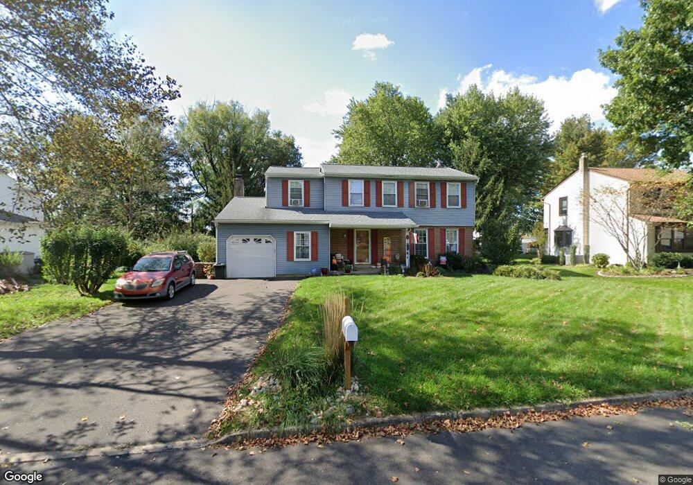
62 Basil Rd Langhorne, PA 19047
Estimated Value: $640,000 - $677,296
4
Beds
3
Baths
1,976
Sq Ft
$331/Sq Ft
Est. Value
About This Home
This home is located at 62 Basil Rd, Langhorne, PA 19047 and is currently estimated at $654,074, approximately $331 per square foot. 62 Basil Rd is a home located in Bucks County with nearby schools including Pearl S. Buck Elementary School, Maple Point Middle School, and Neshaminy High School.
Ownership History
Date
Name
Owned For
Owner Type
Purchase Details
Closed on
Apr 18, 2002
Sold by
Meredith Theresa and Pinho Theresa A
Bought by
Meredith Nelson and Meredith Theresa
Current Estimated Value
Home Financials for this Owner
Home Financials are based on the most recent Mortgage that was taken out on this home.
Original Mortgage
$200,000
Outstanding Balance
$84,092
Interest Rate
7.01%
Estimated Equity
$569,982
Purchase Details
Closed on
Sep 22, 1998
Sold by
Pinho Victor B and Pinho Theresa A
Bought by
Pinho Theresa A
Create a Home Valuation Report for This Property
The Home Valuation Report is an in-depth analysis detailing your home's value as well as a comparison with similar homes in the area
Home Values in the Area
Average Home Value in this Area
Purchase History
| Date | Buyer | Sale Price | Title Company |
|---|---|---|---|
| Meredith Nelson | -- | -- | |
| Pinho Theresa A | -- | -- |
Source: Public Records
Mortgage History
| Date | Status | Borrower | Loan Amount |
|---|---|---|---|
| Open | Meredith Nelson | $200,000 |
Source: Public Records
Tax History Compared to Growth
Tax History
| Year | Tax Paid | Tax Assessment Tax Assessment Total Assessment is a certain percentage of the fair market value that is determined by local assessors to be the total taxable value of land and additions on the property. | Land | Improvement |
|---|---|---|---|---|
| 2025 | $7,576 | $34,800 | $7,040 | $27,760 |
| 2024 | $7,576 | $34,800 | $7,040 | $27,760 |
| 2023 | $7,456 | $34,800 | $7,040 | $27,760 |
| 2022 | $7,260 | $34,800 | $7,040 | $27,760 |
| 2021 | $7,260 | $34,800 | $7,040 | $27,760 |
| 2020 | $7,173 | $34,800 | $7,040 | $27,760 |
| 2019 | $7,013 | $34,800 | $7,040 | $27,760 |
| 2018 | $6,884 | $34,800 | $7,040 | $27,760 |
| 2017 | $6,708 | $34,800 | $7,040 | $27,760 |
| 2016 | $6,708 | $34,800 | $7,040 | $27,760 |
| 2015 | $6,898 | $34,800 | $7,040 | $27,760 |
| 2014 | $6,898 | $34,800 | $7,040 | $27,760 |
Source: Public Records
Map
Nearby Homes
- 273 Shady Brook Dr Unit 243
- 120 Shady Brook Dr Unit 89
- 354 Shady Brook Dr Unit 180
- 210 Shady Brook Dr
- 175 Shady Brook Dr Unit 122
- 187 Shady Brook Dr Unit 129
- 257 Norsam Dr
- 510 Pin Oak Dr
- 462 Scott Ct
- 1988 Knight Cir
- 1102 Waterford Rd Unit 1
- 1835 Windflower Ln
- 1839 Windflower Ln
- 1819 Windflower Ln
- 0 Route 413 Bypass Unit PABU2010042
- 620B Palmer Ln
- 1948 Satter Ct
- 1853 Fieldstone Ln
- 770 Atkinson Ln
- 660 Bayberry Ln Unit T5