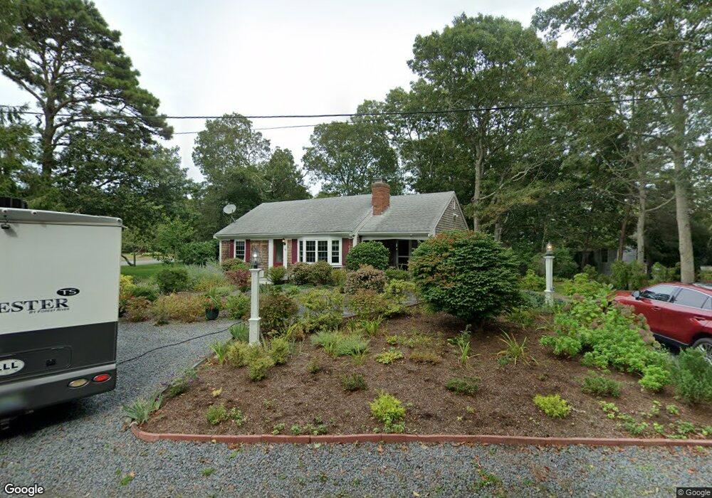
62 Bob o Link Ln West Yarmouth, MA 02673
South Yarmouth NeighborhoodEstimated Value: $541,000 - $615,000
2
Beds
1
Bath
936
Sq Ft
$608/Sq Ft
Est. Value
About This Home
This home is located at 62 Bob o Link Ln, West Yarmouth, MA 02673 and is currently estimated at $569,017, approximately $607 per square foot. 62 Bob o Link Ln is a home located in Barnstable County with nearby schools including Dennis-Yarmouth Regional High School, Sturgis Charter Public School, and St. Pius X. School.
Ownership History
Date
Name
Owned For
Owner Type
Purchase Details
Closed on
Jul 27, 2010
Sold by
Daley Edward F and Daley Joan F
Bought by
Guild David and Guild Terese M
Current Estimated Value
Home Financials for this Owner
Home Financials are based on the most recent Mortgage that was taken out on this home.
Original Mortgage
$178,000
Outstanding Balance
$118,977
Interest Rate
4.76%
Mortgage Type
Purchase Money Mortgage
Estimated Equity
$450,040
Create a Home Valuation Report for This Property
The Home Valuation Report is an in-depth analysis detailing your home's value as well as a comparison with similar homes in the area
Home Values in the Area
Average Home Value in this Area
Purchase History
| Date | Buyer | Sale Price | Title Company |
|---|---|---|---|
| Guild David | $222,500 | -- |
Source: Public Records
Mortgage History
| Date | Status | Borrower | Loan Amount |
|---|---|---|---|
| Open | Guild David | $178,000 |
Source: Public Records
Tax History Compared to Growth
Tax History
| Year | Tax Paid | Tax Assessment Tax Assessment Total Assessment is a certain percentage of the fair market value that is determined by local assessors to be the total taxable value of land and additions on the property. | Land | Improvement |
|---|---|---|---|---|
| 2025 | $3,448 | $487,000 | $150,900 | $336,100 |
| 2024 | $3,300 | $447,100 | $138,500 | $308,600 |
| 2023 | $3,557 | $438,600 | $128,500 | $310,100 |
| 2022 | $3,366 | $366,700 | $120,400 | $246,300 |
| 2021 | $3,142 | $328,700 | $120,400 | $208,300 |
| 2020 | $2,951 | $295,100 | $120,400 | $174,700 |
| 2019 | $2,721 | $269,400 | $120,400 | $149,000 |
| 2018 | $2,588 | $251,500 | $102,500 | $149,000 |
| 2017 | $2,311 | $230,600 | $98,100 | $132,500 |
| 2016 | $2,213 | $221,700 | $89,200 | $132,500 |
| 2015 | $2,074 | $206,600 | $89,200 | $117,400 |
Source: Public Records
Map
Nearby Homes
- 68 Bob-O-link Ln
- 20 Robin Rd
- 11 Bob-O-link Ln
- 33 Lake Rd
- 24 Fast Brook Rd
- 274 Winslow Gray Rd
- 3 Saturn Ln
- 23 Circuit Rd N
- 844 Route 28 Unit 2A
- 844 Route 28 Unit 9B
- 844 Route 28 Unit 2A
- 17 South St
- 255 Long Pond Dr
- 27 Angus Ave
- 8 Rogers Ave
- 17 Angus Ave
- 26 Howes Rd
- 18 Captain Stanley Rd
- 48 Captain Dore Rd
- 745 Willow St
- 62 Bob-O-link Ln
- 68 Bob o Link Ln
- 156 Swan Lake Rd
- 56 Bob o Link Ln
- 142 Swan Lake Rd
- 155 Swan Lake Rd
- 55 Bob o Link Ln
- 25 Muscovy Ln
- 50 Bob-O-link Ln
- 50 Bob o Link Ln
- 49 Finch Ln
- 138 Swan Lake Rd
- 68 Grouse Ln
- 49 Bob o Link Ln
- 139 Swan Lake Rd
- 27 Merganser Ln
- 46 Bob o Link Ln
- 21 Muscovy Ln
- 22 Muscovy Ln
- 46 Bob-O-link Ln