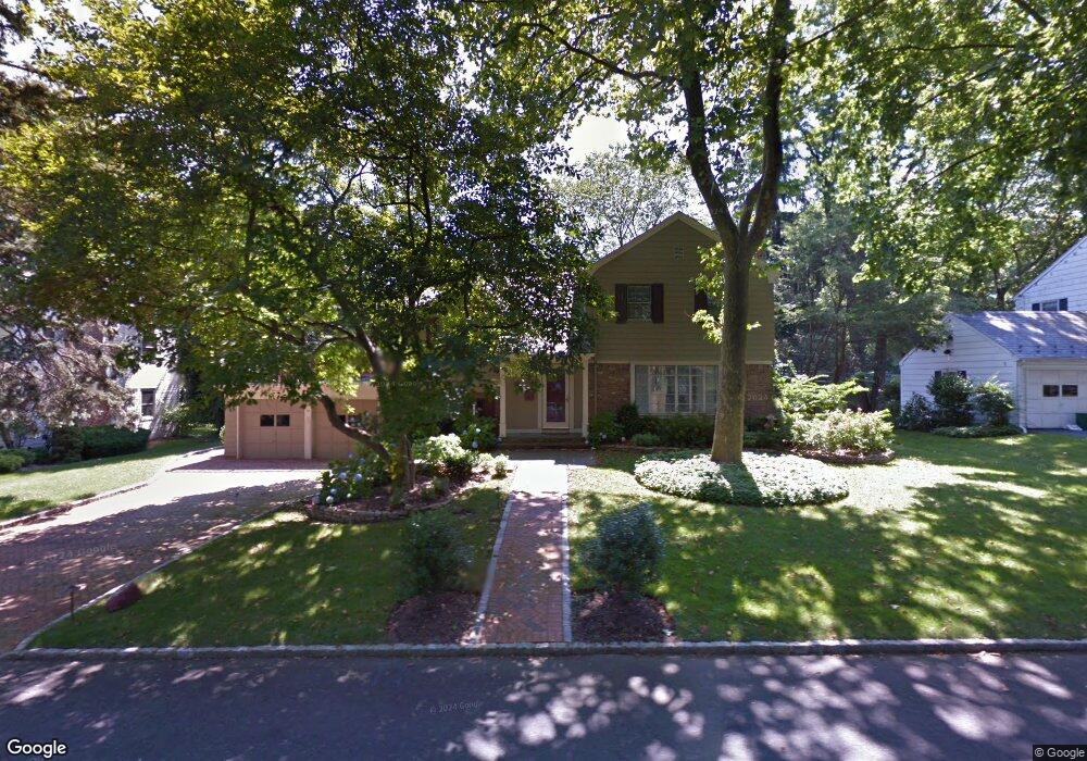
62 Borglum Rd Manhasset, NY 11030
Munsey Park NeighborhoodEstimated Value: $1,704,000 - $1,773,668
4
Beds
3
Baths
1,620
Sq Ft
$1,073/Sq Ft
Est. Value
About This Home
This home is located at 62 Borglum Rd, Manhasset, NY 11030 and is currently estimated at $1,738,834, approximately $1,073 per square foot. 62 Borglum Rd is a home located in Nassau County with nearby schools including Manhasset Secondary School, St Mary's Elementary School, and St. Mary's College Preparatory High School.
Ownership History
Date
Name
Owned For
Owner Type
Purchase Details
Closed on
Nov 13, 2018
Sold by
Reinhardt Gerard E
Bought by
Karachalios Michael and Vlantis Vicky
Current Estimated Value
Home Financials for this Owner
Home Financials are based on the most recent Mortgage that was taken out on this home.
Original Mortgage
$949,600
Outstanding Balance
$834,982
Interest Rate
4.8%
Mortgage Type
New Conventional
Estimated Equity
$903,852
Purchase Details
Closed on
Jan 11, 2008
Sold by
Mcheffey-Atkinson Barbara
Bought by
Reinhardt Gerard
Create a Home Valuation Report for This Property
The Home Valuation Report is an in-depth analysis detailing your home's value as well as a comparison with similar homes in the area
Home Values in the Area
Average Home Value in this Area
Purchase History
| Date | Buyer | Sale Price | Title Company |
|---|---|---|---|
| Karachalios Michael | $1,187,000 | Advantage Title | |
| Reinhardt Gerard | $850,000 | -- |
Source: Public Records
Mortgage History
| Date | Status | Borrower | Loan Amount |
|---|---|---|---|
| Open | Karachalios Michael | $949,600 |
Source: Public Records
Tax History Compared to Growth
Tax History
| Year | Tax Paid | Tax Assessment Tax Assessment Total Assessment is a certain percentage of the fair market value that is determined by local assessors to be the total taxable value of land and additions on the property. | Land | Improvement |
|---|---|---|---|---|
| 2025 | $16,724 | $1,098 | $735 | $363 |
| 2024 | $4,505 | $1,088 | $729 | $359 |
| 2023 | $15,364 | $1,135 | $760 | $375 |
| 2022 | $15,364 | $1,157 | $775 | $382 |
| 2021 | $15,071 | $1,190 | $683 | $507 |
| 2020 | $15,074 | $2,018 | $2,017 | $1 |
| 2019 | $16,002 | $2,018 | $2,017 | $1 |
| 2018 | $16,002 | $2,018 | $0 | $0 |
| 2017 | $10,370 | $2,018 | $2,017 | $1 |
| 2016 | $15,354 | $2,018 | $2,017 | $1 |
| 2015 | $4,744 | $2,018 | $2,017 | $1 |
| 2014 | $4,744 | $2,018 | $2,017 | $1 |
| 2013 | $4,524 | $2,018 | $2,017 | $1 |
Source: Public Records
Map
Nearby Homes
- 84 Middle Neck Rd
- 6 Overhill Ln
- 15 The Oaks
- 25 The Oaks
- 12 Overhill Ln
- 16 Ridge Dr E
- 117 Crabapple Rd
- 19 Ridge Dr E
- 97 Crabapple Rd
- 26 Birchdale Ln
- 79 Farmview Rd
- 40 Hewlett Ln
- 20 Mill Spring Rd
- 19 Tatterson St
- 21 the Glenada
- 52 Woodland Rd
- 38 Country Club Dr
- 80 The Oaks
- 91 Fernwood Ln
- 39 Bluebird Hill Ct
- 72 Borglum Rd
- 52 Borglum Rd
- 61 Borglum Rd
- 71 Borglum Rd
- 51 Borglum Rd
- 82 Borglum Rd
- 44 Borglum Rd
- 2 Bayberry Ridge
- 81 Borglum Rd
- 1 Bayberry Ridge
- 41 Borglum Rd
- 62 Bartlett Dr
- 54 Bartlett Dr
- 61 Port Washington Blvd
- 83 Knollwood Rd
- 83 Knollwood Rd
- 70 Bartlett Dr
- 46 Bartlett Dr
- 92 Borglum Rd
- 91 Borglum Rd