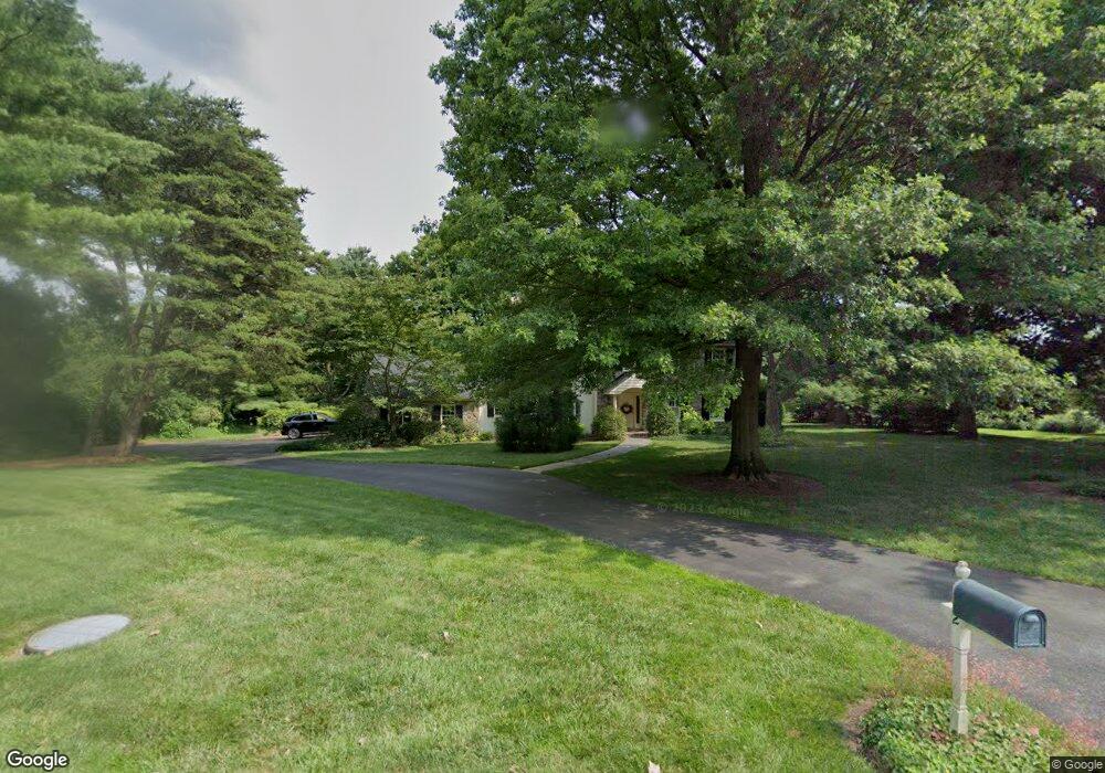
62 Deer Path Kennett Square, PA 19348
Estimated Value: $721,541 - $933,000
4
Beds
2
Baths
3,099
Sq Ft
$261/Sq Ft
Est. Value
About This Home
This home is located at 62 Deer Path, Kennett Square, PA 19348 and is currently estimated at $808,885, approximately $261 per square foot. 62 Deer Path is a home located in Chester County with nearby schools including Kennett Middle School, Kennett High School, and St. Patrick School.
Ownership History
Date
Name
Owned For
Owner Type
Purchase Details
Closed on
Dec 18, 2001
Sold by
Robinson Richard and Robinson Barbara
Bought by
Collins P Clarkson and Collins Donna W
Current Estimated Value
Home Financials for this Owner
Home Financials are based on the most recent Mortgage that was taken out on this home.
Original Mortgage
$304,500
Interest Rate
6.54%
Create a Home Valuation Report for This Property
The Home Valuation Report is an in-depth analysis detailing your home's value as well as a comparison with similar homes in the area
Home Values in the Area
Average Home Value in this Area
Purchase History
| Date | Buyer | Sale Price | Title Company |
|---|---|---|---|
| Collins P Clarkson | $435,000 | -- |
Source: Public Records
Mortgage History
| Date | Status | Borrower | Loan Amount |
|---|---|---|---|
| Closed | Collins P Clarkson | $304,500 | |
| Closed | Collins P Clarkson | $40,500 |
Source: Public Records
Tax History Compared to Growth
Tax History
| Year | Tax Paid | Tax Assessment Tax Assessment Total Assessment is a certain percentage of the fair market value that is determined by local assessors to be the total taxable value of land and additions on the property. | Land | Improvement |
|---|---|---|---|---|
| 2025 | $9,442 | $231,540 | $63,600 | $167,940 |
| 2024 | $9,442 | $231,540 | $63,600 | $167,940 |
| 2023 | $9,259 | $231,540 | $63,600 | $167,940 |
| 2022 | $9,012 | $231,540 | $63,600 | $167,940 |
| 2021 | $8,876 | $231,540 | $63,600 | $167,940 |
| 2020 | $8,710 | $231,540 | $63,600 | $167,940 |
| 2019 | $8,594 | $231,540 | $63,600 | $167,940 |
| 2018 | $8,416 | $231,540 | $63,600 | $167,940 |
| 2017 | $7,828 | $231,540 | $63,600 | $167,940 |
| 2016 | $918 | $231,540 | $63,600 | $167,940 |
| 2015 | $918 | $231,540 | $63,600 | $167,940 |
| 2014 | $918 | $231,540 | $63,600 | $167,940 |
Source: Public Records
Map
Nearby Homes
- 49 Partridge Ln
- 1392 Hickory Hill Rd
- 4 W Pennsbury Way
- 962 E Baltimore Pike
- 519 Baltimore Pike
- 993 Sills Mill Rd
- 997 Sills Mill Rd
- 1702 W Street Rd
- 821 Burrows Run Rd
- 470 E Hillendale Rd
- 24 W Jonathan Ct
- 30 Penn Dr
- 504 Kennett Pike
- 1936 Lenape Rd
- 25 Hillendale Rd
- 800 Fairville Rd
- 102 Alford Ct
- 110 Hannah Ln
- 1540 Fairville Rd
- 2005 W Street Rd