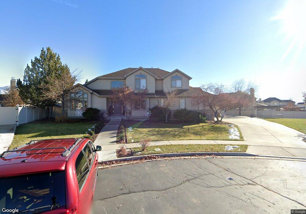
62 E 1380 N American Fork, UT 84003
Estimated Value: $775,000 - $883,000
4
Beds
3
Baths
4,186
Sq Ft
$196/Sq Ft
Est. Value
About This Home
This home is located at 62 E 1380 N, American Fork, UT 84003 and is currently estimated at $819,520, approximately $195 per square foot. 62 E 1380 N is a home located in Utah County with nearby schools including Legacy Elementary School, American Fork Junior High School, and American Fork High School.
Ownership History
Date
Name
Owned For
Owner Type
Purchase Details
Closed on
Sep 10, 2025
Sold by
Parker Tory L and Parker Andrea B
Bought by
Tory And Andrea Parker Family Trust and Parker
Current Estimated Value
Purchase Details
Closed on
Jun 3, 2015
Sold by
Adams Matthew S and Adams Rachael Anne
Bought by
Parker Tory L and Parker Andrea B
Home Financials for this Owner
Home Financials are based on the most recent Mortgage that was taken out on this home.
Original Mortgage
$320,000
Interest Rate
3.62%
Mortgage Type
New Conventional
Purchase Details
Closed on
Dec 20, 2002
Sold by
Newmark Development Inc
Bought by
Adams Matthew S and Adams Rachael Anne
Home Financials for this Owner
Home Financials are based on the most recent Mortgage that was taken out on this home.
Original Mortgage
$235,900
Interest Rate
5.86%
Create a Home Valuation Report for This Property
The Home Valuation Report is an in-depth analysis detailing your home's value as well as a comparison with similar homes in the area
Home Values in the Area
Average Home Value in this Area
Purchase History
| Date | Buyer | Sale Price | Title Company |
|---|---|---|---|
| Tory And Andrea Parker Family Trust | -- | None Listed On Document | |
| Parker Tory L | -- | Access Title Co | |
| Adams Matthew S | -- | Access Title Company |
Source: Public Records
Mortgage History
| Date | Status | Borrower | Loan Amount |
|---|---|---|---|
| Previous Owner | Parker Tory L | $320,000 | |
| Previous Owner | Adams Matthew S | $235,900 | |
| Closed | Adams Matthew S | $15,000 |
Source: Public Records
Tax History Compared to Growth
Tax History
| Year | Tax Paid | Tax Assessment Tax Assessment Total Assessment is a certain percentage of the fair market value that is determined by local assessors to be the total taxable value of land and additions on the property. | Land | Improvement |
|---|---|---|---|---|
| 2025 | $3,337 | $420,640 | $333,300 | $431,500 |
| 2024 | $3,337 | $370,810 | $0 | $0 |
| 2023 | $3,083 | $363,220 | $0 | $0 |
| 2022 | $3,549 | $412,555 | $0 | $0 |
| 2021 | $2,827 | $513,300 | $189,600 | $323,700 |
| 2020 | $2,715 | $478,100 | $175,600 | $302,500 |
| 2019 | $2,362 | $430,300 | $163,600 | $266,700 |
| 2018 | $2,180 | $379,600 | $147,700 | $231,900 |
| 2017 | $2,221 | $208,780 | $0 | $0 |
| 2016 | $2,259 | $197,285 | $0 | $0 |
| 2015 | $2,325 | $192,720 | $0 | $0 |
| 2014 | $2,277 | $186,120 | $0 | $0 |
Source: Public Records
Map
Nearby Homes
- 16 E 1400 N
- 35 W 1350 N
- 1201 N 160 E
- 1071 Timpview Dr
- 179 W 1290 N
- 703 S 850 W
- 9780 N 6000 W
- 287 W 1360 N
- 9947 N Yorkshire Ct
- 5973 W 9960 N
- 356 W 1300 N
- 10238 N 6530 W Unit 15
- 1082 N 390 E Unit 111
- 5284 N 11200 W Unit 3
- 1051 N 390 E Unit 103
- 6079 W Whisper Ln Unit 404
- 1089 N 390 E Unit 106
- 1220 E 700 N
- 1039 N 390 E Unit 102
- 11338 N Annes Way Unit 8