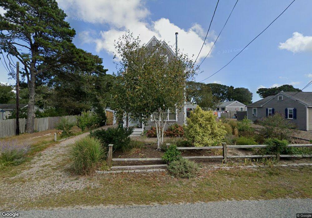
62 Glendon Rd Dennis Port, MA 02639
Dennis Port NeighborhoodEstimated Value: $663,000 - $824,000
2
Beds
1
Bath
650
Sq Ft
$1,144/Sq Ft
Est. Value
About This Home
This home is located at 62 Glendon Rd, Dennis Port, MA 02639 and is currently estimated at $743,844, approximately $1,144 per square foot. 62 Glendon Rd is a home located in Barnstable County with nearby schools including Dennis-Yarmouth Regional High School and St. Pius X. School.
Ownership History
Date
Name
Owned For
Owner Type
Purchase Details
Closed on
Dec 27, 1996
Sold by
Porzio Ralph J and Porzio Janet G
Bought by
Krache Martha E
Current Estimated Value
Home Financials for this Owner
Home Financials are based on the most recent Mortgage that was taken out on this home.
Original Mortgage
$45,000
Outstanding Balance
$4,798
Interest Rate
7.55%
Mortgage Type
Purchase Money Mortgage
Estimated Equity
$739,046
Purchase Details
Closed on
Apr 27, 1990
Sold by
Gerstberger Peter G
Bought by
Porzio Ralph J
Home Financials for this Owner
Home Financials are based on the most recent Mortgage that was taken out on this home.
Original Mortgage
$70,000
Interest Rate
10.26%
Mortgage Type
Purchase Money Mortgage
Create a Home Valuation Report for This Property
The Home Valuation Report is an in-depth analysis detailing your home's value as well as a comparison with similar homes in the area
Home Values in the Area
Average Home Value in this Area
Purchase History
| Date | Buyer | Sale Price | Title Company |
|---|---|---|---|
| Krache Martha E | $83,000 | -- | |
| Krache Martha E | $83,000 | -- | |
| Porzio Ralph J | $110,000 | -- |
Source: Public Records
Mortgage History
| Date | Status | Borrower | Loan Amount |
|---|---|---|---|
| Open | Porzio Ralph J | $45,000 | |
| Closed | Porzio Ralph J | $45,000 | |
| Previous Owner | Porzio Ralph J | $70,000 |
Source: Public Records
Tax History
| Year | Tax Paid | Tax Assessment Tax Assessment Total Assessment is a certain percentage of the fair market value that is determined by local assessors to be the total taxable value of land and additions on the property. | Land | Improvement |
|---|---|---|---|---|
| 2025 | $2,945 | $680,100 | $274,000 | $406,100 |
| 2024 | $3,001 | $683,600 | $263,500 | $420,100 |
| 2023 | $2,922 | $625,600 | $239,500 | $386,100 |
| 2022 | $2,674 | $477,500 | $188,800 | $288,700 |
| 2021 | $4,352 | $451,800 | $185,100 | $266,700 |
| 2020 | $2,358 | $386,600 | $185,100 | $201,500 |
| 2019 | $2,442 | $395,800 | $197,000 | $198,800 |
| 2018 | $2,297 | $362,300 | $187,600 | $174,700 |
| 2017 | $2,137 | $347,400 | $172,700 | $174,700 |
| 2016 | $2,033 | $311,300 | $162,900 | $148,400 |
| 2015 | $1,992 | $311,300 | $162,900 | $148,400 |
| 2014 | $1,979 | $311,700 | $153,000 | $158,700 |
Source: Public Records
Map
Nearby Homes
- 56 Uncle Rolf Rd
- 183 Captain Chase Rd
- 230 Old Wharf Rd Unit 272
- 230 Old Wharf Rd Unit 265
- 154 Old Wharf Rd Unit 14
- 112 Old Wharf Rd Unit E4
- 205 Lower County Rd Unit 8
- 241 Old Wharf Rd Unit 127
- 262 Old Wharf Rd Unit 67
- 262 Old Wharf Rd Unit 5
- 262 Old Wharf Rd Unit 5
- 262 Old Wharf Rd Unit 87
- 38 Cranberry Ln
- 37 Beach Hills Rd
- 37-A Beach Hills Rd
- 22 Ferncliff Rd
- 59 Sea St
- 102 Lawrence Rd
- 27 Mayflower Ln
- 104 Toms Path
- 60 Glendon Rd
- 66 Glendon Rd
- 58 Glendon Rd
- 0 Glendon Rd Unit 20510276
- 0 Glendon Rd Unit 2024660
- 0 Glendon Rd Unit 7033875
- 0 Glendon Rd Unit 2024333
- 0 Glendon Rd Unit 5009348
- 0 Glendon Rd Unit 8039834
- 0 Glendon Rd Unit 9906920
- 0 Glendon Rd Unit 7034426
- 0 Glendon Rd Unit 65B 2016397
- 0 Glendon Rd Unit 1 2024730
- 0 Glendon Rd Unit 2
- 50-A Glendon Rd
- 68 Glendon Rd
- 54 Glendon Rd
- 53 Glendon Rd
- 57 Glendon Rd
- 72 Glendon Rd
Your Personal Tour Guide
Ask me questions while you tour the home.