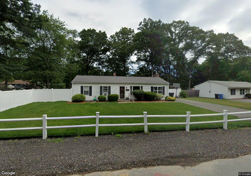
62 Lantz Ave Whitman, MA 02382
Estimated Value: $506,697 - $576,000
3
Beds
1
Bath
1,513
Sq Ft
$354/Sq Ft
Est. Value
About This Home
This home is located at 62 Lantz Ave, Whitman, MA 02382 and is currently estimated at $536,174, approximately $354 per square foot. 62 Lantz Ave is a home located in Plymouth County with nearby schools including St Bridget School.
Ownership History
Date
Name
Owned For
Owner Type
Purchase Details
Closed on
Oct 25, 2010
Sold by
Harkins Charles M
Bought by
Foley Thomas J and Foley Ashley A
Current Estimated Value
Home Financials for this Owner
Home Financials are based on the most recent Mortgage that was taken out on this home.
Original Mortgage
$250,624
Outstanding Balance
$166,199
Interest Rate
4.37%
Mortgage Type
Purchase Money Mortgage
Estimated Equity
$369,975
Create a Home Valuation Report for This Property
The Home Valuation Report is an in-depth analysis detailing your home's value as well as a comparison with similar homes in the area
Home Values in the Area
Average Home Value in this Area
Purchase History
| Date | Buyer | Sale Price | Title Company |
|---|---|---|---|
| Foley Thomas J | $254,000 | -- |
Source: Public Records
Mortgage History
| Date | Status | Borrower | Loan Amount |
|---|---|---|---|
| Open | Foley Thomas J | $250,624 |
Source: Public Records
Tax History
| Year | Tax Paid | Tax Assessment Tax Assessment Total Assessment is a certain percentage of the fair market value that is determined by local assessors to be the total taxable value of land and additions on the property. | Land | Improvement |
|---|---|---|---|---|
| 2025 | $6,001 | $457,400 | $212,200 | $245,200 |
| 2024 | $5,313 | $417,000 | $208,100 | $208,900 |
| 2023 | $4,991 | $367,800 | $180,400 | $187,400 |
| 2022 | $4,857 | $333,600 | $164,000 | $169,600 |
| 2021 | $4,734 | $305,400 | $150,700 | $154,700 |
| 2020 | $4,587 | $289,400 | $143,500 | $145,900 |
| 2019 | $4,297 | $279,400 | $143,500 | $135,900 |
| 2018 | $4,142 | $258,700 | $135,300 | $123,400 |
| 2017 | $3,880 | $257,300 | $135,300 | $122,000 |
| 2016 | $3,608 | $231,400 | $128,200 | $103,200 |
| 2015 | $3,372 | $216,000 | $112,800 | $103,200 |
Source: Public Records
Map
Nearby Homes
- 150 Harvard St
- 157 Auburn St Unit 157
- 159 Auburn St
- 154 Auburn St
- 501 Auburn St Unit 508
- 293 Bedford St
- 95 Temple St
- Plan A Northville Village Unit Plan A
- Plan A Northville Village
- 548 Harvard St
- 48 Day St
- 8 Laurel St
- 22 Old Coach Rd
- 262 Homeland Dr
- 725 Auburn St
- 110 South Ave
- 147 South Ave
- 42 Rock St
- 66 Belmont St
- 101 Washington St Unit 4
Your Personal Tour Guide
Ask me questions while you tour the home.