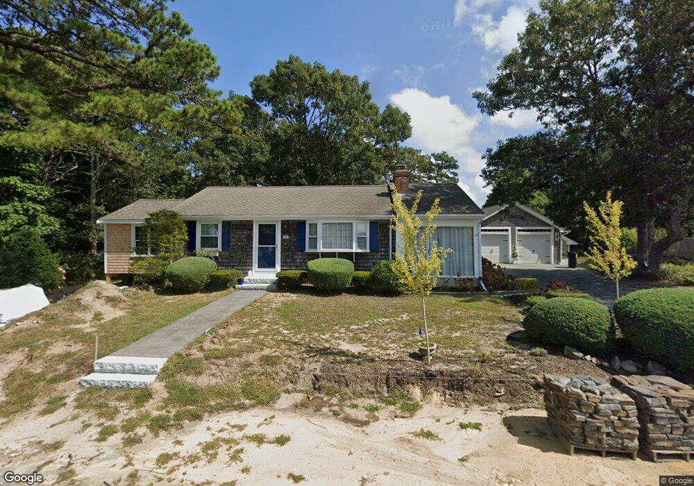
62 Lawrence Rd Dennis Port, MA 02639
Dennis Port NeighborhoodEstimated Value: $581,000 - $727,000
3
Beds
1
Bath
982
Sq Ft
$657/Sq Ft
Est. Value
About This Home
This home is located at 62 Lawrence Rd, Dennis Port, MA 02639 and is currently estimated at $644,714, approximately $656 per square foot. 62 Lawrence Rd is a home located in Barnstable County with nearby schools including Dennis-Yarmouth Regional High School and St. Pius X. School.
Ownership History
Date
Name
Owned For
Owner Type
Purchase Details
Closed on
Nov 6, 2015
Sold by
Paulo Nancy L
Bought by
Mcginnity Thomas D and Mcginnity Joellen C
Current Estimated Value
Purchase Details
Closed on
Jan 15, 1999
Sold by
Harrington James L and Harrington Christine B
Bought by
Paulo Anthony J and Paulo Nancy L
Purchase Details
Closed on
Apr 13, 1990
Sold by
Cutting Philip F
Bought by
Harrington James D
Home Financials for this Owner
Home Financials are based on the most recent Mortgage that was taken out on this home.
Original Mortgage
$10,000
Interest Rate
10.13%
Mortgage Type
Purchase Money Mortgage
Create a Home Valuation Report for This Property
The Home Valuation Report is an in-depth analysis detailing your home's value as well as a comparison with similar homes in the area
Home Values in the Area
Average Home Value in this Area
Purchase History
| Date | Buyer | Sale Price | Title Company |
|---|---|---|---|
| Mcginnity Thomas D | $310,000 | -- | |
| Paulo Anthony J | $145,000 | -- | |
| Harrington James D | $143,500 | -- |
Source: Public Records
Mortgage History
| Date | Status | Borrower | Loan Amount |
|---|---|---|---|
| Previous Owner | Harrington James D | $10,000 |
Source: Public Records
Tax History Compared to Growth
Tax History
| Year | Tax Paid | Tax Assessment Tax Assessment Total Assessment is a certain percentage of the fair market value that is determined by local assessors to be the total taxable value of land and additions on the property. | Land | Improvement |
|---|---|---|---|---|
| 2025 | $2,796 | $645,700 | $252,600 | $393,100 |
| 2024 | $2,621 | $597,100 | $242,900 | $354,200 |
| 2023 | $2,541 | $544,200 | $220,800 | $323,400 |
| 2022 | $2,485 | $443,700 | $198,900 | $244,800 |
| 2021 | $2,582 | $428,200 | $222,900 | $205,300 |
| 2020 | $2,338 | $383,200 | $195,000 | $188,200 |
| 2019 | $2,229 | $361,300 | $191,200 | $170,100 |
| 2018 | $2,138 | $337,200 | $182,000 | $155,200 |
| 2017 | $1,795 | $291,800 | $169,000 | $122,800 |
| 2016 | $1,866 | $285,700 | $182,000 | $103,700 |
| 2015 | $1,828 | $285,700 | $182,000 | $103,700 |
| 2014 | $1,649 | $259,700 | $156,000 | $103,700 |
Source: Public Records
Map
Nearby Homes
- 80 Michaels Ave
- 27 Mayflower Ln
- 37 Ocean Dr Unit 2
- 31 Easy St
- 19 Standish Way
- 64 Beaten Rd
- 10 Grindell Ave
- 22 Wixon Rd
- 112 Old Wharf Rd Unit E4
- 112 Old Wharf Rd Unit E1
- 154 Old Wharf Rd Unit 26
- 154 Old Wharf Rd Unit 14
- 120 Old Wharf Rd Unit 11
- 4 Coffey Ln
- 71 Main St
- 61 Trotters Ln
- 125 Main St Unit 3
- 15 Woodside Park Rd
- 72 Bassett Ln
- 217 Old Wharf Rd Unit 64
- 54 Lawrence Rd
- 70 Lawrence Rd
- 63 Lawrence Rd
- 61 Lawrence Rd
- 55 Polly Fisk Ln
- 51 Polly Fisk Ln
- 67 Lawrence Rd
- 57 Lawrence Rd
- 52 Lawrence Rd
- 69 Lawrence Rd
- 0 Polly Fisk Ln Unit 3 7027812
- 0 Polly Fisk Ln Unit U20 47204
- 0 Polly Fisk Ln Unit 2 6023117
- 0 Polly Fisk Ln Unit U21 47698
- 0 Polly Fisk Ln Unit 10 8038027
- 0 Polly Fisk Ln Unit U23
- 0 Polly Fisk Ln Unit U10
- 0 Polly Fisk Ln Unit 29
- 55 Lawrence Rd
- 61 Polly Fisk Ln