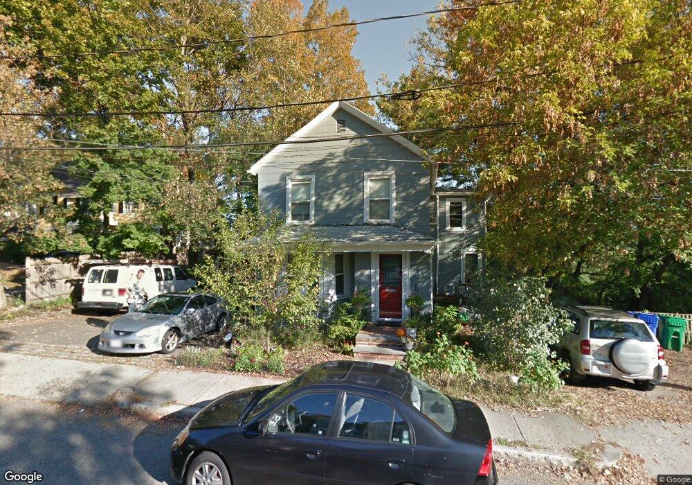
62 Maple St Newton, MA 02458
Newton Corner NeighborhoodEstimated Value: $981,000 - $1,216,000
4
Beds
3
Baths
2,506
Sq Ft
$425/Sq Ft
Est. Value
About This Home
This home is located at 62 Maple St, Newton, MA 02458 and is currently estimated at $1,064,222, approximately $424 per square foot. 62 Maple St is a home located in Middlesex County with nearby schools including Jackson Walnut Park School and Newton Country Day School.
Ownership History
Date
Name
Owned For
Owner Type
Purchase Details
Closed on
Apr 13, 1999
Sold by
Ghannam Hasan and Ghannam Ruth J
Bought by
Ledoyt John B and Ledoyt Nina L
Current Estimated Value
Home Financials for this Owner
Home Financials are based on the most recent Mortgage that was taken out on this home.
Original Mortgage
$250,500
Interest Rate
6.83%
Mortgage Type
Purchase Money Mortgage
Create a Home Valuation Report for This Property
The Home Valuation Report is an in-depth analysis detailing your home's value as well as a comparison with similar homes in the area
Home Values in the Area
Average Home Value in this Area
Purchase History
| Date | Buyer | Sale Price | Title Company |
|---|---|---|---|
| Ledoyt John B | $278,500 | -- |
Source: Public Records
Mortgage History
| Date | Status | Borrower | Loan Amount |
|---|---|---|---|
| Closed | Ledoyt John B | $190,000 | |
| Closed | Ledoyt John B | $250,500 |
Source: Public Records
Tax History
| Year | Tax Paid | Tax Assessment Tax Assessment Total Assessment is a certain percentage of the fair market value that is determined by local assessors to be the total taxable value of land and additions on the property. | Land | Improvement |
|---|---|---|---|---|
| 2025 | $7,301 | $745,000 | $602,600 | $142,400 |
| 2024 | $7,059 | $723,300 | $585,000 | $138,300 |
| 2023 | $1 | $696,900 | $459,100 | $237,800 |
| 2022 | $1 | $645,300 | $425,100 | $220,200 |
| 2021 | $1 | $592,000 | $390,000 | $202,000 |
| 2020 | $1 | $592,000 | $390,000 | $202,000 |
| 2019 | $1 | $553,300 | $364,500 | $188,800 |
| 2018 | $1 | $535,500 | $345,100 | $190,400 |
| 2017 | $1 | $491,300 | $316,600 | $174,700 |
| 2016 | $5,129 | $450,700 | $290,500 | $160,200 |
| 2015 | $4,890 | $421,200 | $271,500 | $149,700 |
Source: Public Records
Map
Nearby Homes
- 10 Williams St Unit 45
- 10 Williams St Unit 26
- 9 Maple St
- 164 Galen St Unit 65
- 164 Galen St Unit 88
- 23 Orchard St Unit 23
- 7 Melville Terrace Unit 2
- 7 Melville Terrace Unit 1
- 4 Remick Terrace
- 25 Ladd St Unit 25
- 27 Ladd St Unit 27
- 65-67 Saint James Cir
- 48-50 Carleton St
- 14 -16 N Beacon Ct
- 39 Charlesbank Rd Unit 39
- 159 Washington St Unit 4
- 180 Hunnewell Ave Unit 180
- 180 Hunnewell Ave Unit A
- 65 Pearl St Unit 1
- 31 Aldrich Rd Unit 1
- 68 Maple St
- 68 Maple St Unit 1
- 52 Maple St
- 59 Maple St
- 57 Maple St
- 57 Maple St
- 5 Jefferson St
- 5 Jefferson St Unit 1
- 5 Jefferson St Unit 2
- 48 Maple St
- 48 Maple St Unit 48
- 48 Maple St Unit 2
- 6 Jefferson St
- 53 Maple St
- 15 Jefferson St
- 15 Jefferson St
- 10 Jefferson St Unit 1
- 45 Maple St Unit 45
- 45 Maple St Unit 47
- 8 Jefferson St Unit 10
Your Personal Tour Guide
Ask me questions while you tour the home.