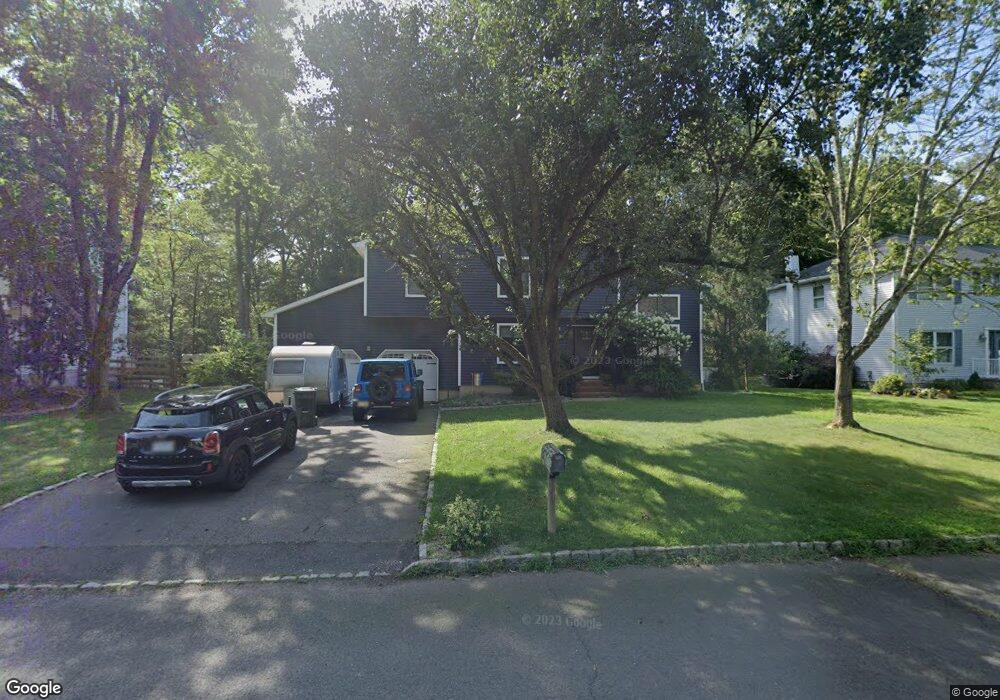
62 Marshall Rd Hillsborough, NJ 08844
Estimated Value: $590,000 - $673,000
--
Bed
--
Bath
1,551
Sq Ft
$413/Sq Ft
Est. Value
About This Home
This home is located at 62 Marshall Rd, Hillsborough, NJ 08844 and is currently estimated at $639,854, approximately $412 per square foot. 62 Marshall Rd is a home located in Somerset County with nearby schools including Hillsborough High School, Brighthorizons at Hillsborough, and Cherry Blossom Montessori School.
Ownership History
Date
Name
Owned For
Owner Type
Purchase Details
Closed on
Jan 23, 2010
Sold by
Linke Christopher C and Linke Ann M
Bought by
Walker Marcia and Gubitosa Amelia
Current Estimated Value
Home Financials for this Owner
Home Financials are based on the most recent Mortgage that was taken out on this home.
Original Mortgage
$337,810
Interest Rate
5.5%
Mortgage Type
FHA
Purchase Details
Closed on
Apr 19, 1999
Sold by
Mckay Randy
Bought by
Linke Christopher and Linke Ann
Home Financials for this Owner
Home Financials are based on the most recent Mortgage that was taken out on this home.
Original Mortgage
$211,850
Interest Rate
7.19%
Purchase Details
Closed on
Aug 27, 1993
Sold by
Confortini Andrew
Bought by
Mckay Randy and Mckay Denise
Home Financials for this Owner
Home Financials are based on the most recent Mortgage that was taken out on this home.
Original Mortgage
$176,000
Interest Rate
7.16%
Purchase Details
Closed on
Jun 17, 1991
Sold by
Tarantino Robert R and Tarantino Theresa M
Bought by
Confortini Andrew L and Confortini Rothman,S
Create a Home Valuation Report for This Property
The Home Valuation Report is an in-depth analysis detailing your home's value as well as a comparison with similar homes in the area
Home Values in the Area
Average Home Value in this Area
Purchase History
| Date | Buyer | Sale Price | Title Company |
|---|---|---|---|
| Walker Marcia | $362,000 | First American Title Ins Co | |
| Linke Christopher | $223,000 | -- | |
| Mckay Randy | $195,000 | -- | |
| Confortini Andrew L | $171,500 | -- |
Source: Public Records
Mortgage History
| Date | Status | Borrower | Loan Amount |
|---|---|---|---|
| Previous Owner | Walker Marcia | $337,810 | |
| Previous Owner | Linke Christopher | $211,850 | |
| Previous Owner | Mckay Randy | $176,000 |
Source: Public Records
Tax History Compared to Growth
Tax History
| Year | Tax Paid | Tax Assessment Tax Assessment Total Assessment is a certain percentage of the fair market value that is determined by local assessors to be the total taxable value of land and additions on the property. | Land | Improvement |
|---|---|---|---|---|
| 2025 | $10,936 | $541,200 | $366,400 | $174,800 |
| 2024 | $10,936 | $510,300 | $352,100 | $158,200 |
| 2023 | $9,779 | $454,200 | $295,100 | $159,100 |
| 2022 | $9,495 | $425,200 | $290,400 | $134,800 |
| 2021 | $9,171 | $390,600 | $238,100 | $152,500 |
| 2020 | $9,197 | $385,800 | $233,100 | $152,700 |
| 2019 | $9,263 | $385,300 | $223,600 | $161,700 |
| 2018 | $8,766 | $362,400 | $199,800 | $162,600 |
| 2017 | $8,515 | $352,600 | $195,100 | $157,500 |
| 2016 | $8,027 | $332,500 | $193,200 | $139,300 |
| 2015 | $7,803 | $327,300 | $179,000 | $148,300 |
| 2014 | $7,714 | $330,500 | $164,700 | $165,800 |
Source: Public Records
Map
Nearby Homes
- 7 Monfort Dr
- 195 Beekman Ln
- 710 Whitenack Ct
- 912 Merritt Dr Unit D
- 902 Merritt Dr Unit E
- 911 Merritt Dr Unit B2
- 104 Devonshire Ct
- 303 Gemini Dr Unit 2B
- 807 Eves Dr Unit 1B
- 806 Eves Dr Unit 1B
- 911 Renate Dr Unit 1
- 790 Eves Dr
- 118 Bluebird Dr Unit 3
- 3120 Revere Ct
- 61 Wallace Blvd
- 3204 Revere Ct
- 107 Bluebird Dr Unit 1D
- 3011 Revere Ct
- 3014 Revere Ct
- 3007 Revere Ct